21 February I took the shuttle around Lake Wakatipu to the Greenstone track car park and started walking along the wide Greenstone River in beech forest. It was easy going on a smooth trail with a few bridges over creeks and some skinny waterfalls. There was rain coming and the surrounding peaks were in cloud. I raced along to Greenstone Hut and had a break there before continuing 11 kms to Taipo Hut on the Mavora Lakes Walkway. It was already late afternoon but I expected the walkway to be easy walking.
I returned into forest, came out onto scrubby moorland and went back into the forest. There was a sign warning about downed trees on the trail but usually on the SI these have been well taken care of. Not here. The next several hours were sheer misery as I constantly came upon fallen tree carnage: multiple logs to crawl under, multiple logs to step over, logs to balance on precariously, huge amounts of branches that required big detours. It was absolutely awful. (It was raining lightly but I didn’t mind that because it has been so hot recently and the change was nice.) I kept thinking the spate of fallen trees would finish but there would be a lull and then more impassable stretches. Apart from the busy highways there hasn’t been any of the TA that I’ve seriously disliked until this. Finally at 7 pm I exited the forest and was on a boggy plateau with a river running down the middle. To my surprise there was a hiker just ahead of me who I’d noticed leaving Greenstone Hut a while before me. I followed him across the bog and having to negotiate a lot of overgrown tussock, unhappy the hut was so far away. At almost 8 pm I was overjoyed to reach it although I wondered why the other hiker was standing outside. There was bad news: the hut was closed as it was being rebuilt and since the builders were staying there we couldn’t sneak in. Just then the rain started again in earnest. I was really mad about all this. I walked across a swing bridge and put up my tent among the matagouri then got into my sleeping bag. I had cut my finger on a tent peg and got blood everywhere. It would be a nut bar for dinner and I had only a small amount of water. Definitely my worst day on the TA. And worst night: my tent came unpegged, my sleeping bag was soon soaked and I wore my rain gear to bed; I was really cold and even shivering but I managed to sleep enough to feel ok in the morning. 22 kms
22 February I packed up and left, everything wet so extra heavy. I was so cold I felt sick. Nothing really improved: it was a shitty path, stony and overgrown, with unnecessary undulations and many streams to cross and keeping to higher ground when there was a nice flat valley below. I was high above the wide Mararoa River with mountains to both sides, the top parts hidden. I surprised a huge flock of ducks. It rained lightly about half the time. I decided to go to the first hut and call it a day and try to dry my stuff as the extra weight was hurting my back a lot. Even this took me forever: 5 hours for 12 kilometres, more than the quoted time. Boundary Hut was tiny and we were 2 overnight. 12 kms
Day 120: 23 February I had a fast walk to the next hut on a puddly 4WD track and had second breakfast. The track continued along North Mavora Lake and the weather ahead looked bad. I came to the lake shore and things looked better ahead, the water was blue where the sun was shining, but the air was still cold. For the rest of the day it would alternate between sun and rain. There was a mountain ahead which looked like it had fresh snow but tantalisingly it wouldn’t come out of its cloud. I had lunch at Mavora Lakes campground in the cold wind and continued along South Mavora Lake, this time on a deserted gravel road which went in and out of forest. I got to a suspension bridge across the tip of the lake, walked across and found a secluded spot to camp by the water. 21 kms

24 February There was mist over the lake when I got up (I was in it) and I watched it lift. A bluebird day! Gradually I peeled off the layers of clothes I’d been wearing day and night. I stayed on the gravel road as it passed through a nice stand of forest and went into an open valley of grazing land. I had low scrubby mountains on both sides and eventually a more impressive range appeared on the horizon ahead. Some mountains had a dusting of snow. I pushed along, glad of a slight breeze which became a headwind for a while. It wasn’t the most exciting day’s walking and the last part dragged. When I reached the highway I had to decide whether to hitchhike to Te Anau or Mossburn to buy food for the next stage and to stay the night and I opted for Mossburn. Mistake. I got a ride easily but there was no shop there, the pub was closed and there wasn’t a campground. A couple saw me standing there looking lost, asked if I was ok, and the man announced he was a trail angel. They took me to Lumsden, took me to the supermarket, waited while I shopped and took me back to Mossburn. It was a great kindness and I had worried about getting stuck in Lumsden; sadly my evening out/night in a bed aspirations had been dashed. I got a ride back to the trail from Mossburn and walked on, highway then gravel road, looking for somewhere to camp. The sun was setting and in desperation I pulled off the gravel road onto a grass/thistle mix near a pleasant sounding stream and hoped for the best. I dreamt I was in a bed and I was really confused when I woke up. 39 kms
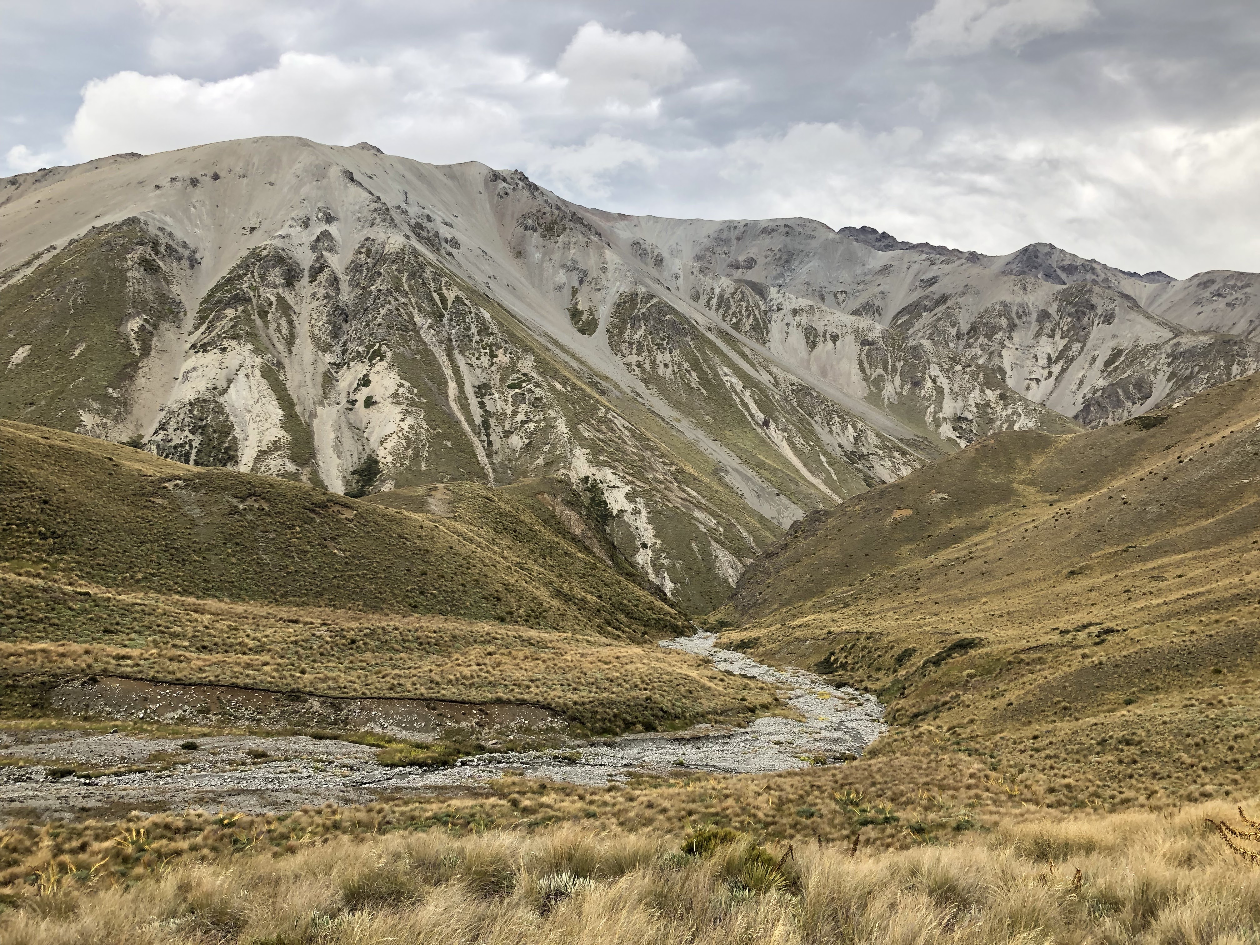
25 February I’m now in Southland, my final region. I walked to Princhester Hut to have breakfast and then started on the Takitimu Range, entering the forest for a climb to a saddle. It was a ferny beech forest with some fallen trees (but nothing like the other day) and lots of moss on the trees. There was more mud than I’ve seen recently. I was in shade until the saddle, a lovely peaceful spot without a view. The descent was fine and then I reached the tall tussock I had heard bad things about. My day turned difficult because of the tussock: it was often up to my shoulders, hiding the marker poles from my view, and it obscured the path (what path there was). At first it was fun but after I got badly lost I became fed up. I enjoyed the intermittent forays into the forest but the tussock really got me down. This was a shame because the scenery was excellent: scrub covered mountains, forest and the yellow tussock, with a few streams. It was a second bluebird day, rather hot for the stressful walking.
Near the end I climbed a low peak for a wonderful view of the land I had crossed. I got to Aparima Hut (2 huts, new one and old one) exhausted. The location was great, above the Aparima River but I was too tired to go for a swim. 21 kms

Near the end I climbed a low peak for a wonderful view of the land I had crossed. I got to Aparima Hut (2 huts, new one and old one) exhausted. The location was great, above the Aparima River but I was too tired to go for a swim. 21 kms

26 February It was an overcast day and I was in the forest all morning, ups and downs, sometimes everything mossy and sometimes a sea of bright green ferns, sometimes muddy. I still find it impossible to tell how fast I’m going in the forest and this section seemed to take a long time. I crossed the ankle deep Wairaki River (this was the first river crossing in my new shoes) and had lunch at the Lower Wairaki Hut - there was barely space for 4 of us. The afternoon was a big improvement. I climbed in the forest until I was in a cloud, and continued above the tree line, emerging on a ridge, Telford Tops at just over 1000 m, loose rocks and low alpine plants. At first I was in total whiteout but the mist began to swirl around and I could see rolling tussock hillsides one way and steep forested mountains on the other side. I walked on the ridge for a while, scree and rock, and then descended over grassy hills to a camping area by a stream. It was raining lightly and the sandflies were bad. The rain persisted, everything around me was in cloud and for the third night this week I couldn’t cook so didn’t eat dinner. I’m sure a mouse crawled over my face in the night. 22 kms
27 February Day started cloudy but improved to get hot. I crossed Telford Burn and had to walk through NZ’s largest private farm station, owned by someone who hates hikers so there was an underlying bad vibe. It was all rolling hills and at the crest of an early hill I saw the ocean for the first time. I stopped for coffee before wading the Wairaki River, one of the wider crossings of the TA. 
The trail had sections through fields of thistles, stretches full of cow poo, and it seemed like hikers got shunted off the direct route. One hillside was covered with sheep, in other places there were hundreds of cows. There were extensive views over a patchwork of farmland. The trail often featured fence lines straight up hills, rutted ground, a nice track we could see but not use. At one point the hillside was covered with fields of swedes and I had to walk between rows of plants knee high. When I reached the end I intended to get the shuttle to the pub in Nightcaps but the pub was closed, so I tried to hitchhike to Nightcaps to buy food but there were no cars. I called the owner of a hikers’ cabin on Birchwood Station to book a bed and explain my predicament and she offered to do my shopping if I texted her a list. That was great and I stayed in the cabin, a few extra kilometres, grotty but convenient. 30 kms
The trail had sections through fields of thistles, stretches full of cow poo, and it seemed like hikers got shunted off the direct route. One hillside was covered with sheep, in other places there were hundreds of cows. There were extensive views over a patchwork of farmland. The trail often featured fence lines straight up hills, rutted ground, a nice track we could see but not use. At one point the hillside was covered with fields of swedes and I had to walk between rows of plants knee high. When I reached the end I intended to get the shuttle to the pub in Nightcaps but the pub was closed, so I tried to hitchhike to Nightcaps to buy food but there were no cars. I called the owner of a hikers’ cabin on Birchwood Station to book a bed and explain my predicament and she offered to do my shopping if I texted her a list. That was great and I stayed in the cabin, a few extra kilometres, grotty but convenient. 30 kms
28 February I decided on an alternative route to the TA to avoid logging activity and a detour; honestly, I just wanted a break from the irritating trail. I walked a very quiet gravel road passing farms. I had good views over the surrounding countryside - so green, so neat. At the top of a hill some people were processing a lot of sheep and I asked what they were doing: Cleaning the shit off their bums before we shear them. It was a hot day. At lunchtime I booked my accommodation in Bluff, thereby setting a finish date.
Back on the TA I started towards Longwood Forest on a gravel road, initially through an active logging area and then into bush, which, curiously, appeared to be young stringy barks. Later gorse and toe toe. I paused at a clearing before the forest trail proper began (the reputedly really muddy one) and I was persecuted by bumble bees. The narrow forest path was lovely: moss on everything and lots of ferns and at first not too much mud, mostly avoidable. I climbed towards Bald Hill and came to a clearing with some spectacular mud then returned into the forest. Eventually I came out onto a boggy plateau with low scrub and flax and reached the summit of Bald Hill (802 m). From there I could see the southern coastline and, very clearly, the distinctive mound where Bluff sits. That was exciting. I descended on a gravel road (views of islands) until I found a nice place to camp. It was a still evening and not many sandflies. 35 kms
1 March The mud got a lot more pervasive with lakes of mud across the path.
I did well keeping out of the worst of it until I suddenly sank in almost to my knees.
Not so bad really, and I had to worry less about getting wet feet/legs after that. A kereru flapped past, surprising me. The trees were increasingly stunted. I came back out onto a boggy plateau with low vegetation - there was a lovely wild feel about the area - and I could see Longwood Trig (760 m) in the distance, the peak was rounded, and there were many bumps before I reached it. In places on the plateau there were trenches of water I had to leap over. It was drizzling. I had a fantastic view of Stewart Island, to the west the gentle curve of Te Waewae Bay with mountains behind, the complicated waterways around Riverton to the east, and great expanses of farmland. And Bluff. I remained on the tops for a while then returned to the muddy forest for a steep descent to Martins Hut. The latter part of the descent was among punga, something I haven’t seen for ages. The trail was a little less muddy after that, this seemed to coincide with there being more streams, but I encountered lots of obstacles from fallen trees to slips. I stopped at Turnbulls Hut, the last hut on the TA, and very decrepit. I had a final brief climb and a long descent, ultimately almost to sea level. The mud got intense again although never really soupy. (This mud has been much worse than the mud on the NI at Pirongia but somehow less distressing.) The last kilometre was an avenue of punga and beech, and then I was done with the notorious Longwood Forest.

I did well keeping out of the worst of it until I suddenly sank in almost to my knees.

Not so bad really, and I had to worry less about getting wet feet/legs after that. A kereru flapped past, surprising me. The trees were increasingly stunted. I came back out onto a boggy plateau with low vegetation - there was a lovely wild feel about the area - and I could see Longwood Trig (760 m) in the distance, the peak was rounded, and there were many bumps before I reached it. In places on the plateau there were trenches of water I had to leap over. It was drizzling. I had a fantastic view of Stewart Island, to the west the gentle curve of Te Waewae Bay with mountains behind, the complicated waterways around Riverton to the east, and great expanses of farmland. And Bluff. I remained on the tops for a while then returned to the muddy forest for a steep descent to Martins Hut. The latter part of the descent was among punga, something I haven’t seen for ages. The trail was a little less muddy after that, this seemed to coincide with there being more streams, but I encountered lots of obstacles from fallen trees to slips. I stopped at Turnbulls Hut, the last hut on the TA, and very decrepit. I had a final brief climb and a long descent, ultimately almost to sea level. The mud got intense again although never really soupy. (This mud has been much worse than the mud on the NI at Pirongia but somehow less distressing.) The last kilometre was an avenue of punga and beech, and then I was done with the notorious Longwood Forest.
I wanted to get to the pub at Colac Bay for dinner but I wasn’t sure how late they served food, so I raced the 4 kilometres along the highway and I made it in time (I got there at 7.30). The air was heavy like a storm was coming and I was soaked with sweat. My first proper meal since Arrowtown. And I’ve reached the south coast. 30 kms
2 March So happy to walk down the road and see the ocean.
I crunched along the pebble beach listening to the crashing surf. Then I joined a coastal walkway that crossed little coves with smooth rocks and climbed to go through paddocks of sheep. There was a lot of flax obscuring the path. The beaches had tiny pebbles and were hard work walking. I stopped once for a paddle in the surf. The trail ended with a fern forest and I found some ripe blackberries. I arrived in Riverton (I was there in 2007 for the Riverton to Invercargill marathon) and went to a nice cafe.

I crunched along the pebble beach listening to the crashing surf. Then I joined a coastal walkway that crossed little coves with smooth rocks and climbed to go through paddocks of sheep. There was a lot of flax obscuring the path. The beaches had tiny pebbles and were hard work walking. I stopped once for a paddle in the surf. The trail ended with a fern forest and I found some ripe blackberries. I arrived in Riverton (I was there in 2007 for the Riverton to Invercargill marathon) and went to a nice cafe.
I started out along wide sandy Oreti Beach. It seemed bizarre to be walking along a beach at the other end of the country - oyster catchers, low dunes, beige sand, tailwind, just like the beginning. Some flotsam, some seaweed. The big difference was that I could see my destination, Bluff, across the water. There were loads of Godzone competitors in groups of 4 walking towards me along the beach and then I bumped into Sue (from Boundary Hut) for a chat. After many hours I started looking for somewhere to camp in the dunes and I made several forays off the sand but I couldn’t find any patch of open ground for my tent. At last I settled for a sand access path through the dunes used by trail bikes; I hoped none would come by. I had 2 cheese scones with nutella and 2 snickers for dinner. 33 kms
3 March A lovely morning to finish the beach with golden sunlight, mist obscuring Stewart Island and a few birds around. I had breakfast on the beach. The walk into Invercargill was along a straight road crossing Oreti River and then New River estuary, which had plentiful bird life except that I couldn’t see over the side of the bridge. I got into the city centre quickly. 15 kms
Day 129: 4 March I slept badly but I was surprised I slept at all, with the mixture of excitement over finishing and awful snoring. I got up and had breakfast at the hostel in the dark, while there was a heavy shower, then bought some food and walked out of Invercargill. I pretty much took the highway all the way to Bluff: boring (light industry, swamp, rundown farmhouses) but fast walking, and after I left the built up area the shoulder was slightly separated from the road, so safer. It was a cool morning. Half way along it started raining and I got very cold. Then the sun came out, then it drizzled.
At the edge of Bluff (an unattractive place where everything looked uncared for) I was supposed to join a walkway but the access was behind a locked gate so I took the former TA route.
I climbed steeply to the top of the bluff for which the town is named to get a view of the town’s industry and expansive flat plains. A path descended in forest to Stirling Point - back on the real TA - and I could suddenly see the southern terminus signpost. I ran across the car park and hugged the sign. (2 days later on Stewart Island I met a couple who had watched me do this and wondered what on earth was going on!) Finished! It was an odd moment. I had some photos taken
and went to the restaurant that was right there; I had coffee, loaded wedges and a glass of rosé. It was sunny and I had a view of little islands. Then I walked slowly into Bluff. 35 kms

I climbed steeply to the top of the bluff for which the town is named to get a view of the town’s industry and expansive flat plains. A path descended in forest to Stirling Point - back on the real TA - and I could suddenly see the southern terminus signpost. I ran across the car park and hugged the sign. (2 days later on Stewart Island I met a couple who had watched me do this and wondered what on earth was going on!) Finished! It was an odd moment. I had some photos taken

and went to the restaurant that was right there; I had coffee, loaded wedges and a glass of rosé. It was sunny and I had a view of little islands. Then I walked slowly into Bluff. 35 kms
South Island total: 1345 kms
New Zealand total: 3032 kms
Vertical ascent: 79773 m
Nights in my tent: 75
Day 130: 5 March Rest day in Bluff. Relaxed. Ate a dozen oysters. Lovely evening with Viv - champagne!