25 March 2021

Walk the Yorke


Walk the Yorke is a route for walkers around the Yorke Peninsula in South Australia using beaches, tracks, roads and untracked coastal dunes. At various points there are Heysen style hiker shelters with a covered picnic table and a water tank where walkers are allowed to camp and there are also many council campsites and commercial caravan parks. The route passes through small towns where resupply is possible. The main challenge is access to drinking water as there are no freshwater sources; there is a small water tank at the hiker shelters but you could get there and find the tank empty, and there are occasionally public toilets with a tap. I decided to take my chances with this, having already abandoned other walk plans for precisely this issue, especially after I established that there would be plenty of tourists around who could help me out with water in case of emergency. As it transpired I found water at every hiker shelter and only once asked someone for water. I also didn't appreciate that it is essential to walk at low tide because of the seaweed problem so I didn't check the tides before starting out, and here I really got lucky.


I chose to do a section of the route around the leg/foot-shaped peninsula from Edithburgh at the southern end of the east coast (on the heel) going clockwise to Hardwicke Bay on the west coast (above the instep). This choice was largely dictated by the availability of public transport between Adelaide and those settlements as much of the peninsula is not serviced by buses. 


March 13 It was raining when I woke up in Edithburgh so I didn't rush away and the rain had pretty much stopped when I left the motel. I walked down to the jetty and started on the trail. There were a bunch of scuba divers heading out. The first few kms were behind the beach and the path was decorated with rocks covered in mosaics with a fishy theme. When this part ended I had to walk on the road behind houses so I went onto the scrappy beach instead. I could faintly see tiny Troubridge Island. 

Around the next point I felt I joined the trail proper, with a sandy track beside the water and then a beach walk. I was introduced to a major feature of the beaches of the peninsula: the large amount of seaweed, either spread lightly or in clumps. At one stage the seaweed was so deep I couldn't walk on it and I had to leave the beach. I followed a dirt road for a bit with a view of Troubridge lighthouse far in the distance and a massive wind farm. This road came close to the water where I found I was on top of low cliffs. There seemed something unusual about the cliffs being vertical but so low, less than 10 metres, and totally flat on top. 

The coastline was deeply indented. Sometimes I could just make out a bit of Kangaroo Island on the horizon. Eventually I reached the lighthouse and beyond it passed several long sandy beaches. 

The walking trail left the road and followed a marked route across the dunes through scrub. I left the dunes at my first walkers' shelter of the hike where I was happy to find water in the tank and I made a cup of coffee. I haven't mentioned the wind, but all day it was incredibly windy.

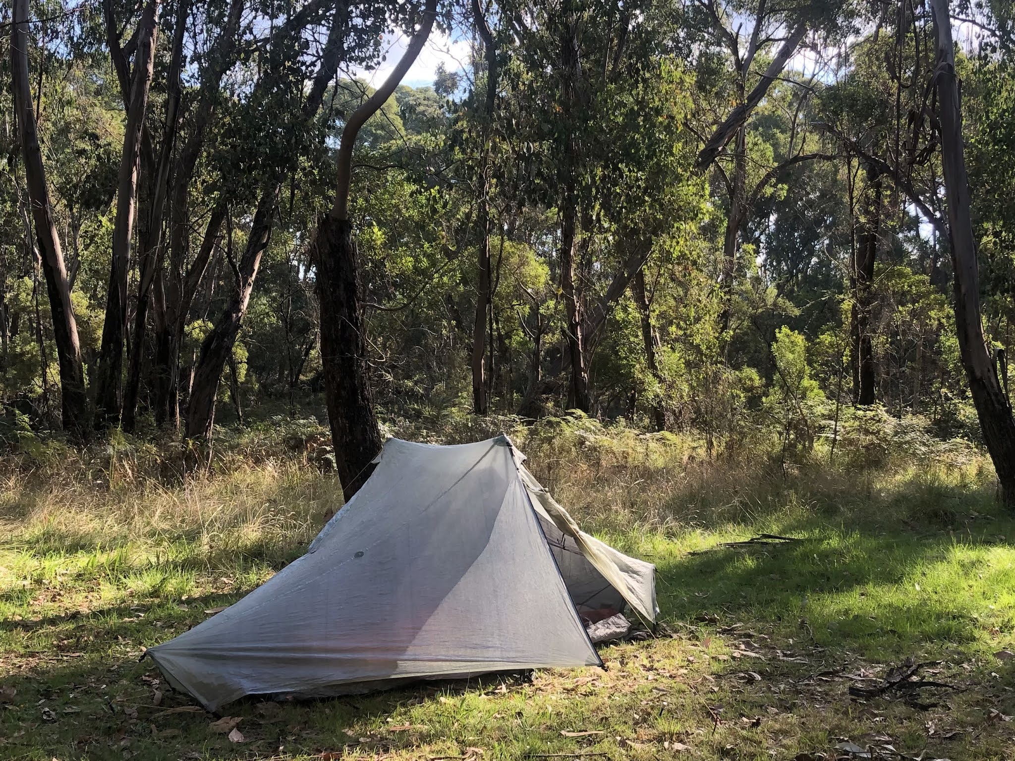
From the shelter I had to follow a fence line between stunted melaleuca/casuarina and empty paddocks for several kms into Port Moorowie where I hoped to camp. It was a large settlement, a couple of kms long but without camping opportunities. I got water at the public toilets and went on. I was really tired having done 34 kms already so I was happy to reach Mozzie Flat shelter quite soon. I found a spot to camp among the vegetation and hoped my tent would be ok in the wind. 36.8 kms

March 14 The wind had dropped slightly overnight and the weather looked promising with a blue sky. I set out on a long morning of beach walking. It was low tide so I had lots of firm sand and at first not much seaweed. There were flocks of juvenile hooded plovers whose nests there are signs everywhere telling beachgoers to watch out for. It was lovely on the quiet beach in cool sunshine. Then the seaweed got really thick and I tried without success to walk on the dunes instead, so I ended up making slow progress to Sturt shelter along the beach. I made coffee at the shelter.

From there I continued a while on the beach then had to come inland to skirt the Davenport conservation park, which is so ecologically important that walkers are not allowed in. However the edge was nice too with interesting coastal bushes and I saw a few dark coloured kangaroos. At the end of the park I came to 2 parallel sandy roads and a curious sign telling me to keep off both roads; I didn't know what to make of this as the ground between the roads looked impenetrable, so I walked on one of the roads until there was a strongly worded sign telling me to leave it, and I walked on the other road.

I came out to the South Coast Road, unsealed but hard baked, and walked many kms in the hot sun, before suddenly turning off and continuing on a sandy track just behind the beach. I could see Kangaroo Island more clearly. The beach was completely covered in pale seaweed and impossible to walk on. I was again exhausted by the time I reached Foul Bay shelter and I stopped for the night despite No Camping signs. 32.8 kms

March 15 The wind dropped further in the night and the stars were amazing. The first couple of kms were tricky, through the bush and the trail kept coming to a dead end, but I got to South Coast Road again for a few more kms. 

Then I came to Kangaroo Island lookout, saw the island, and found a huge improvement in the hike. The coastline was a series of headlands and bays, the rock tinged with red, and huge boulders.

 I walked either over the rocks, on the sand or on the bushy dunes that were on the cliff tops. There wasn't a proper trail but I followed whatever little track looked promising, trying not to go too close to the cliff edge as the edge sometimes looked precarious. Some of the bushes were flowering. Coming off the beach was always hard as I had to scramble up the big sandy dunes and coming down was steep too. 

At one stage I was following a dirt road and I noticed a shelter that wasn't on my map so I detoured to it and made coffee; it had a toilet too, which I haven't seen for some days. 

The dunes/ beaches combo lasted for a while 

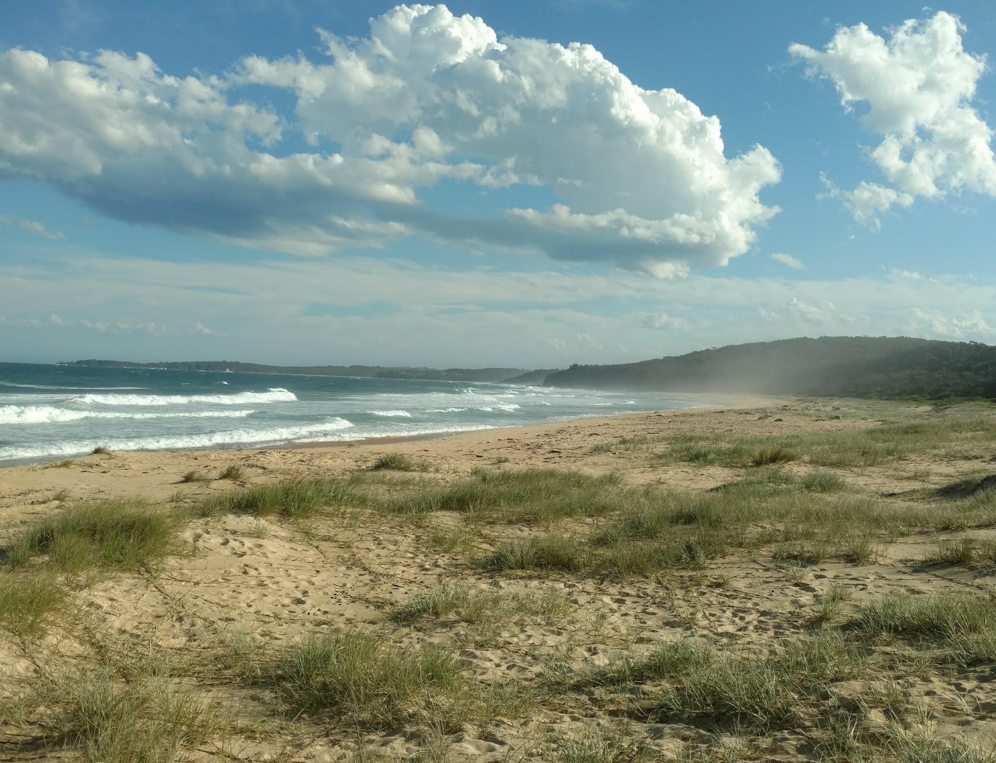
until I came to my final beach which led to Marion Bay and was about 8 kms long in a big arc. There were low spinifex dunes along the beach and behind them were high dunes with dense bush. (The gully in between is called a swale.) There was no hard sand, the beach was definitely not flat and I was walking straight into the wind. I could see distant houses across the bay and I did not believe I could walk that far. After 2 kms of struggle I had a brief rest and things went better after that. I marched quickly along on some hard sand until I reached seaweed which was thickly spread at the water's edge so I had to go higher up the beach to the soft sand. Finally I made it to the town, but not before a big disappointment when I came off the beach thinking I was in the town and had to return to the beach for more fun.

In Marion Bay I went straight to the shop to get food for the next few days before it closed and then went to find the caravan park. I went to the pub for dinner (walking another 2 kms I don't include in my total) and through the window I could see the entire tortuous beach; it did look extremely long. 30 kms

March 16 Out of Marion Bay I had another short beach walk - dune spillage had completely covered part of the staircase down to the sand so it looked odd in 2 sections.

Then I went into Innes National Park. At first I crossed grassland and almost immediately I surprised 2 emus. 

Then I climbed a headland and saw some kangaroos. 

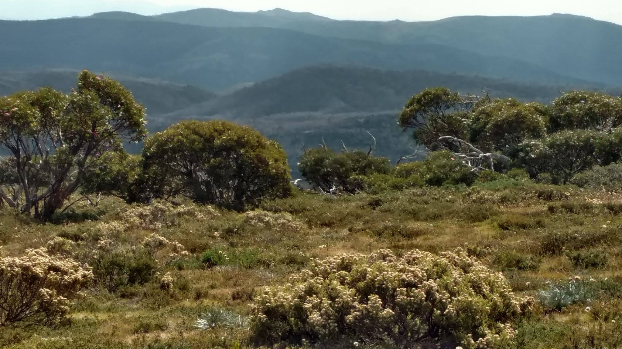
I followed a dirt road through medium sized scrub to a little settlement, Stenhouse Bay, with a long jetty then started on the Thomson-Pfitzner Plaster Trail. That's a name, and more exciting than the scenery; it was along a former tramway used to transport plaster and all through a rather dull forest. The trail ended at Inneston, a settlement mainly in ruins; I sat eating my lunch and noticed an emu mooching around.

My afternoon walking was better. The trail went into the bush and was very winding and also undulated a little. To my surprise I saw a blue lake in the distance. 

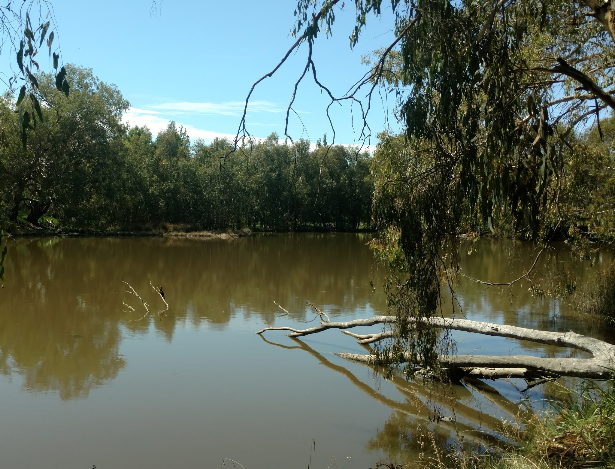
The trail went around the lake (close by I could see salt crusts) allowing a wide berth in case it would suddenly expand. I walked through samphire flats, heath and mallee woodland. I was tired, possibly still from yesterday's sand ordeal.

I put up my tent at Pondalowie campground beneath a high dune for some shelter from the wind then did a bit more of the trail without my pack. I walked out to Pondalowie Bay, saw the islands in the bay, saw 2 lighthouses and had a tiny beach walk. Much more of this beach tomorrow. 25 kms

March 17 Perfect blue sky and slight breeze. I completed the walk on nice sand along Pondalowie Bay and 2/3 of the way along I noticed a line of 10 dolphins swimming parallel to the beach not far out to sea. They were alongside until I left the beach. 

Next I had 8 kms on a gravel road passing varied scrub and mallee, and passing a dried up salt lake. The vegetation is colourful despite the poor nutrition. I broke the walk for a short detour to Shell Beach, a small sandy cove, where I had a refreshing swim in the beautiful azure water. 

After the road I turned onto a trail to Gym Beach. The trail started as low bush. Not far along I saw an emu with 4 young ones on the track; they ran down the trail. Moments later I saw 3 emus taking a stroll near the trail, stretching their necks from time to time to peer at something. Approaching a bend I heard a snort and found an emu with 5 young ones. More snorts, another pair of emus. It was wonderful. The trail went into mallee forest and I startled another emu with 4 offspring.

I sat in the shade of a rock on Gym Beach to have lunch and I noticed a group of 4 dolphins frolicking nearby at the water's edge. 

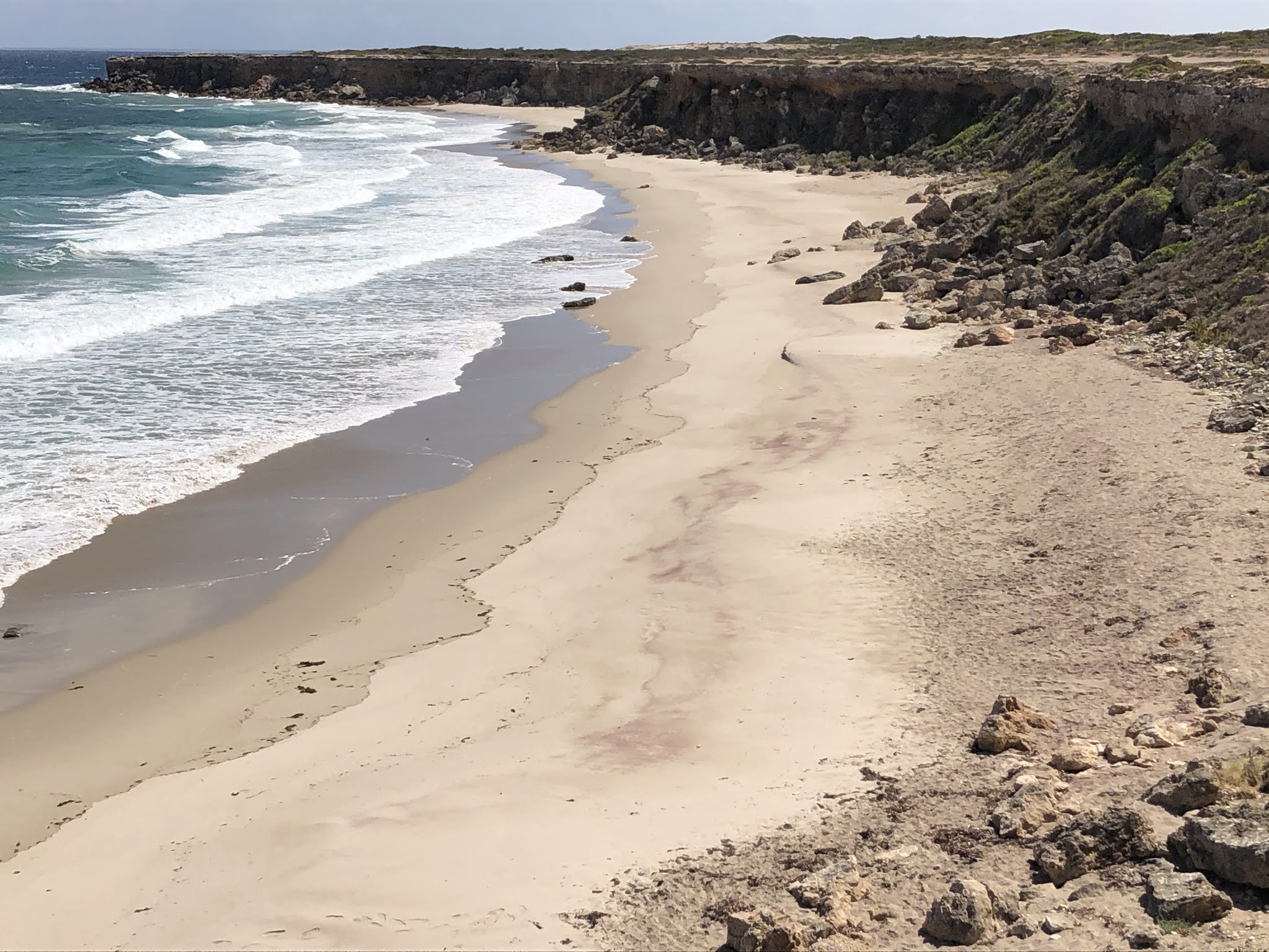
Some quite tricky walking followed. I did the length of Gym Beach on lovely firm sand and ended up at the base of rocks which I could only get around by going in the water. That was ok but the waves were much rougher at the next set of rocks so I had to climb up and over them and that was a little scary with my pack. I came down to another beach and then saw some decrepit rusty steps leading up to the cliff tops where I was supposed to be. After that episode I stayed high up, only descending to a beach where I could clearly see the way off it at the far end. The route wasn't really marked although I was able to follow footprints (human and animal). You can't get terribly lost, the only problem is having to climb up or down dunes. I see human footprints a lot but I have yet to see a person walking. The coastline was amazing; I've not often been impressed with SA beaches in the past but I am now. Beautiful curves of sand backed by multiple rows of dunes or sheer rocky cliffs and perfectly breaking waves. Some cliffs have heath like vegetation on top or otherwise are stony. I took a break on a headland and again saw a pair of dolphins swimming by. Beyond some high cliffs, maybe 30 metres, at the final beach (photo at beginning), I could see it was ok to walk on the sand and I felt so hot I had to have another swim. 

I climbed the dune and followed a path made by surfers to my campsite for the night, Formby Bay Shelter. Formby Bay is a popular surfing beach and the shelter was decorated with buoys, thongs, driftwood, netting and other bits and pieces. Another crazily windy night and I wasn't able to secure the tent well so everything flapped noisily. 26 kms

March 18 I walked 7 kms along stunning Formby Bay beach: white sand, dunes and sapphire sea. No seaweed. Just me and hooded plovers. At the end I climbed the headland and sat for a while. 

A fisherman was parked and asked if I had walked here; he said he had seen me in Marion Bay. The next bit was on the tops with interesting rock shelves and pools below. I came to Gleeson's Landing where I intended to camp but it didn't look too special, just massive rocky flats, and was chockers with caravans. However I was extremely pleased when a caravaner offered me a diet coke. I haven't had one for years and it was great on a 30 degree day.

I continued across another beach, disappointed to see seaweed returning, and the tide was coming in so the sand was softer. Thanks to the coke I went like a rocket. At Swincer's Rocks I saw a couple of caravans and found myself a nice patch of sand in the dunes to camp. The beach was sandy and without seaweed. I made a brief foray into the water. There was a line of rocks parallel with the shore about 200 metres out and another line further out. Windy? Yes, very.

I don't remember when I last saw the sun rise and set on the same day but today I saw it rise over a paddock and set over the ocean. 18 kms

March 19 I finished off the beach where I camped and then walked on the tops, passing a succession of boulder filled coves. I could already see Corny Point lighthouse far off. The path was not well marked but that didn't matter. I came down to Gravel Beach and chatted to some caravanners then followed a formed path at the water's edge. 

I crossed both the Berry Bay beaches (connected at low tide) and climbed to the lookout; I couldn't find the clifftop trail so I came back down to the beach and when I was directly beneath the lighthouse I scrambled up the dune. 

At the lighthouse I chatted with a couple from Victoria who offered me a bottle of water; initially I said no thanks but then I changed my mind and it was freezing cold. Fabulous. Just past the lighthouse was a perfect semicircular beach.

From the lighthouse the trail followed the coastline up high but was poorly marked. (The trail marking has been barely existent since Foul Bay except on roads.) I reached the road and walked into Corny Point.

The tide was way out and I had my introduction to another Yorke Peninsula feature: a line of tractors on the beach (that had pulled boats out over the sand). Corny Point was oddly long for a small settlement. From first reaching houses I walked 1.5 kms along the beach to the shop, where I bought food and ate lunch, then walked a further 2.5 kms to the caravan park. Nice pub. 20 kms

March 20 Almost all on the beach today. I walked 7 kms to The Pines, a small settlement, on firm sand by the water. Seaweed had created a wall between the high tide mark and the dunes. The tide was way out and I wouldn't call it a beautiful beach but the walk was particularly pleasant, with a slight breeze and a variety of birds: sooty oyster catchers, hooded plovers, herons, seagulls. There were lots of nice shells. Near a rocky spit lots of pelicans were resting and I livened things up for them by losing a shoe in quicksand, Tasmanian style.  Nearer The Pines the seaweed was in big clumps, looking like boulders from a distance, but I found there were no rocks involved when I dismantled some of the clumps.

At The Pines (which were clusters of low casuarinas) one map showed a shop but the other did not. So I asked a resident and was happy when she said there was indeed a shop, and we had a discussion about the seaweed. The shop lady said she wasn't turning on the coffee machine on a 30 degree day (although she would have sold me any deep fried food imaginable) and, as often happens when I come across a shop unexpectedly, I didn't know what I felt like, but I definitely didn't feel like a fry up, so I merely got an iced coffee and a cold twix.

After here I entered the Leven conservation park with little seaweed and sweeping bays. The sand was whiter and the water a more attractive blue. The land was really flat. I powered along to get to Burners Beach where I could distantly see what I thought were shacks but turned out to be caravans. At the camping area I chatted with a couple and drank a bottle of their cold water. It was a nice enough campsite with toilets and rubbish bins and sheltered, but I realised the hiker shelter was still 1 km ahead so I went on. That place turned out to be getting the full force of the wind and had water (with a bee colony) but no other facilities and nowhere to swim. So I went back to join the caravans. Good move. I had my swim in the calm waters and sat on the beach to watch the sunset. A stingray swam back and forth in the shallows. 17 kms

March 21 (I am so over these really windy nights with the tent flapping madly however tightly it is tied down.) I walked to the next beach along and sat on some beach steps to have breakfast at Point Souttar. The walk into Point Turton was meant to be on dirt roads but I went on the beach/rocks where I could. Mainly the coastline was low reefs and rock pools. 

Point Turton was another strung out place and on the lengthy walk a man working on his car started chatting, which evolved into him phoning his son for him to talk to me about the trail. I was let in on the secret as to why there are so few signs in some parts of the route.

I checked into the caravan park, had my first shower in 9 days and walked into the town. The shop was not where it was shown on my gps and I started to panic as I was overheated and hungry, but fortunately I managed to find it. I ate the largest donut followed by a pie, with a large coffee (even though it was also 30 degrees today). The pub here was also nice and gave a great view over the 11 kms of beach I would be walking tomorrow. 13 kms

March 22 I think the beach between Point Turton and Hardwicke Bay looked better last night at high tide than it did this morning at low tide. The walk was not the most exciting at the start with too much seaweed, giving way to a wide sandy beach with a view in a giant arc from Point Souttar in the south west to Port Minlacowie in the north, about 33 kms I calculated. I took one break before Hardwicke Bay and reached the town at midday. I checked out the tractors on the beach 

and sat under a shelter to eat lunch. This was supposed to be the end of my hike but I felt I couldn't stay there for a day and a half until my bus and decided to walk on. I continued through the town noticing that many houses had a tractor and boat parked outside.

The walk to Port Minlacowie started on dirt paths because there was too much seaweed on the beach and then I went onto the beach; there was still too much seaweed for comfortable walking but I had to put up with that. Sometimes I walked on the exposed rocky reef decorated with red samphire. I was really hot and tired when I reached the Port Minlacowie campsite after 7 kms and I sat by a cairn in a tiny bit of shade. 

Then something really nice happened. I saw a woman walking over towards me from a nearby house and she said she was wondering if I was the hiker who had recently spoken to her on the phone. I looked perplexed since I so rarely use my phone and she said it can't have been me because she would have recognised my accent. She said the hiker had planned to walk from Edithburgh to Hardwicke Bay and I suddenly realised that, yes, I was that person; I had phoned her to ask a few things about the hike when I was in Adelaide after I found her number on a Walk the Yorke related website and now I recalled she had said she lived just north of Hardwicke Bay. It was strange that it took so long for the penny to drop because I had thought of our slightly unusual conversation many times while I was walking along. I spent the rest of the afternoon with Celia and John, and we went for a swim at the Port Minlacowie boat ramp so that became the furthest point of my hike.

I camped right on the beach where I could hear the waves lapping and watched another sunset. 22 kms

March 23 I got up late and had another coffee with Celia. Then I walked back to Hardwicke Bay, at first along the road for a change. I saw some sheep. Back on the beach I survived the seaweed and walked through the town to the (closed down) shop and the official end of my hike. I had lunch and then a woman very kindly drove me to the caravan park in the larger town of Minlaton (where I could catch the same weekly bus that picks up in Hardwick Bay tomorrow morning) as there was nowhere in Hardwicke Bay where I felt comfortable about camping. 8 kms

Total 251 kms

Overall this was a wonderful hike and way more beautiful than I had expected.


08 March 2021

NSW South Coast hikes


After doing my Jagungal loop I decided to head for the coast and do the Light to Light walk near Eden in the far south, even though I knew the trail wasn't at its best after the fires last year. It was a long drive from the mountains so I was pleased to see that there were some good day walks along the coast on the way.

Feb 26 My first walk was the Bingie Dreaming Trail between Congo Beach

and Tuross Head. It was an overcast day but a pleasant temperature for walking. The trail was a mix of beach walking - hard on the outward journey because it was high tide and there was very little beach and no hard sand so I resorted to walking a fair bit on the dunes - and forest sections when I went inland to get around headlands. There were also grassy flats, complete with grazing kangaroos

 and several wide lagoons to go around, which came very close to the ocean at high tide. The forest was interestingly varied: patches of dense giant banksias, casuarinas, zamias, and ordinary schlerofyll. The beaches were long and mostly yellow sand.

When I got to Tuross Head it was coffee time and I asked someone where I could find a cafe; he wanted to send me miles away so after walking a while I asked someone else and then someone else, finally reaching a cafe 2 kms from the end of the trail. I hadn’t budgeted on this extra distance.

The sun was out for a while on the way back and the beach walking was good. All up 29.5 kms.

Feb 28 I walked the Kangarutha Trail in Bournda National Park from Kianinny Bay in Tathra to Turingal Head and return, 17.5 kms on a very hot day.

This was a completely different coastline with deeply indented rocky bays and lots of up and down. I crossed various pebbly, rocky and sandy coves and walked high above others. Some of the track was in melaleuca forest, very grey and dense. 

I saw lots of dark coloured wallabies and a goanna but the highlight was noticing a wombat on the path ahead of me and watching it run off really fast. This seemed an unusual environment to stumble across a wombat. 

The penultimate beach, Wallagoot Gap, was exactly as the name suggested, a tiny beach between high cliffs.

On the way back I detoured to Whites Bay with dramatic rocks.

March 2 My next hike was supposed to be the Light to Light Track but Ben Boyd National Park was closed for several days while they did aerial shooting of feral pests. So I had to cool my heels in Eden, and I decided to try the hike up Mt Imlay. The mountain dominates the skyline to the south of Eden. It's only a short 6 kms return walk but with a 600 m gain in elevation to the top at 886 m. The notice board at the trail start had warnings about the steepness and mentioned that people had got lost in the forest so I took my PLB.

This whole area was badly burnt in 2019 so I had low expectations. The long access road and the whole mountain featured charred tree trunks and some epicormic growth, although low ferns had proliferated and there were plenty of tiny gum saplings. There was nobody around.

The trail rose steeply in the burnt forest from the car park and soon entered overgrown young vegetation. It was extremely windy although I didn't feel the wind once I was among the trees. The mountain appeared as a big dome but I felt that I wasn't seeing the top yet. I first had to crest a subsidiary mountain then traverse across to Mt Imlay. Mostly the trail was a distinct dirt path with just a couple of rocky bits. There were remains of interpretive signs, which had substantially melted but at least showed where the trail went, and there was some pink flagging. I made a little cairn at one place where the track went over rocks. I had views towards the north, the coast and the coastal ranges, and these views weren't blocked by leaves on the trees.

The trail reached a rocky ridge and followed it as a more gradual climb, with the summit out of sight until I was right there. The last stretch featured lots of grass trees among the rocks. The views over Eden and Twofold Bay were good but hazy. 

Coming down I had no issues at all with following the trail.

March 3 Light to Light Track. As this is a point to point walk, and the shortest distance between the ends is the trail, I would have to do it both out and back, but with limited camping options, so I made a plan.

In the late afternoon I drove to Saltwater Creek campground close to the midpoint of the walk and parked. From there I headed north towards Boyd's Tower where the walk officially begins. Although the camp area itself was not much burnt the trail was straight away through burnt land. I walked 5 kms to Mowarry Point and camped just above the sandy beach in a setting that was totally idyllic (pictured at the top). The vegetation wasn't burnt and kangaroos came to visit.

March 4 It was going to be a hot cloudless day. I continued 8 kms to Boyd's Tower, leaving my pack hidden in the bushes at Mowarry. The tower is a simple stone structure that was intended to be a lighthouse but was not allowed to operate as one so was used as a lookout for whales when whaling was the big deal around Eden. The views towards Eden were very clear.

I turned south and walked in light forest, mostly burnt. There were impressive red rocks and cliffs and nice views back to the tower. 

I crossed a few pebbly beaches and a short red rock shelf, then yellow grassland. The dark red, almost purple, rock is a distinctive feature of this coastline. Leather Jacket Bay was a nice spot, a deep sandy bay.

 Mowarry Beach still looked beautiful with the sapphire water and red rocks and I sat under a tree for lunch, having retrieved my pack. From my vantage point I watched a goanna on the dunes about 100 metres away. I walked a long rock shelf and had some views of inlets down the coast but most of the scenery was, sadly, dead banksias and casuarinas.  I could see Saltwater Creek beach in the distance and was happy to get there. As I descended to the beach a black snake wriggled off the track.

It seemed I had no option but to stay at this campground, having discussed the camping situation with hikers who had come from the other direction. The beach was long and the water looked inviting so I walked to the far end and had a short swim. I was surprised the water wasn't colder. There was a goanna skulking around my campsite and it gave my car a good hiss.

The wind came up like crazy in the night. I was using my Tarptent and it blew over repeatedly between 1am and 4am because the pegs wouldn't hold in the sandy ground. One time I couldn't find a peg until I saw it on the other side of the tent. I gave up trying to keep the tent upright and I wrapped it around me like a bivvy. Then I slept well. 22 kms

March 5 The southern half of the track was often away from the coast, although usually within sight of the ocean, and was more enjoyable for showing greater recovery from the fires. The first long stretch was through high yellow grasses with sparse (burnt) banksias that could be  filtered out. 3 kms out of Saltwater Creek I had my first sight of the lighthouse at Green Cape,  the end of the Light to Light, 14 kms away by trail. Among the grasses was a little coastal heath with wildflowers

 and green forest in the distance. I crossed a pebbly beach at Hegarty Bay (where there was a tiny campsite closed due to danger of falling trees, and some trees looked very threatening) and a pretty creek with flowing water. After more grassland there was a long blocky rock platform

which I almost missed by having too much fun bashing through some melaleuca and not noticing a turn off the track. From the rock platform I had another clear sighting of the lighthouse.

The track went through mature forest with scribbly gums and other gums which was a real treat, then descended to Bittangabee Bay, a deep inlet with a small beach.

Moments after glimpsing the beach I looked at my feet just in time to see a fat snake slithering off the path.  I left my pack at the campground and continued towards the Green Cape lighthouse.

The track went into a ferny gully and through casuarina forest. I saw a lyrebird scratching in the bushes. The trail stayed in light forest crossing a couple of stagnant creeks. For the final 4 kms the track was over open heath, views of the lighthouse in the distance, and more wildflowers. It was really windy. I was with some other walkers and when they all suddenly stopped I guessed correctly they had met a snake.

At the lighthouse the water below was really churning and I had to put on my rain jacket against the gale. I had a good view along the coast southward into Victoria but this was a bleak spot on such a windy day.

I turned back and returned to Bittangabee campground. On the way I saw the same lyrebird scratching about. This campground also had its resident goanna looking very much in charge. I had a pleasant time sitting on the rocks by the beach, well sheltered. The cliffs were very dramatic

24 kms

March 6 I set out early for returning 10 kms to Saltwater Creek. Bittangabee beach looked so lovely in the morning light.

Again I enjoyed the forest. From the long rock platform I could see crabs on another rock platform far below. At Hegarty I sat for a while, luckily no trees fell. When I got to Saltwater Creek (Saturday morning)  it was like a different place, busy with cars parked everywhere. 61.2 kms altogether.

Mt Jagungal, February 2021


The loop around Mt Jagungal together with bagging the peak (Australia's seventh highest, 2050 metres) was a hike I had long wanted to do but never got round to. This was a real shame since the whole northern part of Kosciusko National Park was devastated by fire last summer and the Jagungal area was closed for months afterwards so the hike was out of the question. Now I finally had a chance to go there. 

As it happens the severe fire damage in this part of the Jagungal Wilderness dates mostly from the 2003 bushfires rather than the 2020 fires. New snow gums have grown near the burnt ones in some but not all areas so large swathes of bare white snow gum trunks and branches are everywhere.

Feb 22 I drove to Round Mountain trailhead and walked 2 kms to Round Mountain hut, which is ruined and only a fireplace remains. The hillsides were covered with charred snow gums from the 2020 fires. I could see Mt Jagungal (and the long saddle adjacent) from the campsite, looming large, 11 kms away and 19 kms by track. This mountain is just so much higher than anything around it.

Feb 23  This was a long day. It was a cloudy and cold morning and I thought I should have brought gloves and rain pants. For some reason I had checked the weather forecast for Tumbarumba rather than for Jagungal! I walked in all my clothes. I made the long descent on Farm Ridge track to the Tumut River, surrounded by yellow grasses, and had to wade the river - it wasn’t  wide but had a surprisingly strong current. 

Farm Ridge was maybe the best of the day's walking as there was little sign of fires, lots of leafy snow gums and green grass. But the mist was swirling so I had limited views. I joined Grey Mare trail and soon had to wade a creek, just as my feet had got dry, then stopped for coffee and while sitting there the sun tried to come out. 

I continued to O'Keefe's hut which had a nice smell of timber inside and walls covered with newspaper pages from 1930s and 40s. When I left the sun was shining. Almost immediately I had good views of Mt Jagungal and masses of skeleton snow gums from the 2003 fires. 

The turnoff to the summit was marked by a cairn but no sign so I hoped it would remain clear where to go. I did not know at that time that there is no cut trail to the summit, just a worn route. I had a short bit over grass and crossing the headwaters of the Tumut River twice, now easy to jump over, then went into ti-tree. This was dense and got up to shoulder height; for many stretches I couldn't see the track at eye level, could only feel for it with my feet. (The ti-tree was so dense that I couldn't have got through it if there wasn't a trail.) 

I emerged to snow gums, both skeleton and alive, and startled a little snake, who couldn't decide which way to go. I thought the last part would be a scramble but the route remained on grass until a few rocks right at the summit. I was having a race to beat the incoming clouds on the final pinch. 

The summit was a mass of boulders and it was windy. I had fairly extensive views in all directions of alpine moorland and countless peaks but sadly the landscape is blighted by the vast number of patches of skeleton snow gums; it looks like there are grey boulders dotting the mountainsides but looking more closely these are dead trees. 

I think I saw the same snake on the way down, and then another. By the time I was down the sky was blue. 

I did the final few kms to Derschkos hut on flat Round Mountain fire trail. This hut was in a valley and the damage from the 2003 fires was well hidden by new growth. It is a Snowy Mountains Scheme research hut rather than a cattlemen’s hut. I camped beside the hut and ate inside  because it was cold. The hut is at 1620 metres. 26 kms

Feb 24 It was a beautiful clear night, very cold and in the morning there was frost on the grass around the tent and on my shoes. The Tumbarumba forecast had said zero chance of frost. I wasn’t too cold once I got going. I came into a large valley, rounded hills all around, lots of wildflowers. 

The track undulated, with some serious climbs, and the creeks almost all had bridges; this track is obviously used by vehicles in preference to the one on yesterday's side. 

In the last 5 kms I came back to the recently burnt part. I passed Round Mountain which was very burnt. My final creek crossing was a tributary of the Tumut River, with a makeshift sheet of iron for a bridge and a lizard resting on it, who just looked at me and didn't move. I had been able to look behind me and see Mt Jagungal almost the entire way back.

My car was still alone in the car park. 14 kms today, 42.3 kms for the loop. My verdict: this was a good walk and I am pleased I have finally done it. I can only imagine how great it would have been prior to 2003.

Hume and Hovell Part 2


My trip to Tassie was cancelled at the very last minute by a covid lockdown so I decided it was time to go a few more rounds with the pensioners (that’s my take on the charming track markers for this trail). The part of Hume and Hovell from Tumut to Albury that I haven't done is logistically challenging but I decided to try some sections. Much of the trail is still closed from the fires last year. When I escaped from Melbourne I was driving towards Tumbarumba and I noticed I was going to drive through the tiny settlement of Lankeys Creek which is on the Hume and Hovell so I thought I might as well stop there overnight. I was not at the time intending to start hiking from there. It was a nice campsite by the creek and I could leave my car off the road and out of sight. In the morning it was very foggy and as I drove out I saw camels in the paddock by the campsite. I thought this must be a mirage caused by the fog.


Feb 13 I had a snack in Tumbarumba then parked by Mannus Creek to start my 2 day hike to Lankeys Creek. I would then have to walk the return back to my car.  Beyond the Lankeys Creek campsite the track is closed from last year's fires.  I walked 12.8 kms to Mundaroo campsite mainly on hilly logging roads, passing cleared and uncleared pine plantations. The campsite was a pleasant surprise as it was a clearing in native forest by a tiny creek, and there were lots of tiny birds.

Feb 14 Next day brought much better walking, in forest and crossing several creeks, then along a fence between native forest and pines. I saw an echidna which immediately ran and hid 

then a big brown snake. I had seen quite a number of kangaroos jumping off into the bush. There was some blackberry but this time I didn't mind because the plants were full of fruit. I stopped in the pine forest for coffee and went on, but after a while I realised I was going completely the wrong way and I had to backtrack to a brand spanking new stile I had missed.

I climbed in dry forest onto a ridge 

with amazing views down onto farmland, the Carboona Gap, and to mountains in the distance. 

But then I emerged to dry grassland full of thistles. These thistles were dead but dead thistles are extremely prickly. I went downhill to greener pasture with lots black cows, curious about me. I had to wade Copabella Creek 

and crossed more forest to Lankeys Creek. 

The route followed this creek on river flats. It had become very hot and I was exhausted as I trudged through paddocks (although the river flats were very beautiful) then had 3.5 kms of road to finish the day. A guy pulled up in his car and asked if I was going to the campsite and said he would visit later as he lived close. This was odd. He was surprised to hear I had camped there before without his knowledge - that was the night I came from Melbourne - and I soon realised  the campsite is on his land. And he has a camel trekking business.

 I cooled my feet in the creek after just under 30 kms and had a great starry night. 

Feb 15 The next morning the camel guy drove me back to my car which was great and saved me 2 days of walking. Then I did an out and back on the 5.5 kms section of track between Mannus Creek and Mannus Lake. I had my final blackberries of the trail. There were pelicans on the lake. I made a cup of coffee with lake water before seeing a sign warning about toxic algae and saying not to drink this water.

That afternoon I drove to Woomargama to embark on another section. I parked and walked 1.6 kms to Samuel Bollard campsite. It was a clearing in forest, very dusty and dry with a water tank and strangely the toilet was locked. This was a warm evening, good stars, deep red sky at sunset.

Next day I intended to walk east from SB to Tin Mines campsite (Lankeys Creek to Tin Mines is the closed section I mentioned) and then walk back to my car the day after. I've been doing the trail east to west but Tin Mines didn't appear to be accessible by 2WD.

Feb 16 The walk started on a logging road and some huge logging trucks came past. Then onto fire trails, much nicer. The route kept making turns, signed, but I had no idea where I was as the route on my gps was totally different. The trail must have been realigned. I followed the signs but it only takes one missing sign to get lost and sure enough this happened: after climbing a horrendous steep hill the dirt road abruptly ended. I backtracked, took the alternative track and luckily soon saw the markers again.

The track entered Woomargama National Park and climbed to a lookout on top of Mt Jergyle. I sat on a huge granite slab and had views towards Wagga 

and Canberra 

with lots of forested peaks in the foreground. All looked bluish in the heat haze. It was very warm and hard to get out of the sun. All the comfortable looking logs by the trail were in full sun. 

From the lookout I had 8 kms of descent among lovely grey gums, although the terrain was still very dry, to Tin Mines, which means there will be a long uphill tomorrow. Tin Mines campsite was very spread out and grassy with a swamp behind.  There was nobody else there until a family turned up, from Victoria and they had been booked on the same ferry to Tassie as me! 21 kms.

Feb 17 Next morning I started earlier and hurried uphill to Mt Jergyle. It was nice and cool, trees looking lovely in the sunshine, ferns, kangaroos, lots of noisy cockatoos. 

I stopped at the summit and, of all things, I rebooked my Tassie trip, while again enjoying the great view. Back on the descent I tried a different route, which was the gps route I had but not the signed route. It was all on logging roads. I went through an area closed because of logging activity, so I had to hide in the bush when a truck went by. This was dusty work and the heat was making me tired. It was a really undulating road, with some views towards the south and the mountains. Black clouds were gathering. I drove to Woomargama and was keen to stay at the motel. The Victorian lockdown was almost over which was a relief; I was no longer a fugitive.  22 kms

Feb 18 I returned by car to park near Samuel Bollard and start the 3 day final section of the track to Albury. The track went into forest and along a ridge on very nice single track, some views, descending to a gully at the confluence of 2 creeks, both dry, then climbing back up.

The next part I had read about: the untracked route follows a fence line and is a sea of thistles while on the other side of the fence (where I'm not supposed to go because it's private property) there is an old fire trail without thistles. Very soon I was bored with the thistles so I climbed over the fence and walked on the forbidden side. 

The trail finally came out onto open hillsides with lots of boulders and few trees. It was again hot and sunny but there was a slight breeze. I followed little paths and soon lost the main trail, but I wasn't worried because I could see Lake Hume in the distance and that was where I was headed. Actually I was looking at the upper reaches rather than where my destination lay but by the time I realised this I was back on track. The route crossed many stiles in various states of disrepair and the views of rounded hills and small dams were really pretty. But no cows today.

On the final stile was a sign saying the Hume and Hovell is closed annually along here all the way back to Lankeys Creek until Feb 28 because of fire risk. So I've done at least 2 naughty things today.

I had to walk another 8 kms on a bitumen road to the campsite which was hot work. I was pleased to arrive at this campsite on Lake Hume; it was a commercial camping ground and I was given a good grassy spot (freshly watered grass) overlooking the lake. 26 kms

Feb 19 It was already hot when I set out before 8am. I began with a nice 8 kms in a travelling stock reserve with rolling hills, sparse woodland, lots of cockatoos and parrots. More stiles.
The rest of the day was a hot trudge along quiet country roads. Occasional I had a stop to rest in the shade. Actually it became so boring I listened to a podcast while walking. I walked around Mt Budgingi and came to Table Top Reserve (town water and flush toilets) on Lake Hume, only 9 kms across the lake from last night but 23 kms of walking around the lake. It became windy and remained hot so I didn't do much.

Feb 20 Beautiful red sky at sunrise and I thought it might be a cooler day but again it was hot by 8.30am. I had 5 kms on bitumen road, some glimpses of the lake, then a stretch along a travelling stock reserve in wooded grassland, then I avoided new housing development by walking along a busy road, passing Albury airport. I had to walk along the bike path by the Riverina Hwy in blazing sunshine, then went down a trail in Mungabareena reserve by a channel of the Murray River, nice and shady. 

I climbed Eastern Hill and didn’t have to go far up for good views over surrounding hills and Albury and Wodonga. I descended to residential streets, crossed the Hume Hwy, booked a motel and walked to it. There I ate 2 bowls of cornflakes (the breakfast supplied by the motel). 

I left my pack there and did the final 2 kms of track, along the Murray to the Hovell Tree. Lots of people were swimming in the river. It was a relief to reach the tree


but a low key finish to the track. 28 kms today and 77 kms for this section.

Feb 21 I had to return to Samuel Bollard car park to collect my car. I took the bus from Albury to Woomargama

and the driver said this was the first time this year he was stopping there (it’s a request stop) and he called another driver to tell him about this. It was a very hot (34 degrees) 11 kms walk, 2 hours with a short break, right in the middle of the day. I was passed by a few cars but because it was Sunday there were mercifully no logging trucks.