When I was on the GR 10 I asked some of the hard core hikers which other GR’s they would recommend and every single person said I should do the GR 70, Chemin de Stevenson. It’s loosely based on the walk Robert Louis Stevenson did with a donkey named Modestine in 1878 and described in his book Travels with a Donkey in the Cevennes, and goes 270 kms from Le Puy en Velay south to Alès. So I read the book and embarked on the walk. I have to say that in the early part I didn’t feel the walk lived up to its publicity but later on it was wonderful.
August 26 I had breakfast at the Place du Plot in Le Puy, watching a stream of walkers head out on the Chemin St Jacques. After passing the cathedral and walking a loop around the old town I climbed out of town and continued climbing through farmland. I could see the distinctive rounded volcanic hills all around. The area is called the Velay. There were plenty of us out on this trail. The trail followed farm roads and rough paths, crossing the River Loire (tiny) in a small town, Coubon. I stopped for a coffee. The church had a striped facade like Le Puy.
Then a long rise among farmland and into pine forest, going through a few hamlets. Many old stone crosses near the trail. I came out onto a ridge with views of scattered villages and descended to town Le Monastier sur Gazeille. The Romanesque église abbatiale looked derelict but it was impressive inside (10th to 13th century).
The buildings along the main street were pastel colours with wrought iron balconies.
At the bottom end of the town was a 9th century church, where a woman explained to me the history of the town. I found a campground near the river. 22 kms
August 27 A misty muggy day and I could just discern the tops of the volcanoes. There were those rounded humps everywhere. I followed rocky trails along a ridge and went through hamlets; houses in local volcanic grey stone style. The blackberries by the trail are perfect for eating. I stopped in St Martin de Fugères for coffee and bread (pretty church, locked).
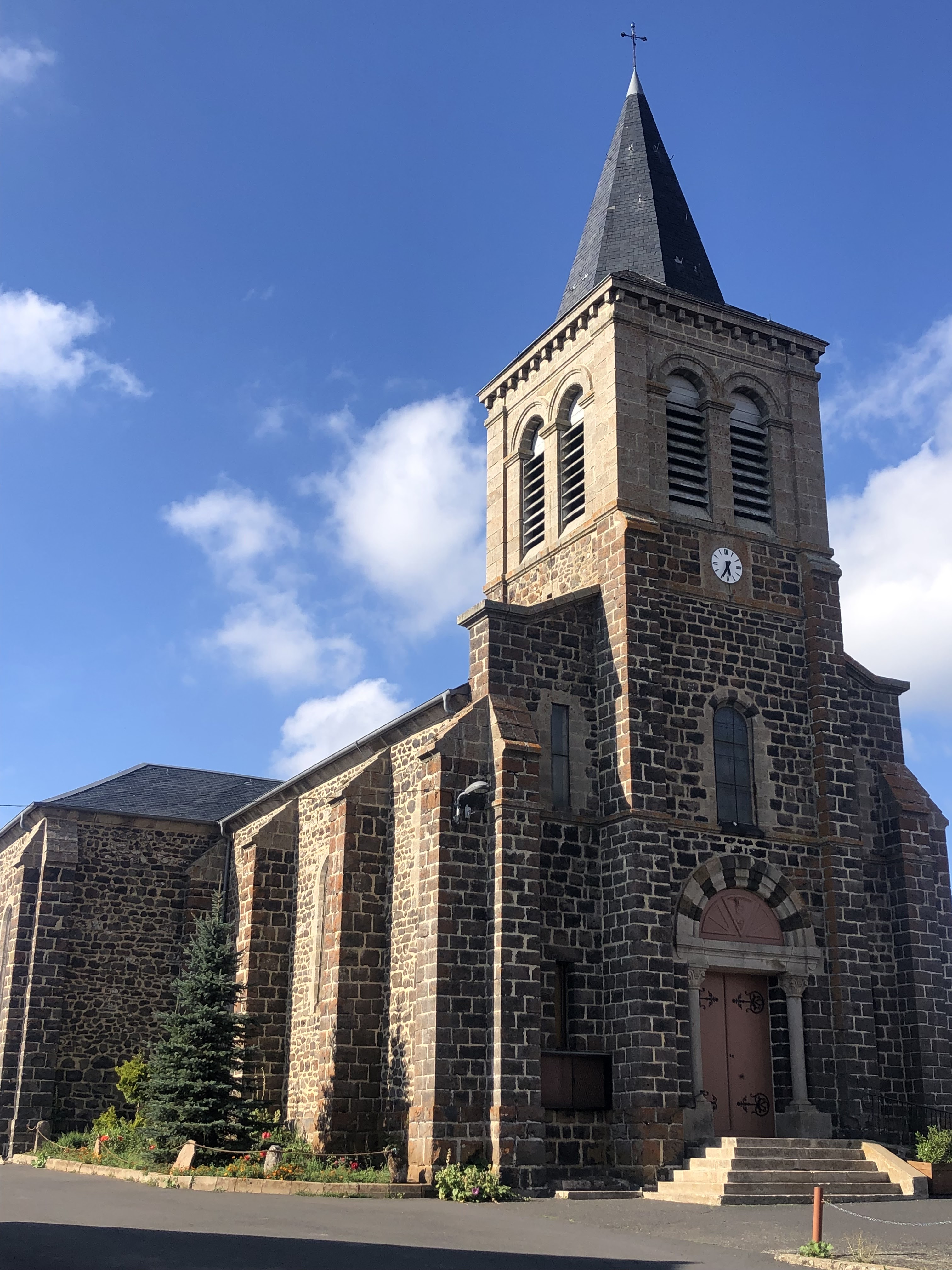
I had a tricky rocky descent to Goudet, on the Loire with castle ruins above the town, and then a longish climb to a plateau, views of farmland and hills. I was surprised to be above 1000 metres. The trail undulated to Ussel, where I sat to eat picnic lunch with two guys from Agde and Carolin, then climbed gradually to Le Bouchet St Nicolas at 1200 m. Nice church, locked.
I camped at the municipal campsite with the others. 23 kms
August 28 Sunny day. I walked beside fields to busy town Landos and through several hamlets, waited for some cows to move off the road, then I walked with Carolin to Pradelles. We had lunch. This is supposed to be one of the prettiest villages in France and it had lots of quaint houses in pastel and stone, narrow streets and many small fountains. It was a shame so many of the buildings were
A Vendre with large signs.
I walked downhill, it was really hot, to much bigger Langogne which was a very ordinary town with nothing going on (Sunday) and to the campground by the River Allier. A German woman camped next to me with the same brand of pack and tent as mine, first time I’ve seen them in France. At the campground I was able to order a pizza for dinner. 29 kms
August 29 I like the French custom of saying Bonjour to everyone you see, but while you’re cleaning your teeth in the sanitaires: hmm, not so sure.
Langogne was more appealing on a lively weekday morning, lots of old stone houses, covered marketplace, 11th century church I could go inside.
I walked uphill out of town, descended in pine forest to an old stone bridge over a little creek then climbed to go through several hamlets: Saint Four de Mercoire, L’Herme, bits of pine forest, Sagerousse, Fouzillac, Fouzillic. Stevenson inadvertently walked around in a circle here but I didn’t have to. The houses are now a paler stone and the volcanic humps are gone.
I came through deciduous forest into Cheylard l’Evêque, pretty village of stone houses and a quaint church (also a chapel on the hill above the village). I like these local churches where the bells are tucked inside the façade.
I climbed in two sections of pine forest with nice views of forested hills in between; there were people in the forest collecting mushrooms. Came to a lake Étang de l’Auradoux
and, after a rocky descent, Chateau de Luc (13th century - ruins) with a tower to climb for good views of the area. Luc had an unexpected shop and a municipal campsite below the château (a field by the Allier that was too well lit). 29 kms
August 30 After a couple of villages I had a long climb in a lovely pine forest, and good views at the top. This region is the Gevaudan. I met my first (and only) group walking with a donkey. In La Bastide-Puylaurent I had coffee. There were lots of hikers around.
I had a long gradual climb in pine forest, lots of wind turbines in the area, and a long descent to the village of Chasseradès which oozed oldness. It was on a hillside with a simple but very lovely (inside and out) 13th century church at the top. From there I descended to Miradol, a cluster of houses dominated by a massive rail viaduct.
I came into countryside and decided to bivouac in the corner of a field by the railway line, with a nice view of hills. 26 kms
August 31 Not one train all night. I had a little while among the rolling hills then returned to pine/fir forest for some climbing and descending, finishing in a cute hillside hamlet Les Alpiers. I could already see Le Bleymard below, a small town, tucked in among hills. When I got there I went to the supermarket and had a coffee and after a long while I realised I wasn't even in the town yet. The real town had old stone buildings and a long narrow street but by the time I got there everything was closed for lunch.
I climbed to Mount Lozère ski resort (going the wrong way for the first time) and had a break - for a ski resort it had a surprisingly nice vibe. Then I continued to Pic de Finiels, the summit, which I feel has been unlucky to be measured at 1699 metres. The whole area was covered with heather and some stunted pines, dolmen marked the route, and the summit was a large windswept plateau.
There were views back towards Le Bleymard and quite a lot of mountains; the best mountain views were southwards towards the Cévennes, a hazy bluish panorama.
The descent started with a lovely path winding through low pines then opened out to give views over the hills and the village of Finiels. As I came into Finiels I noticed a pitched tent in a meadow and I was very pleased to find a campground, lots of little nooks with shade and views. 29 kms
Sept 1 I continued to descend from Finiels on boulder strewn open hillsides to Pont Montvert - the landscape is quite different here - where I found a nice bar for coffee across the road from the River Tarn.
Then I climbed in the open to a minor summit with good views back to the town and all the way to the Pic.
The next climb, in forest, was the steepest yet, emerging at a clearing where there were lots of cairns, but this wasn't the summit; the summit, 1421 metres, was an open top with a fabulous view to the Cévennes. There were some day walkers around but I'm not seeing many serious hikers at all.
I then had a long afternoon of gradual descending, soon going into beech forest, later pines. The early part contoured beneath granite cliffs. It turned out to be a tiring day and it was hot (33 degrees); I felt a storm was coming, but none came. As I descended I ended up on the GR 68 heading for Florac and when I reached the town (back on the GR 70) it was several kms to the campground, which was by the river Tarnon. I'm now in the Cévennes. 32 kms
Sept 2 Since I hadn't seen the town properly I went back for a look around and checked out the chateau (modernised) and church (locked) and a maze of old laneways. There are sheer granite cliffs rising 500 metres above the town, forested with curious bastion-like outcrops, stretching a long way.
After pain aux raisins and coffee in town I had a walk along a river and then in beech/chestnut/oak forest in quite rugged gorge country, climbing a lot for a trail described by the campground manager as flat. Three kms from St Julien d’Arpaon it started raining but I was well protected by the trees. As I emerged from the forest the rain stopped and I reached St Julien where there was a brand new snack bar/toilets and covered seating for lots of people. I sat there as a thunderstorm passed over and it rained again. It got quite cold.
The next part was along a rail trail high above the river and beginning in a steep sided gorge. There were several short tunnels and two viaducts. The trail remained above the river until reaching the former station of Cassagnas, which was now a gîte with camping. The rain finished but it was a dull day. I ate with a nice group of walkers at the gîte (herbed sausage with mashed potato for main course) and soon after I went into my tent there was the loudest thunderstorm. Later in the night there was another storm. 22 kms
Sept 3 I left the gîte and soon came to a farm where a sign indicated I was on the GR 72 going the wrong direction. I couldn't see a sign for the GR 70 so I decided to follow the GR 72 as it ended up in the right place, St Germain, and I had a nice walk in forest. There were no waymarks at all until I suddenly saw a solitary GR 70 signpost. Most odd. I ended up at the Col de Laupies where I had a fabulous view of forested mountains with clouds swirling in the foreground.

While I was there three hikers appeared and I consulted them about returning to the GR 70; they sent me further uphill in a direction I wasn't sure was correct but they were adamant. After a km I reached a plateau and I was clearly in the wrong place so I came back down and found the right trail. At the next col (de la Pierre Planté, with a dolmen) I came across a group from the gite who couldn't understand why I was behind them. I explained what had happened and it transpired that I couldn't find the right start today because I was confused about the direction from which I had approached the gîte yesterday and didn't want to backtrack. I had lunch with them and I was perfectly satisfied that the view was better at the other col.
Back on the GR 70 I had a long descent to St Germain de Calberte, nice church (whitewashed inside like so many here), and sat with gîte people at a cafe. I was going to camp there but I didn't like the look of the campground so I waited for the shop to open at 4 then walked on, descending further, seeing nowhere suitable to camp but knowing a storm was coming. Finally I found a patch of flat ground by a dry river bed. I just got my tent up before a brief shower, but no storm. 26 kms
Sept 4 It was misty in the valley when I got up. Approaching St Etienne Vallée Francaise I had a lovely view of the village and it proved to be a really pretty place.
The supermarket and épicerie were open but not the restaurant (Sunday). Inside the church they had uncovered fragments of frescoes.
I had a big climb back into the forest and up to Col St Pierre. The view there was limited but not much higher I got to Signal St Pierre which was a summit at 695 metres with a quite spectacular 360 degrees view over the entire Cévennes, the inner lower mountains and the outer higher ones. This was the best view of the entire trail. From here the route had recently been altered, to give more climbing but with a nice stretch along the crest so I had the terrific views for longer. I came down to St Jean du Gard, a town which was all closed up like Langogne last Sunday. However I found a cafe to have a very large ice cream (while Severine, whom I’d been meeting all day, went to the museum).
The campground was out of the town and had the worst mozzies. I had dinner there with Severine, who didn't eat, and when she left I had another ice cream sundae. 19 kms
Sept 5 It was a showery morning with bad weather forecast all day but I didn't want to stay another day at that campsite. I had coffee in town during a big downpour then set out; I only planned to go a short way to Mialet which apparently had several eating and sleeping options. The track was quite rough and I came across a guy I had seen at Cassagnas who was struggling; he wanted to know what there was at Mialet and I told him what I'd read was there. On the edge of the village was a lovely multiple-arched 1740's stone bridge, Pont des Camisards; I was trying to work out how to access it for a photo when a delivery driver stopped to ask me the way somewhere.
Mialet was a pretty hamlet of stone houses and it poured when I got there. The church was locked. The épicerie was closed. I didn't see the bar/restaurant. I saw no gites. I saw no water tap. (By chance I later bumped into that guy in Alès, had coffee with him and heard that he had stayed in Mialet.)
I left as soon as the rain stopped and began the long climb to Col de Mayelles. It was a constant battle with the rain and I sheltered under an oak tree to eat lunch. When it wasn't raining it was so humid I was drenched in sweat. I heard thunder. The view at the col wasn't special but on the approach and afterwards I had great views over the mountains. It feels so much more mountainous here where the mountains aren't very high (500/600 metres) than it did near Le Puy where the mountains were much higher. The trail stayed on the crest for a long time, with sheer cliffs, and the walking was slow, with another great view from an opening called Montcalm.
I could see the sprawling town of Alès from there. The descent was frustrating as it also involved a lot of steep climbing and many rocky bits that were hard because the rocks were slippery from the rain. I passed some castle ruins. In the late afternoon the sky cleared completely.
I was going to get to Alès quite late with no idea where I could stay, so when I saw a patch of grass at the edge of the forest, just 2 kms from the GR 70 finish, I decided to stop and camp. 23 kms
Sept 6 Nice birdsong in the morning, then as I was getting out of my tent I heard a big din and a flock of sheep were coming along the trail, followed by a group of goats. As they passed my tent was lying on the ground and some sheep had a sniff while the patous checked me out. I had a steep kilometre into Ales passing mining remains and then narrow streets with peak hour traffic. The trail finish was by the Eglise Notre Dame de Rochebelle (locked). As I stood reading the signboard outside there was a sudden downpour. 2 kms
I went on into Alès in the rain because I was anxious for a drink of water and breakfast.
Total distance 285 kms


No comments:
Post a Comment