On the morning of Monday 17 August I set off from Emerald in Queensland's Central Highlands to drive three hours to Nebo, 80 kilometres on my side of Mackay. I had been in Emerald after finishing the 90 kilometres Carnarvon Gorge Great Walk two days earlier and I was heading to Nebo to begin the 60 kilometres Mackay Highlands Great Walk in Eungella National Park.
On the way to Nebo I intended to stop near Clermont and climb Wolfang Peak which I had read about in a tourist brochure spruiking activities in the Mackay region. The out and back walk was supposed to take one hour each way. I had also read a couple of blogs about the walk to get more details but serious information was hard to come by, as the bloggers had noted. It sounded like a fun way to break up a long drive. Clermont to Nebo is almost 200 kilometres along the Peak Downs Highway, in the heart of coal mining country, not passing through any settlements. So a break for stretching my legs made sense.
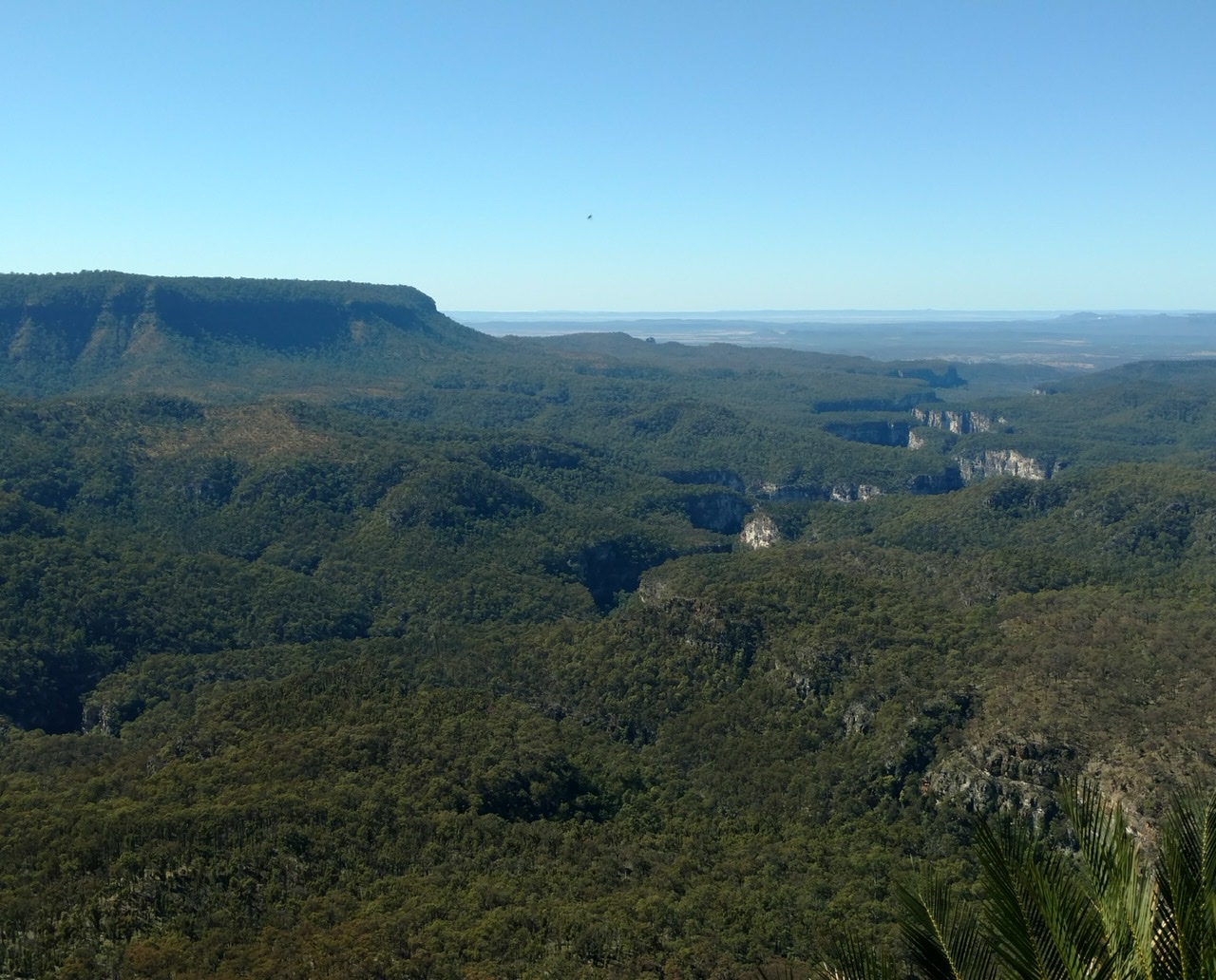
I stopped after about 100 kilometres in Clermont to prepare for the hike with coffee and a doughnut (I thought at the time that the small town had a nice vibe) then drove towards Wolfang Peak in the Peak Range National Park. It was very clear on the horizon, a sharply protruding volcanic plug (521 metres above sea level and around 250 metres above the plains) jutting out of the flat scrubby terrain. There were other similar peaks but none so stark and all were individually well isolated.
I turned onto a sandy road about 30 minutes out of Clermont which was signposted to the peak walk and parked as I didn't think it would be sensible to drive my car on the sandy road. This dirt road was parallel with and very close to the highway. The access road began where I parked and ended about two kilometres away, at a turnout off the highway. I started walking the access road and soon realised I had parked in the wrong place, as I should have parked at the turnout I just mentioned, and this gave me a couple of extra kilometres to walk to the trail start, but never mind. From the access road there was a paddock to cross to get to the base of Mt Wolfang and the blogs gave quite precise info as to where to start crossing the paddock.
I had set out 12.15pm. A number of things I did before setting out were to prove very fortunate later on: I had a big drink of water while I was by the car, making it less critical to drink while hiking; I wore a long sleeved shirt to protect against the midday sun; I took sunblock with me as well as applying it before leaving the car, which I would not always do on a short hike. The most fortunate thing was that I had fully charged my phone while driving that morning, which I don't generally do.
However I had made a major mistake in not taking my personal locator beacon with me as I considered the walk too short for it to be necessary. On another occasion I had not taken the PLB on a short hike and I had encountered several snakes so I had clearly not learnt my lesson there. Another mistake I made was that I had not told anyone that I was going up the mountain.
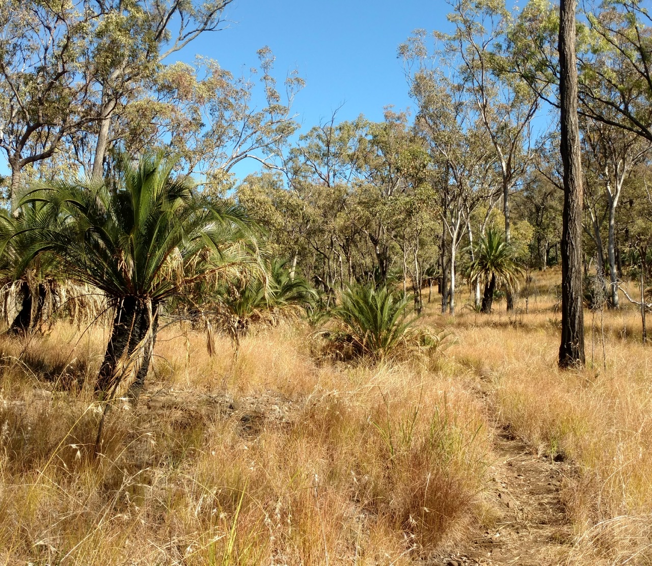
When I thought I was at the nearest point that this dirt road would get to the peak I climbed over the wire fence and started to cross the woodland paddock towards the base, as instructed in both of the blogs. I have a vague recollection of wondering if this was the correct starting point or if I should have started about half a km before this point near a Peak Range National Park sign but where I started looked as it had sounded in the blog posts; I wasn't worried about climbing the fence, thinking the blogs were quite old and the national parks folks could well have put up a fence recently. There were feint trails in the paddock which could have been made by previous walkers. Or animals; animals now seem the more likely cause, but it's worth stressing that this early on I didn't have any feeling that it could be remotely out of the ordinary to do this walk.
I reached the base and very soon I saw the pink guidance tape on trees that was also mentioned in the blogs. All good and I climbed easily on the dirt and then over rocks. There were a few patches of bush/trees but higher up it was all rock, some of it smooth and the rest mainly large rectangular blocks. By now the route was marked sporadically with red or white paint on the rocks or cliff faces. The white markers were partially rubbed off and looked older. It wasn't easy peasy but I've done far more challenging climbs without a second thought.
After a few scrambles, again nothing heart stopping, I passed a couple of cairns and reached the top. I admired the 360 degree views of scrub, stunted trees, other peaks, a few farms, all below the wonderful blue sky. In one direction the highway formed a straight line across my field of vision. It was a gorgeous late winter day, completely still and likely close to being the last of the year's moderate temperatures. I didn't linger because, I have to admit, I was a touch nervous about the descent.
I came down the higher steep part without difficulty, following the markers and then I came to a confusing marker and didn't know what to do. I remembered that marker from my ascent and I was convinced I had approached it from below. So I made a route decision to continue to descend and talked myself through some precarious terrain, although I never felt in danger. In hindsight I don't think I tried hard enough to understand the ambiguous painted marker and this part of what happened that day has been troubling me ever since because I can’t see why I made the decision to go the way I did. I don't think I have ever been hiking somewhere like this where a detour off the curriculum could have such devastating consequences.
I came to a rather tricky place on the rocky mountainside and I had to repeatedly manoeuvre my feet to get into a good position for the next part, a short but almost vertical descent; I could not decide whether to go facing towards the rock or facing away and I momentarily considered taking off my running vest (backpack) as I feared the things in the pockets would serve to push me away from the cliff face, but thank goodness I didn't do that. I could see the possibility of falling and it looked a serious fall. Then I slipped and fell. A lot went through my head as I fell. I am not clear how far I fell in metres but I fell past the point I had looked down on. When I landed my first thought was that I was alive. Then I expected to see a bone sticking out of my right ankle because it hurt a lot; it was painful but no bone was showing and I immediately tried to stand on it. (Only last week I'd had a conversation with a hiker about walking immediately after a sprain rather than resting the ankle.) My left leg was bleeding from several grazes including a dramatic gash down the outside from knee to ankle. But no pain on that leg.
My mind has rendered the full details of the fall somewhat hazy, no doubt as part of my coping mechanism. (For example I thought at the time that I had banged my head as I fell but now I'm not sure, but I'm fairly certain I tried to grab a bush as I passed it.) I looked at the trail I had created with the GPS on my watch on my outward route to see how far I currently was from that line and it didn't seem far. I decided to try to continue in that direction. (That's what I always do when I've gone off course and usually this delivers me back to the correct trail.) It also crossed my mind to see if I had mobile signal but I didn't do so. Walking wasn't pleasant, but it was possible and I had to do it, so I did it.
After walking across a small scree slope and scrambling along the edge of another cliff (which I really should not have done in my injured state) I reached, after maybe only 30 metres, a metre wide ledge and I could see no possible way forward. So I could not get back to my outward GPS trail. Ahead horizontally was a big gap in the rockface and below was a seriously big drop, pretty much down to the paddock.
Almost instantly I became terribly scared. I suddenly saw that I was in a life threatening predicament. Going back would have been dangerous on the cliff edge (and I am glad I didn't try) and continuing onward was impossible.
So at this moment I turned on my phone and happiness washed over me as I saw that I had a strong signal. I called Denis to alert him that I was about to call 000 and then called 000. It was 2.22pm.
The police answered immediately and had some trouble working out what part of Queensland I was in, but once they located me the rescue was under way. I felt overwhelming relief. From now on my fate was in the hands of experts and I knew I was completely safe where I was as I was on a slightly hollowed out ledge that was not tiny and well sheltered. The sun blazed down on me but I had my sunblock.
After my 000 call the paramedics, SES and police were soon in constant contact by phone. On their first call a paramedic asked several routine questions, including checking out my covid status. She asked my age and I said I was 63, which I sensed surprised her; this surprised me too because I am only 62, so I guess my mental state wasn't great at that moment. The paramedics were totally focused on my injury and I tried to emphasize that my main concern was getting rescued, that the injury was mild, as indeed it didn't feel serious just then.
The first sign of rescue activity after about 30 minutes was that I saw three cars: police, ambulance and another vehicle. They entered the dirt access road, from the other end to where I'd parked, and to my dismay they drove the full length, in effect past the point where they would be nearest to me, and almost out of my sight. Not surprisingly they phoned to say they couldn't see me. Soon I saw a group of people walk from the vehicles towards the base of the mountain and then continue towards the backside until I could no longer see them. This was a feature of my entire rescue: I would carefully explain how I was facing the highway and the rescuers would act as though I was on the backside of the peak. This could be because the walking trail is on the backside.
Throughout the whole episode I was convinced that I was easily visible from the highway only 400 metres away, but I was half way up a pink-tinged mountain wearing pink, and 400 metres is a big distance when it comes to spotting a speck on a mountainside, so clearly this notion was ridiculous.
I now have to question whether I was ever on the correct trail; no trail is shown on the map automatically downloaded to my GPS watch or on the map I downloaded to my phone so I will never know for sure. The blogs both mentioned large caves full of bats and I had seen some small caves but none that gelled with the description in those blogs. I have now concluded that had I not been injured my best option would have been to return to the top and try to descend again staying with the markers.
The police must have worked out that the Audi parked just off the highway was mine because they asked several times if I could see 'your red car'. Either they had done a rego check or they linked a stranded Victorian hiker with a nearby car with Victorian plates. I couldn't see the car but this info failed to help them locate me. I felt very fond of my car when they asked me about it: a link between me on the mountain and my life in the outside world, and also the closest thing to family that I had with me.
The helicopter pilot from RACQ Central Queensland Rescue phoned at 3pm and said his chopper was an hour away; they were just leaving Mackay. That felt good to hear. I could easily sit there for an hour, although even moving slightly to prevent going numb from sitting in the same position for too long scared me. There was a drop to the foot of the mountain right in front of me.
I had with me in my running backpack two muesli bars, half litre of water, sunblock, phone, purse and that's all. I had lost my sunnies in the fall (I didn't realise this until I was sitting on the ledge) but I'd retrieved my pink cap. At that stage I hadn't eaten or drunk since Clermont apart from the water at midday at the car. Or had a wee. The paramedics told me not to eat or drink, which seemed odd on a hot day but I did as I was told. So I was becoming really dehydrated sitting in the full sun and there was no shade whatsoever on my ledge.
I wasn't doing much during this time. When I kept my right foot still the ankle wasn't hurting. I tried to wipe the blood off my left leg as best I could and I began to feel bruising on that leg that I hadn't noticed before. I gazed mindlessly at the other peaks dotted around the plains and wondered what was growing in one rather distinctively bright green field across the highway. There would be an occasional vehicle crossing my view along the highway.
The people on foot were still trying to reach me but had no chance of getting to me from the back of the mountain. I looked at my watch data later and saw that I was considerably higher on Wolfang than I imagined at the time; I had descended less than a hundred metres from the top. It would have been more frightening if I'd known I was still so high as I sat on the ledge. In total I had walked less than four kilometres from my car, that's all, and I'd only been walking for slightly over an hour, not including my stops on the peak and when I fell.
I heard the chopper way before I could see it. It came so close that I was sure it must have seen me but then it went away and the pilot phoned to say he had not located me. Shortly after I had my only breakdown when I said to an SES person on the phone that I hoped someone would find me. He assured me they would.
Not long after the chopper came in much closer and definitely saw me. It went away briefly, as I'd been told it would, then returned and hovered maybe ten metres above me. I've never watched a chopper hover from such close range. A huge wind came up. I could see a guy getting organised while sitting in the doorway and then I watched him descend on a cable and clamber onto my ledge. He was gesticulating as he descended but I assumed this was not aimed at me. I stood up as he landed. Then he strapped two huge belts around me (I was worried that the water bottle in my vest back pocket would prevent the harness from holding me) and gripped me very tight, and we were winched up to the chopper. That part was terrifying because of the drop of about 100 metres below. I recall my rescuer grabbing one of the skids but beyond that I'm not sure how I got inside.
All I knew was that I was sitting right inside the chopper and that felt amazing. Warm. Safe. A solid floor. We flew down to the ground and I stepped out; I didn't give the injured foot a passing thought. Immediately I felt really faint and almost collapsed which got them worried, but when I lay down I was ok again. I was initially confused as to where we were but they said we were at the back of the mountain. Makes sense as none of them seemingly ever wanted to have anything to do with the front (highway) side. I have a strong picture in my mind of a bottle tree right next to the chopper. The SES people and police arrived on foot; a policeman checked how I had come into Queensland, rather sheepishly I thought, and indeed it would have been awkward if he had to arrest me right then.
They strapped me onto a stretcher and put me back in the chopper. There was the pilot (who told me he'd once climbed Wolfang in 40 minutes), emergency doctor and paramedic, rescue guy, and a crewman. In the chopper the doctor and paramedic did some medical stuff and couldn't understand why I didn't want painkillers. But I was not in pain. My main issue was that my back was uncomfortable and I couldn't move at all while I was strapped to the stretcher. I said to the doctor that I do a lot of hiking and run ultramarathons, just to reassure him, or rather myself, that I wasn't a complete novice out in the bush.
These guys had rescued someone here only a month ago and also six years ago. Despite this the Isaac Region website and a widely available Mackay tourist brochure both have a picture of a pair of women setting out calmly for the peak with minimal equipment. No warning, nothing.
We were headed for Mackay, which was for two reasons: firstly the chopper was based in Mackay and secondly the paramedics thought it best I go to the Mackay hospital as the Clermont hospital is only small and doesn't have an orthopaedic specialist. Nobody knew what injuries I had sustained. We stopped at Moranbah aerodrome to refuel and I could crane my neck to watch a beautiful sunset. Then we flew on to Mackay airport and I was driven to the Base Hospital by ambulance and taken into the emergency department, where I was triaged at 7.30pm. It had been a long afternoon's adventure with a good outcome.
I was diagnosed with a small avulsion fracture in my ankle (Weber A was the location) caused by a severe sprain and they decided I didn't need plaster. I was given a moon boot for my foot and offered crutches which I declined because the only time I've had them in the past (for a less serious injury) I found them a nuisance. Making such a silly choice was another indication of my poor mental state. I was surprised to have to ask to have the gash and grazes on my other leg cleaned up despite the leg being really bloody. As the nurse cleaned me up I could feel bad bruising on my upper thigh.

Around 10pm I was discharged into the Mackay night where I didn't have a hotel reservation. (I felt this was quite poor treatment for an older person completely alone who had been through a traumatic experience but at the same time I didn't want to spend the night in hospital so I wasn't going to make a fuss.) They couldn't give me anything to eat because they had run out of sandwiches so I was beside myself with hunger. I was still in considerable shock when I left the hospital.Online I found a hotel at the airport with a reception desk that was still open and got there in 15 minutes by taxi. I was able to reduce my hunger with a cookie and KitKat from a vending machine at the hotel, the kitchen being well and truly closed, and I collapsed happily on my bed shortly before 11pm.
One of the SES had driven my car back to Clermont and the next afternoon I took the bus from Mackay to Clermont to be reunited. Before leaving Mackay I went back to the hospital to get a pair of crutches and of course they made a huge difference to my mobility. While waiting for the bus I ate a large amount of greasy food as the bus stop was outside a service station, so I could satisfy my hunger without having to move far. I stayed three days in Clermont before very gingerly driving to Mackay, with no plans to move on soon. I think I was still in shock that weekend. On the Monday, exactly a week after the accident, I was back in hospital all day getting antibiotics intravenously for cellulitis in my foot, a condition that was temporarily far more unpleasant than my sprain/fracture.
Now I am piecing together in my mind what really happened, and I am trying to silence the what ifs in my head because it doesn't help to catastrophise about a worse outcome. I feel hugely grateful for my rescue.

Here’s the link to the RACQ CQ video of my rescue: https://www.facebook.com/CQRescue/videos/1066749910453598/