When I went to Townsville for the marathon in 2004 I was surprised at how nice it was, especially the long trail along the shore facing Magnetic Island and lots of outdoor cafes. (Even then I didn't remember anything from my visit in 1989 to start my bike ride to Broome.) I thought it would be a good place to go this winter as part of my recovery to do some longer walks in warm weather.
August 7 Castle Hill was top of the list. The red rock towers over Townsville and I had run up it twice. This time I walked along the esplanade to Rowes Bay, going over the headland at Kissing Point with its WW2 forts. I wanted to approach the peak a different way from before and I walked streets until I reached the Cudtheringa track to the top. There were hundreds of rock steps and my heart rate was absolutely maxing out because of my strange virus. The trail was through dry bush and it was hot. I came onto the road for the last bit. At the top there were several short trails I hadn't done before, so I did them all, to forts, the summit (286 m) and viewpoints. 

I came down on the road (because the other trails looked too rough for me at the moment) and through the botanic gardens. 14 kms


I came down on the road (because the other trails looked too rough for me at the moment) and through the botanic gardens. 14 kms
August 8 Cape Pallarenda was next. I hadn't been there before. It's 10 kms out of Townsville and I caught the bus! I had planned an ambitious hike which was almost too much on this hot day. I walked to Shelly Cove and passed some more forts, then started on the Under the Radar trail, a walking/bike trail. Early on there were a few bikes. The trail undulated a lot and had many unnecessary hairpins, through dry forest. Soon I had views over the sandy expanses of Shelly Beach. From higher points I had views of the water and little islands. Castle Hill was prominent in views towards the city. The trail crossed dry creeks and one filled with mangroves. There were also big areas of woodland. I was trying to conserve my water and with constant coughing my mouth was like parchment. Eventually I came to a junction and I turned onto a flatter trail which took me to the inland part of the park. For the last part I walked beneath the Many Peaks range along the edge of extensive lagoons, very green and full of water fowl. I was quite exhausted and disappointed to miss the bus by a few minutes. I walked a little way to the Pallarenda settlement and was amazed to find a cafe so I went there for ice cream and a soft drink. 17 kms
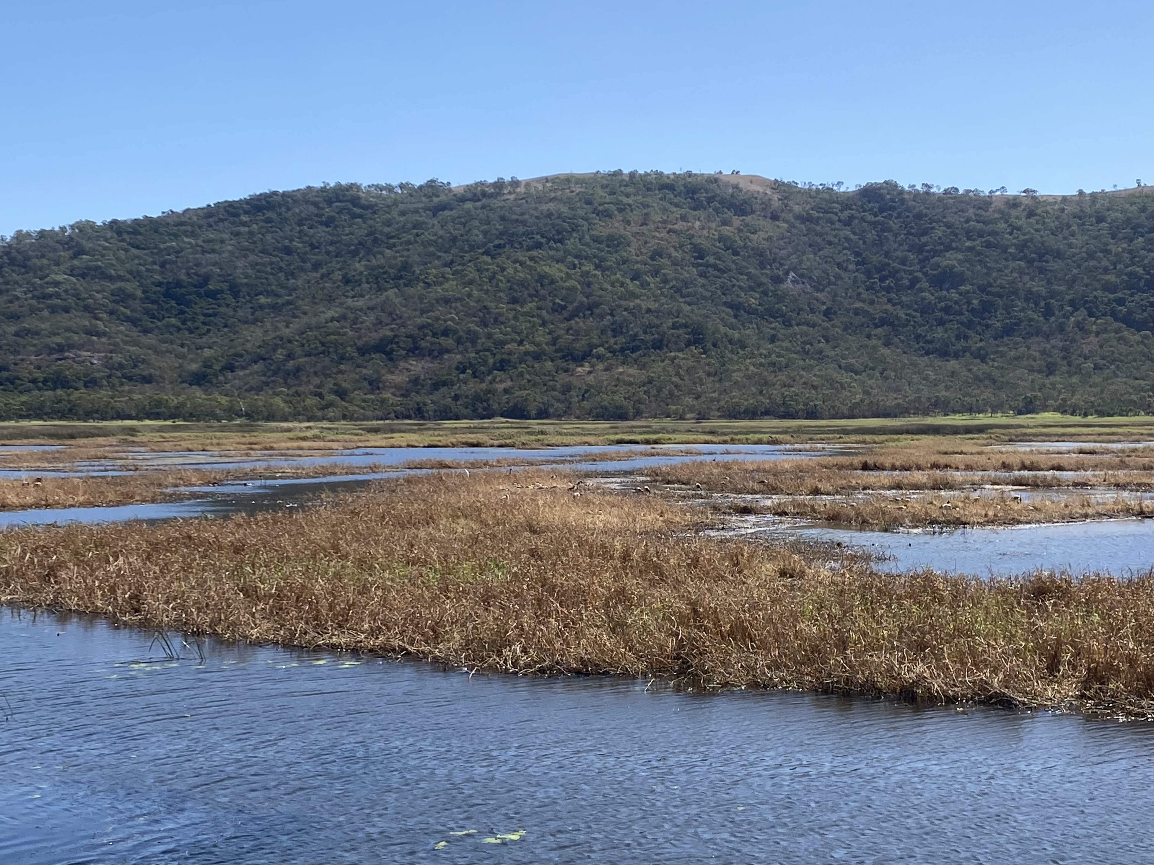
August 9 I returned to Cape Pallarenda for another hike. This time I took the Many Peaks trail up Mt Marlow (218 m). The ascent was rocky, mostly in dry forest with lots of hanging vines and huge boulders and a comfortable gradient. There were plenty of openings with views towards the lagoons and Magnetic Island. The last part was grassy hillsides. Another walker was sitting at the summit and kindly named the islands we could see. There was a pleasant breeze. 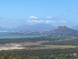
The descent was easier than I expected contouring grassy slopes in woodland, no more rocky steps. I reached the bottom by a huge boulder, Bald Rock.
From there I took the Freshwater trail through the wetlands with thousands of water birds. 11.8 kms

The descent was easier than I expected contouring grassy slopes in woodland, no more rocky steps. I reached the bottom by a huge boulder, Bald Rock.

From there I took the Freshwater trail through the wetlands with thousands of water birds. 11.8 kms
No comments:
Post a Comment