The iconic Puy de Dôme mountain in the Massif Central near Clermont Ferrand is one of about 80 volcanic formations (puys) in a cluster called the Chaîne des Puys. In shape the puys are either domes, cones or have craters. The volcanic activity has also produced many lakes. There has been no eruption since 4000 BC. The GR 441, Tour de la Chaîne des Puys, does a loop in this area, which is part of the Auvergne regional park.
5 August I got the train to Volvic station and the shuttle to the village, had breakfast and started out on the GR 441. It was cold. The dark grey stone that has been used in so many of the Auvergne churches comes from Volvic. So does the mineral water.
After a while I went over a couple of 1100 m summits, Puy de Jume and Puy de la Coquille, with some views towards several forested peaks including Puy de Dôme, which really stood out for its height. I passed two parked police cars on the trail and saw the police chatting with a group of walkers, seemed to be about people stealing the water that was there for the sheep! Some pleasant forest, passing below a few summits, then I came onto a grassy ridge with great views towards Puy de Dôme, Puy de Pariou (grassy top with obvious crater) and another. I had my first of only 2 chats of the entire hike. The top of Puy de Dôme was now in cloud.
I descended into the valley in larch forest then began the climb up Puy de Dôme (1465 m). It was gradual for a long time then steep at the end with a lot of steps, and out of the forest with views over lower mountainsides. There were masses of people around. I just reached the cafe below the summit as the mountain was swallowed up by cloud so I had a snack until it cleared. Then I walked around the summit trail with good views over the northern puys (mostly cleared of trees and with craters visible), villages in the valleys, Clermont Ferrand and the forested southeastern puys. 

The sight of these clusters of low volcanoes is unusual. It was extremely blustery and cold so I went back inside and almost immediately the cloud returned. This time it showed no signs of lifting so I started downhill on the trail which was the route of a Roman road, seeing nothing until the Col de Cessat where I returned to pine/birch forest. I was looking for somewhere to camp and decided on a sheltered spot on a side trail, camping on a layer of leaves. The wind howled in the treetops all night. 28 kms


The sight of these clusters of low volcanoes is unusual. It was extremely blustery and cold so I went back inside and almost immediately the cloud returned. This time it showed no signs of lifting so I started downhill on the trail which was the route of a Roman road, seeing nothing until the Col de Cessat where I returned to pine/birch forest. I was looking for somewhere to camp and decided on a sheltered spot on a side trail, camping on a layer of leaves. The wind howled in the treetops all night. 28 kms
6 August Cold and windy. Could only see some lower puys. I walked a short way and stopped for coffee at a hotel before Laschamp. I went on in forest and farmland, mainly sheep. The wind was cold and there was thick cloud. When I got close to Puy de la Vache I decided to walk to the top in case I could get a view; the climb was steep but I got good views towards Puy de Dôme (top in cloud), Puy de Lassolas and Puy de la May northwards, 
several lower puys westwards,
Lac d'Aydet in the distance and green valleys. The sun was trying to come out but the wind remained cold. I detoured to a little cave which was warm inside. More farmland than Saulzet Le Froid, totally dead village but contradictorily warm out of the wind. Next Pessade, where a kilometre before the village someone had painted on the road snack bar ouvert 7/7. I thought this was too much to hope for on Sunday but there was a bar where I got coffee and bought nuts to add to my low food supply. They asked me why Australians come to Pessade. After that I had a nice surprise: I was walking along a ridge with a view across the valley to a line of puys with Puy de Dôme now completely clear of cloud.
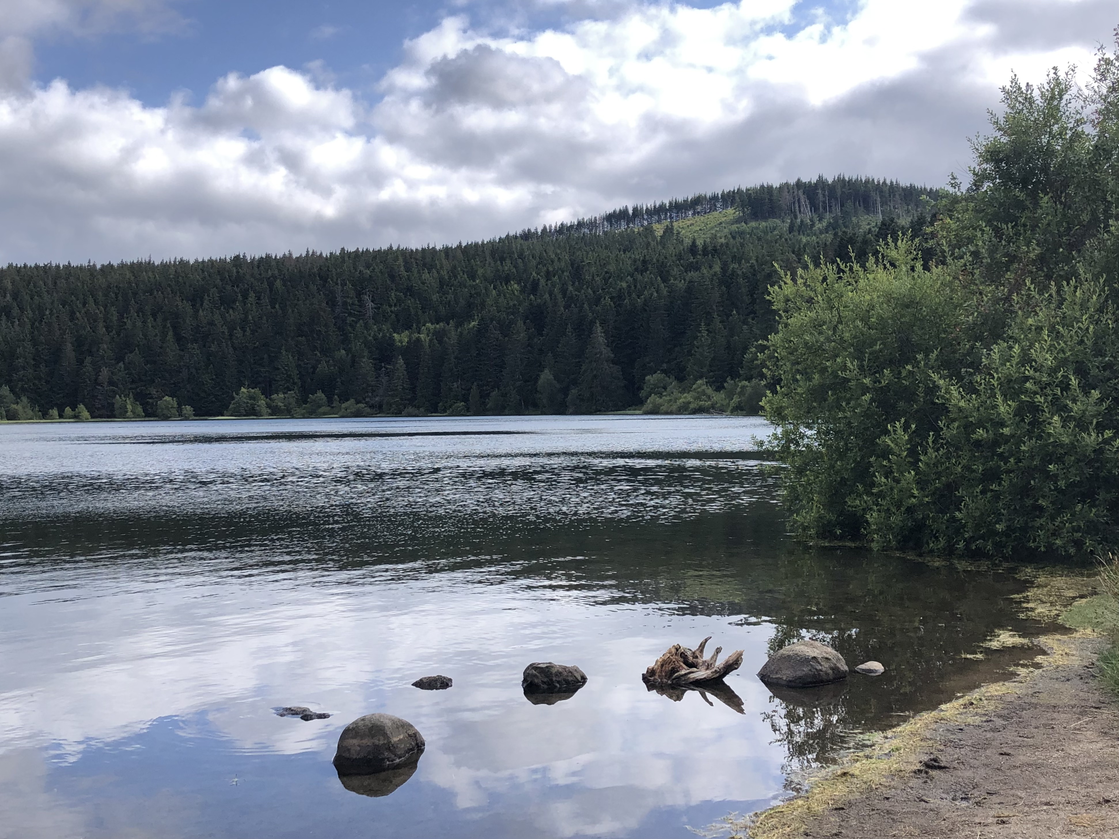
I climbed in forest to Lac de Servières, a very pretty lake with a puy on one side.
On the way I found ripe blueberries. I had intended to camp there but it wasn't allowed and I was too cold to wait for bivouac time so I walked down towards Orcival and chose a place on the edge of the forest with a view across the valley to the same line of puys I'd just seen.
There were ripe wild raspberries right nearby. 29 kms

several lower puys westwards,

Lac d'Aydet in the distance and green valleys. The sun was trying to come out but the wind remained cold. I detoured to a little cave which was warm inside. More farmland than Saulzet Le Froid, totally dead village but contradictorily warm out of the wind. Next Pessade, where a kilometre before the village someone had painted on the road snack bar ouvert 7/7. I thought this was too much to hope for on Sunday but there was a bar where I got coffee and bought nuts to add to my low food supply. They asked me why Australians come to Pessade. After that I had a nice surprise: I was walking along a ridge with a view across the valley to a line of puys with Puy de Dôme now completely clear of cloud.

I climbed in forest to Lac de Servières, a very pretty lake with a puy on one side.
On the way I found ripe blueberries. I had intended to camp there but it wasn't allowed and I was too cold to wait for bivouac time so I walked down towards Orcival and chose a place on the edge of the forest with a view across the valley to the same line of puys I'd just seen.

There were ripe wild raspberries right nearby. 29 kms
7 August I woke up to sunshine although the puys were in cloud. The wind had dropped. I walked down to Orcival, the village totally hidden in its valley. It was a really nice place, dominated by the large and beautiful Romanesque church built of Volvic stone, apparently the best of the Auvergne churches, and simple columns inside. 
Lots of walkers around and everything was open.
I had a spare day so I decided to do a loop walk from Orcival to Lac Guéry. I found quiet roads in dairy country, all very green. I walked towards Puy Mandon then passed strange pointed peaks and went into green forest, ferny undergrowth. The lake (highest in the Auvergne) was a good lunch spot, and the other side wasn't far from where I ran in 2019.
The mountains were higher there. From the car park I got a view over the curious pointed peaks (weathered granite) Roche Tuilière and Roche Sanadoire and the cradle like valley between them.
I descended into that exact valley in beech and spruce forest, passing a big rockfall on the side of Roche S. Then more dairy farms and tiny hamlets until I was back above Orcival (but couldn't see it) and I descended to a campground at Étang Fléchat, a green pond. 24 kms

Lots of walkers around and everything was open.

I had a spare day so I decided to do a loop walk from Orcival to Lac Guéry. I found quiet roads in dairy country, all very green. I walked towards Puy Mandon then passed strange pointed peaks and went into green forest, ferny undergrowth. The lake (highest in the Auvergne) was a good lunch spot, and the other side wasn't far from where I ran in 2019.

The mountains were higher there. From the car park I got a view over the curious pointed peaks (weathered granite) Roche Tuilière and Roche Sanadoire and the cradle like valley between them.

I descended into that exact valley in beech and spruce forest, passing a big rockfall on the side of Roche S. Then more dairy farms and tiny hamlets until I was back above Orcival (but couldn't see it) and I descended to a campground at Étang Fléchat, a green pond. 24 kms
8 August I walked back into Orcival. The woman at the cafe remembered my coffee order. I climbed out of Orcival (nice view of the village) and spent the morning in farmland, also passing a château that wasn't open to visitors. I had a break in the square in Olby then more open countryside towards Mazaye. Briefly I was walking directly towards Puy de Dôme with the chaîne des puys spread across the horizon. 
I thought the interesting part of this GR might be over but it wasn't. I passed another off limits château then I had a steep climb to St Pierre le Chastel, a village on top of a butte with an 11th c church in Volvic stone and a 360 degree view over countryside dotted with villages, and puys on every horizon.
From there I rushed along the road to Pontgibaud to reach the Château Dauphin before closing time. The town looked pleasant but I couldn't stop. The château dated from 1300s, restored 1800s, a solid square block of castle with towers, crenellations and ornate gardens.
I took a rather boring tour of the inside. Then I went to the municipal campsite, stopping at the Volvic stone church on the way. 28 kms


From there I rushed along the road to Pontgibaud to reach the Château Dauphin before closing time. The town looked pleasant but I couldn't stop. The château dated from 1300s, restored 1800s, a solid square block of castle with towers, crenellations and ornate gardens.

I took a rather boring tour of the inside. Then I went to the municipal campsite, stopping at the Volvic stone church on the way. 28 kms
9 August I went into Pontgibaud for breakfast and walked on to St Ours on farm/forest trails. I found a few ripe blackberries. In St Ours, after visiting the 12th c church, 
I saw a long queue at the bakery so I felt compelled to join it. Soon after the village I was again looking at that Puy de Dôme, then I went into forest and was climbing gradually, walking between various puys, and I went around the base of forest covered Puy de Verrières. More hamlets and grazing land and stony tracks. The weather was beautiful again. I came to a grassy clearing where there was a curious art installation (rectangular thin blocks of local rock pegged to wire cables to look like sheets of paper drying) over a small waterfall. Great for camping. 22 kms

I saw a long queue at the bakery so I felt compelled to join it. Soon after the village I was again looking at that Puy de Dôme, then I went into forest and was climbing gradually, walking between various puys, and I went around the base of forest covered Puy de Verrières. More hamlets and grazing land and stony tracks. The weather was beautiful again. I came to a grassy clearing where there was a curious art installation (rectangular thin blocks of local rock pegged to wire cables to look like sheets of paper drying) over a small waterfall. Great for camping. 22 kms
10 August I had breakfast by a stream with little swimming animals then continued on stony trails. The sky was black over the chaîne des puys. Quite suddenly I saw the Château de Tournoël through the trees and soon I was there. I had coffee on the terrace of the auberge (above Volvic) while it started raining, and then when I took my cup, milk jug, water glass and sugar glass inside the stack toppled and I dropped the lot on the tiles! I liked this château because it appeared ruined even though it was renovated only this century.
It had a great outlook over the area around Volvic with distant mountain ranges. I enjoyed the guided tour. Then I walked down to Volvic, passing a huge statue of Mary and stations of the cross on the hillside. I emerged at the fountain where I started. 8 kms


It had a great outlook over the area around Volvic with distant mountain ranges. I enjoyed the guided tour. Then I walked down to Volvic, passing a huge statue of Mary and stations of the cross on the hillside. I emerged at the fountain where I started. 8 kms


Total distance 140 kms
No comments:
Post a Comment