My intention is to walk down the eastern side of France, starting from the German border. This means walking through the Vosges forests and over the main peaks, the Jura forests and peaks, passing Lac de Bourget and through Grenoble, crossing the Oisans and Écrins massifs in the Alps and through the Queyras and Mercantour national parks to the Mediterranean at Menton.
Days 1 - 10 The Vosges
19 May As a warm up I set out packless from Bad Bergzabern, Germany, the random place I was staying, to walk over the border into France. I felt it necessary to begin this hike outside France to be able to truly cross the country. My starting point was the bakery. I walked past vineyards and through forest, a few hills, and went through several villages. Outside Shweigen Rechtenbach I reached the border at a crossroads in the fields, totally unmarked but the road signs were suddenly in French.
I detoured to Altenstadt to go inside the 11-12th century church with a tower. I followed a tiny river into Wissembourg where the Traversée des Vosges officially starts. I stopped for coffee in the town centre and was pleased they had a copy of the guidebook I needed at the bookshop opposite the cafe. Wissembourg was hopping with tourists; a town of quaint half-timbered buildings. The church had frescoes and was very cold inside and beside it was an 11th century chapel. 17 kms
20 May I took the bus back to Wissembourg, went to the supermarket and had breakfast then started on the GR 53. I was climbing immediately and went in and out of forest crossing over several cols. I was surprised to be in the (low) mountains so quickly. At Col du Pigeonnier a group was roasting a pig on a spit. Shortly past there I met a long distance hiker and we had a long chat, my first conversation in French.
I came into Clembach missing the bakery being open by 15 minutes. I followed a little stream to Col de Lischhof where I chatted with another hiker and had a climb to a col above Chateau de Fleckenstein, with a glimpse of the castle ruins on the way up. It was nice forest with window views over the mountains. There are so many trails in every direction. The cafe at the castle was just open but when I’d finished my coffee the ticket office for the ruins was closed; a relief because I could see lots of steps and didn’t fancy climbing them, and I got a good look at what remains of the castle anyway.
I went on to a nearby campground on a lake, very busy mainly with Germans. First night for new tent and quilt. 21 kms
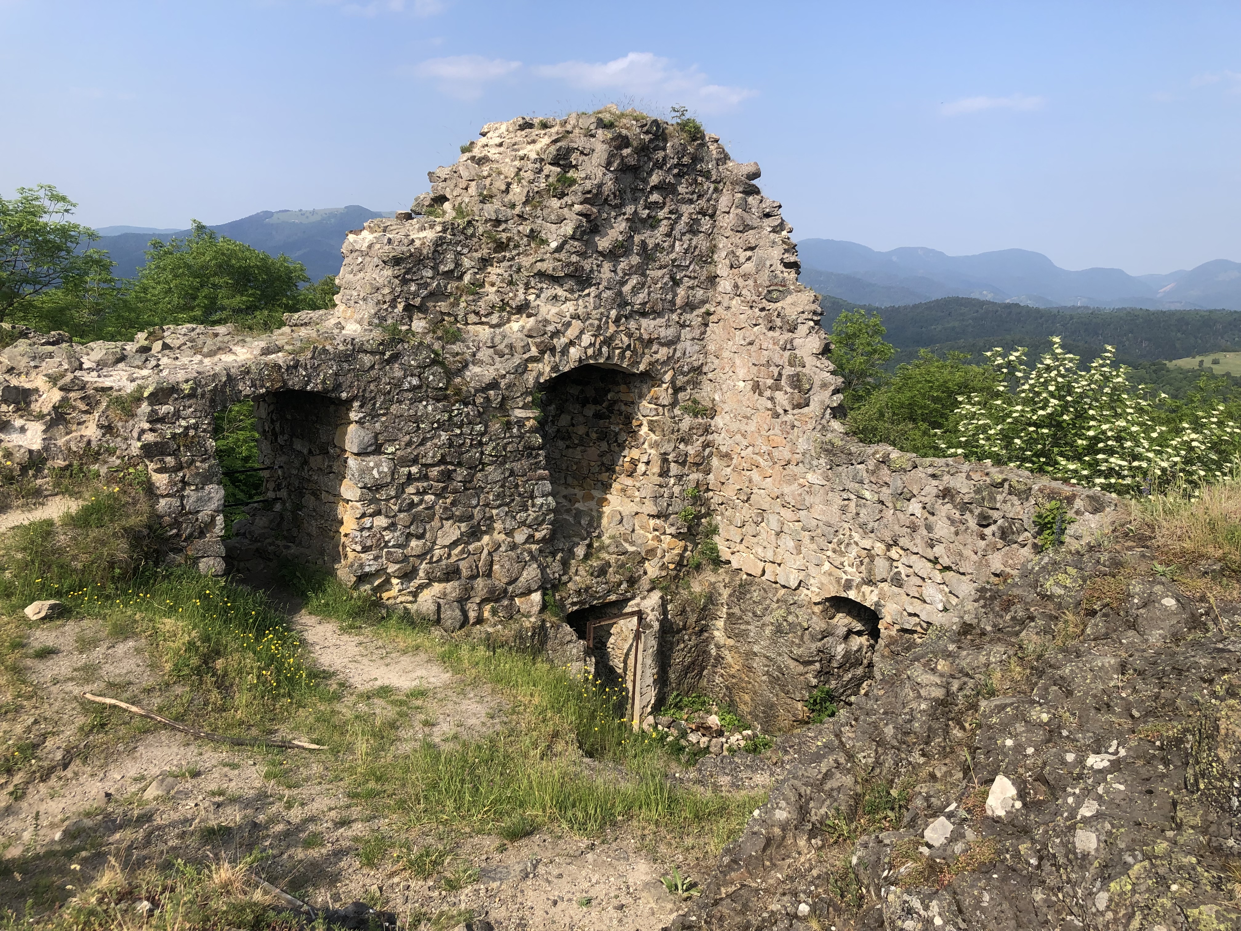
21 May Warm and slightly hazy day. I had a big climb in forest to Chateau de Frohensbourg on a tiny peak and very little remaining, then I continued climbing to a ridge which I followed first on one side and then the other, all in pine, lime, birch and oak forest. I went on, passing the pancake like stacks that were the Zigenfeuls rocks, and got to Chateau de Wasigenstein. This was actually 2 castles with fragments of walls and a tower remaining, and a more spacious base. I walked around it; the view over the forest clad mountains was great. I descended to Obersteinbach village (a remote castle in view) and climbed back into the forest. I hadn’t expected the Vosges to be flat but this was surprisingly hilly.
After several cols I came to a cluster of castles: Vieux Windstein, on a little pinnacle with some intact archways; Mittel-Windstein hidden among the trees with only some carved steps in the rock; Nouveau Windstein in a large clearing with some rooms, a stone tower and windows. I had lunch there and then after a few minutes of walking I came to the edge of a village with a cafe, so I had a coffee while listening to the people at the next table code switching between French and German every few sentences. I left the GR 53 and went along the Maginot Line for a bit, then the GR532, followed a stream, had extensive views to the south, passed farms and arrived at a campground on the outskirts of Niederbronn les Bains. I had not intended to walk so far. 25 kms
22 May I had breakfast sitting in the square in Niederbronn. I rejoined the GR53 and had a steep climb in lovely forest to Chateau de Wasenbourg (nice windows) on a hilltop with a huge view over the Alsace plains,
then went over the top of Reisberg, past hollowed out boulders filled with rainwater, to summit Wasenkoepfel (526 m) with a 19th c tower. I descended to the remains of Chateau de Grand Arnsbourg on a pinnacle
and continued down in sparse pine forest, then sat by a stream in a meadow and made coffee. It was a really muggy day. Two American hikers with ZPacks backpacks came past. Another climb followed by a long descent to a stream; on the way I ate lunch while a little rain fell. I got to Lichterberg and had an extremely steep (and hot) climb to the huge fortress, which was unfortunately closed so I made a tour around the moat. I walked downhill through the town and back into forest. I heard thunder so I soon stopped to camp, at a little clearing beside the trail by very tall skinny larches. The birds twittered away. (I had seen a woodpecker with red tufts and yellow breasted wagtails.) No storm came. 23 kms
23 May I stayed in the forest (saw a deer), emerged at Wimmenau where I was told the bakery had closed down and they were hoping for a new one, came to some caves and then descended to Erckhartswiller, a very protracted village. Then another climb in green forest followed by a quick descent to La Petite Pierre, a town with typical Alsace buildings and a lot of hotels. It was on a ridge completely surrounded by forest. I located the bakery and ate quiche then saw the 15th c frescoes in the church and walked around the castle ramparts.
I had arranged by phone to camp at an auberge in the valley and there were nice lakes nearby but when I saw the camping area it was knee high grass (and the restaurant was closed today) so I decided to go on. I climbed to the cleared summit of Weyerkopf where there were picnic tables and a football pitch, possible to camp out of sight among the trees (a deer came close), hoping there wasn’t a game scheduled. The birdsong was great. 22 kms
24 May I stayed in the forest, stepping over a snake and descended to Graufthal, a village in a tiny valley between cliffs. There was a row of troglodyte houses built into a cliff (painted blue, to be seen I guess)
and remains of a 14th c abbey. I continued on a dirt track as the valley widened to Oberhof where I had coffee at the bar/restaurant. The path went on through light forest and passed some large sandstone caves. I was following another hiker, Jean Jacques, and when I caught up we chatted. Then we got lost together and walked into Saverne and sat in the main square waiting for the Auberge de Jeunesse to open.
One side of the square was dominated by the Chateau des Rohan (19th c). I went in the church and admired its solid Romanesque tower. I was surprised to get a room to myself in the hostel, which was on the top floor of the chateau, with a priceless view over the main square and hills beyond. I went to a restaurant with Jean Jacques. 16 kms
25 May The market was set up in the square when I left.
Out of town I returned to the forest. There was a charity walk happening, with aid stations. Soon I came to Chateau du Haut-Barr, quite extensive with an ugly restaurant in the middle of the ruins.
In the next couple of hours I encountered a tower commemorating the Club Vosgien, a rock offering a good view over the surrounding forest, a large cave,
the base of a huge tree trunk with a roof built over it, saw a castle ruin on a hilltop. The forest had a whole mixture of pines, spruce and larches. I took the optional climb to the summit of Giesfels and had a fabulous view over forested hills, the inhabited valley below and the Rocher de Dabo across the valley: a large flat rock on a hilltop with a chapel and tower on top of the rock. I crossed a lovely gurgling stream, went through the hamlet of La Hoube (Romanesque church tower) and soon crossed another stream. Quite suddenly I had a glimpse of the chapel on the Rocher de Dabo and realised I was right under it;

I came into the open and could see it clearly, and also a quick way up, so I dumped my bag and walked up. The main thing about the chapel is the amazing setting on the high rock and the view of the Vosges from the rock was also good, including some higher mountains than I’ve been over so far. I stopped at a large clearing; I’d been intending to camp there but I went on. I went through a lovely gully by a stream. The forest was steep and it was going to be hard to find somewhere to camp and I hopped onto the GR 531 because it was a wider path with grassy edges; I ended up camping right by the trail, above the outskirts of Wangenbourg, still in fir forest. 25 kms
26 May I walked into Wangenbourg for breakfast; the bakery was closed but I got coffee and a massive cookie at the shop. It was a beautiful morning. After a brief look at the castle on the edge of town I started my climb up Shneeberg (961m). At the top I could see mainly forest. I descended to the chateaux de Nideck; I could climb the tower of the outer castle to see the inner castle but both were well hidden in the forest.
Then I descended to a stream and passed the Nideck waterfall, pretty impressive.
I stayed by that stream and then another, went through the edge of Oberslach village and came into Urmatt. It seemed a nice little town (shop, bakery, hotel) but not much going on. I had dinner in the hotel’s restaurant with Jean Jacques and a Belgian hiker: 3 types of sausage, 2 types of ham, sauerkraut and boiled potatoes. 21 kms
27 May I left Urmatt on the GR 532 with a climb almost to the top of Hahneberg. The trail was often single track winding through the trees and clearly not much used. I descended to the edge of Grendelbruch with views of the village, and then climbed to the top of Falkenstein (a pinnacle) where I had a panoramic view over several towns in the valley. It was a good trail with times of expansive views and times of shady forest.
I had lunch in a clearing and soon reached the GR 5. I chatted with a Belgian hiker who was heading for a hotel; he said that he was retired so he had to spend his money. I was aiming for a shelter and just before it I climbed a rock to take me above 1000m for the first time. The shelter was on the edge of a sloping meadow with mountain views, lots of people coming past. I decided not to camp there and just as I was about to leave a day hiking couple stopped at the shelter; we chatted at length, mainly about the weight of gear and they felt I had a way to go with lightening my pack. I walked another kilometre and found a peaceful spot to camp.
22 kms
Day
10: 28 May After seeing 4 deer run through the trees I had breakfast at the Hohwald waterfall (it made the air cold)
and descended into Le Hohwald, full of hotels, then I walked in beech and later spruce forest towards Mont St Odile. There were lots of MTB riders on the trail. There was no view of the convent St Odile until I was there, after crossing through a wall of enormous boulders (possibly a bronze age arrangement) and following a path with more of the boulders that bore ceramic plaques of the stations of the cross. I have never seen a place so busy, lunchtime on the Sunday of Pentecost long weekend. I checked out the views over the plains and the hills and got lunch at the kiosk (not so popular).
Then I followed the ridge passing more of the unusual wall and several impressive large boulders, before descending to the Chateau de Landsberg. From a lookout I could see the outline of the Chateau Haut-Koenigsbourg on a hilltop 20 kilometres away. Landsberg was in better shape than some: round towers, intact window frames, fireplaces, internal walls.
I arrived at an open shelter with a water fountain and was all set to camp but again there was no open ground and people kept stopping by, so I went on towards Barr without wanting to camp too close to the town. Luckily I found a spot above the town that was sheltered from the wind that had come up suddenly. I ate dinner by a vineyard overlooking several towns dotted around the valley.
23 kms, total so far 219 kms
Days 11 - 20 Towards the Haut-Vosges
29 May I descended into Barr through vineyards. It was a nice town with many typical Alsace half-timbered buildings and I was happy to find an open bakery on a public holiday.
I walked through the valley with a good view of Chateau Haut-Andlau on a hilltop and then came to Andlau, another pretty town.
It was already very hot. I checked out the abbey church and looked for a cafe to no avail but the little shop was open. I decided to detour off the GR 5 to walk through more vineyards and be out in the open for a while. In Bernardvillé I got water at a winery. By midday I was back on the GR 5, climbing to Chateau Bernstein in spruce and beech forest. The car park was jam packed but it was quiet at the castle, which was in good shape, and I climbed the keep for a view over the towns on the plains.
Then I walked on to Chateau Ortenbourg which had a really solid surrounding wall.
Both had good windows. Only 5 minutes further was the ruined keep of Chateau Ramstein on the adjacent hill. I descended steeply towards Chatenois and a murky river. I could tell I wasn’t going to find anywhere to camp so I continued into town. It became a slog as I followed the weed infested river bank (looking back I could see the last 2 castles on their hilltops) and then walked the length of the town to the gîte d’étape. I found a restaurant and sat outside with my riesling and steak frites; very pleasant after a long day.
28 kms
30 May I left Chatenois via the remains of the town walls and a large church with green tiled tower, and I was soon climbing in forest (chestnut, beech, oak, larch). Few views but pleasantly cooler than yesterday. I had one view over yesterday’s castles. I continued to the very imposing and elevated Chateau de Haut-Koenigsbourg, which was totally different from all the ruined castles so far.
First coffee on the terrace overlooking the plains then a lengthy tour of the castle which was great. (A reconstruction from 1900 of the original and it was nice to see what these castles would have been like when they were inhabited.) Next village was Thannenkirch, laid out along a ridge with colourful houses, and I chatted there with a French couple. I returned into the forest and walked to my next cluster of castles. First, Château de Haut-Ribeaupierre with nice circular tower which I climbed;
next Chateau St Ulrich which had far more rooms than usual, good windows and no fewer than 3 staircases to climb;
from there I could see Chateau Girsberg on a pinnacle close by.
All of these had a great view over Ribeauvillé and towards tiers of tree covered mountains. I descended steeply following the town ramparts alongside a vineyard. Ribeauvillé was a picture book town with colourful half-timbered buildings, fountains, souvenir shops, even a stork nest on a roof with storks hanging out, and charming despite the tourists. I walked all the way through the town to reach the campground. 22 kms
31 May Rest day in Ribeauvillé and tonight in a hotel so I had to walk back into town.
There was one place in the main street where I could see all 3 castles on the hills above the town and the storks guarding their nest. Happily that place was called the
pâtisserie. 2 kms
1 June I’m going into the Hautes-Vosges. I left Ribeauvillé via vineyards and went into forest with a lot of climbing. Out of the blue I passed ruins of a 13th c convent (just a few low walls) and further on a random patch of huge boulders. I crossed Col de Fréland in an open area with a lookout towards the mountains I’m heading for then went along a military road (WW1) in spruce forest. Lots of larks.
Beyond the Col de Reyhaud (on a 15th c mule track) I had steep climbing to the Petit Brézouard (1209 m) with a 360 degree view of forested mountains and pastures but few buildings. It was downhill from here but quite tiring because it was so hot. I was planning to camp at the Col de Bagenelles, which turned out to be a large car park with a fabulous view down the Liepvrette valley, everything was a dazzling green. There was a Club Vosgien refuge across the road, closed but it had a little patch of grass for my tent, and water. 24 kms
2 June On the far side of the car park was another green valley, the Béhine, which I descended to reach Le Bonhomme. Everyone I had asked had been sure there was no shop in the village but there was a depôt de pain set up in a room of the school, with coffee also. Jean Jacques came past.
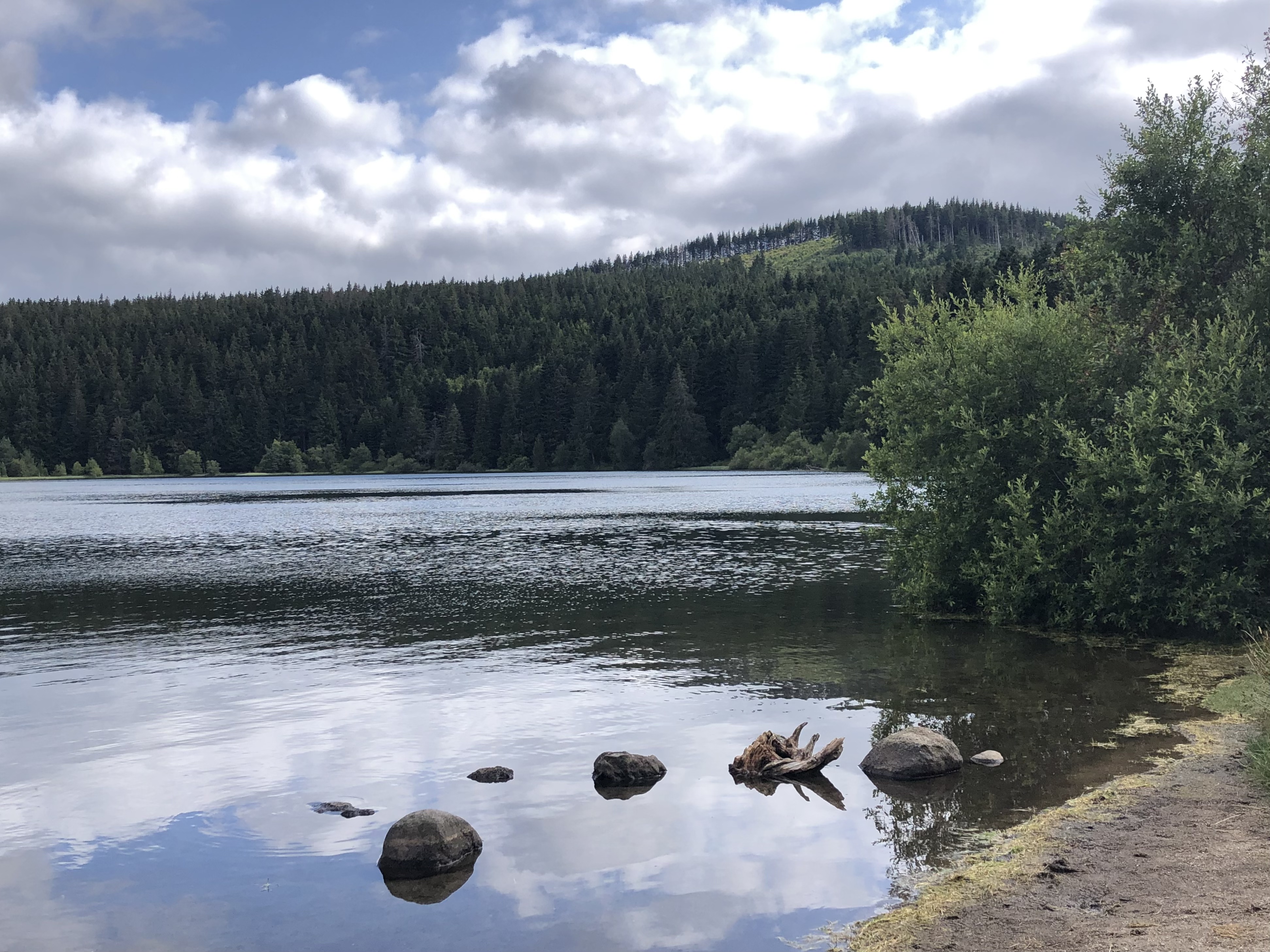
I went onto the GR 532 (which stays on the tops) with the hope of getting some views from the peaks. First I came to a sombre WW1 cemetery in the forest. The trail went uphill, partly on a rock flow; no view from the first peak and then a view from a lower one only because the land had been cleared to create ski pistes. I arrived at the Col de Calvaire, a ski resort. After that I detoured via the Lac Blanc (glacial) with a rooty/rocky trail that went to the lake’s edge before climbing high above it to a dominant rock stack.

The rocky path stayed above the lake (my first mountain lake) with great views. I emerged onto a vast plateau, Le Gazon du Faing, with stunted black pine and blueberry plants with plenty of unripe fruit (unlike all the fruitless blueberry I’ve seen so far). It was wonderful up there with mountain views in all directions, and busy with walkers. This was a real change from my Vosges experience to date. The trail moved to the edge of the plateau (view into valley far below) where there were dramatic cliffs and rock formations. I descended to Col de la Schlucht which had a cluster of restaurants and hotels. After a glass of Grenadine I went on in forest to Trois Fours where I had intended to camp but camping wasn’t allowed, so I climbed to the summit of Le Hohneck (1363 m) for another 360 degree mountain panorama.

There were still lots of people around. I continued on, a bit frustrated because I wanted to stop, and I waited until I got into beech forest then picked a spot just inside the forest with a view of green hillsides and the sound of cowbells (although I couldn’t see the cows). 29 kms
3 June After 5 minutes I was at the Col de Firstmiss where there was water and I watched the noisy cows while I had breakfast. Staying on the tops I climbed peak after peak: Le Rainkopf, Rothenbachkopf,
Batterienkopf, all with wonderful views of forest and alpine pastures and some black-looking lakes. Sometimes it was heather/grass with wildflowers by the trail, sometimes blueberry and occasionally alpine beech forest. I got to Le Markstein, a ski resort, and went to a typical ski resort cafeteria (blueberry pie and a cheese platter). It was weirdly quiet apart from cyclists and motorbikes.
Going towards Le Grand Ballon I walked just above the road, parallel to a distant mountain range, and escaped into forest with a glimpse of a lake below and glimpses of the summit which was far above me. The last part of the climb was on scree and it got windy. The views from the viewing platform on the ugly white building at the summit (1424 m, highest in the Vosges) were good, half towards mountains and half over the plains. To the south the weather looked bad. It was time for a snack; unfortunately my gps guided me to the ruins of the 1800s chalet-hotel rather than the current one. I turned a corner and saw the real place with relief. Behind the restaurant there seemed to be an informal camping area with an outlook over the mountains so I camped there. 22 kms
4 June A very downhill day. I set off across ski slopes, very peaceful, then forest. I got a good view of Le Grand Ballon
just as I got to the ruins of Chateau de Freundstein; not much there.
Shortly after I came to a
Ferme-Auberge with a terrace overlooking the Grand Ballon so I had a coffee. I descended more rapidly passing some granite outcrops and had window views over towns in the valley. I wasn’t on the right path but the one I was on was popular. I looked around the ruins of Chateau Engelbourg just above Thann, with its curious upright stone ring called the ‘eye of the sorcerer’ which is all that remains of the keep.
There was a good view over the old part of Thann and its extremely ornate Gothic collegial church.
Hardly any half-timbered buildings. I was surprised to cross a river in Thann (I haven’t seen flowing water for days) and the streets were deserted, everything was closed even though it was Mothers’ Day; but I found a snack bar right beside the church. I checked out the church and had to find a hotel since I was out of food and the shops weren’t opening until Monday, tomorrow. 15 kms
5 June I had a massive climb out of Thann, first on a narrow road alongside a stream, then some bush bashing because I stayed on the road too long, trail through forest, a few bits of grassland and I was back on the tops again. I stopped at the first refuge, on top of Le Rossberg, with views north and south. The refuge wasn’t open but the gardienne was there and she offered to boil water for me. Then a funny thing happened: she completely disappeared for 30 minutes and I wondered where she had to go to boil water. She also gave me a bowl of fruit salad.
I had great views along the tops and could still see Le Grand Ballon. The trail descended to a farm and I had to walk through it. Then I contoured through forest with some steep bits and frequent views, eventually reaching the Col des Perches, above a lake that I couldn’t see. The path down to the lake was nasty but worth it: the lake was hidden by trees until I was at the very edge and the green water sparkled.
A few minutes later I had a view over the lake from above, an unattractive blob of green water. The trail contoured again, crossing some scree and crossed several small clearings; I hoped I wouldn’t regret not having stopped to camp. But I was lucky: I detoured off the main trail up a rocky peak called Roche de l’Enfer (1101m) overlooking nothing but forested mountains, with a table, and I could just squeeze my tent in. It was a dramatic place to sleep.
When I woke up
at midnight the full moon was orange. 24 kms
6 June I stopped lower down for breakfast and an older runner came past (both surprised to see each other so early); he had done the Ballon d’Alsace marathon 9 times. Soon I had my first view of Le Ballon. The last part of the climb was steep and I came out at a vast clearing. There were rings of mountains encircling the summit (1242 m). A hiker arrived who had walked from Paris and we had a long chat. I went down to the cafes (none open) and made my own coffee.
Then I set off downhill towards Giromagny. Almost immediately I saw Jean Jacques ahead and we walked to town together. The trail was lovely, following La Savoureuse stream almost all the way. There were lots of waterfalls and rapids in the forest. Then we crossed meadows and went through a tiny village with a huge church, and arrived in Giromagny. We went to the gîte d’étape, nobody else there, with a lot of paperwork to fill in. Giromagny was most uninspiring: derelict buildings, no obvious centre but we had good pizza. 19 kms
Day 20: 7 June I’m now keen to get to the Jura so I’m picking my route through the last of the Vosges carefully. Today started differently with rural countryside and several lakes, some with birdlife and some for sunbathing. Then back to birch/oak forest for a climb to Fort de Salbert, a hilltop with fortifications (the highest in the well fortified Belfort area) and a great view back towards the higher Vosges mountains.
Also a view over Belfort. Back in the valley I had a quick coffee in Essert, a suburb of Belfort, and set out for 15 kms on a canal towpath; not amazingly interesting but it was a change and reasonably shady. The first part was between the canal and the same river I had followed from Le Ballon; the rest was between the canal and the
autoroute. There were many locks.
I could see villages away from the canal and I saw an interesting church I couldn’t get to, but the next time I saw one (with an old tower) I walked into the village and uphill to the church; it had workmen inside so I couldn’t go in. It was far too hot and I couldn’t find any water so I went into the Mairie; they said I could take some from the bathroom but they weren’t sure if the water was drinkable so I sat in the cool foyer and filtered it. At the end of the towpath I came to a lake in Brognard with a sandy beach which was packed with families. I stopped to camp at an adjacent lake. Lots of things were forbidden but camping wasn’t mentioned. 34 kms
Days 21 - 30 Into the Jura
8 June The dawn chorus drowned out the autoroute noise for a while. Not a very interesting walk to Mandeure, along bike paths through the Montbéliard conurbation. A man said I was laden like a donkey.
In Audincourt I found a boulangerie and had a break (and a banana filled croissant). There I saw the Doubs river for the first time, a major feature of the Jura region. I was able to walk beside it a little (shallow and clear with some rapids) but mostly I had to walk by the road. It was 31 degrees, no shade. Mandeure had nothing going for it so when I had located the start of the GR 509 I caught the bus to take me into Montbéliard. I had pizza for lunch and dinner and bought the guidebook for the Jura. 15 kms; total for the Vosges 455 kms
9 June Rest day in Montbéliard. Toured the chateau, drank coffee.
10 June I took the bus back to Mandeure and started on the GR 509, the trail across the Jura. Just beyond Mandeure were the remains of a Roman amphitheatre on a hillside. I went into forest and climbed to a lookout over the Doubs then soon came to a tiny road through farmland. More climbing then a descent to the river in Pont de Roide. The heat was stifling. I saw a bar advertising a terrace on the river so I went for lunch, a stretch to say it was on the river but I could glimpse it. I had a croque monsieur, an odd choice since I’m carrying cheese, ham and bread.
After that a steep climb in forest, passing some old stone walls and unusual low granite cliffs. I came to a ridge path and had some long views over the countryside. In Chamesol, on the way down through pastures, I asked a couple doing some renovations for water and felt much better after a good drink. It was a long descent to St Hippolyte on little roads and a winding forest track alongside a deep ravine. The town looked pretty, in a steep sided gorge of the Doubs, lots of nice buildings (including a medieval church I couldn’t get into).
A band was playing accordion music, so I sat at a bar for a drink. Then I completed my tiring day by walking along the river to the campground, where I was able to camp by the river. 29 kms
11 June The bakery was open in town (not anticipated during my planning) so I had breakfast in the quiet square.
When I got going I made very slow progress because (a) I went the wrong way, doing unnecessary climbing (b) it was hot (c) I tried to short cut up a steep hill covered in blackberry and nettles. A lot of the trail was on little roads. Some views into the valleys and of sheer limestone cliffs among the trees. I stopped in Courtefontaine and then went wrong again; the trail left the road unexpectedly to go across a field with no markings. After a climb I reached a farm where I asked for water and soon I was in Fessevilliers, a hilltop village. Juliette and José, whom I met yesterday, were sitting by the church and we chatted again. It was a nice Romanesque church, baroque inside.
More quiet roads (freshly cut grass was all over the road) and a forest interlude. In Urtières I had a view over a very deep wooded chasm right below my feet….and then I had to walk down into it. The descent wasn’t bad and there was a good view of Goumois in the valley, also of high cliffs above the town.
At the bottom it was mossy and damp. I stopped at the Goumois campground before reaching the town. 28 kms
12 June I walked along the river into the little town and unfortunately the shop that I had been relying on was closed. I crossed the river into Switzerland and was able to have breakfast at a hotel in Swiss Goumois. A selection of ham and cheeses but no fresh bread. Enough to eke out my food stores.
Having gone into Switzerland I decided to stay there and I walked a trail parallel with the GR 509 on the other bank of the Doubs. After a relatively unspectacular 2 days this was really lovely: first by the river with perfect reflections of the far bank, saw the river narrow, then in forest as I climbed and saw sheer limestone cliffs across the river (encountered my 3rd snake). I was in shade almost the whole time. I got water near a hut and stopped at a stream to do my favourite (coffee) thing. The trail descended past meadows to a hamlet Blaufond where I crossed the river and returned to France. It was hot in France. I undulated along the river, wide and placid, on single track through nettles and often on limestone chips. Lots of moss. There were sections with limestone cliffs beside the path.
The final hut before I had to leave the river, Abri du Torrent, was in such a pretty setting I decided to sleep inside on the floor. I watched falcons circling.
30 kms
13 June I climbed steeply above the river and at the top I met Juliette and José. The trail went along a ridge with views into high valleys and then forest. I walked with them for a while until the trail markings didn’t make sense with my gps or topoguide and we parted company. I descended with a view over the Chatelôt dam and the big lake above it, surrounded by limestone cliffs. The path followed the lake edge (once cut into the limestone and passing under an arch) until the Saut de Doubs, a powerful waterfall.
There was a snack bar so I had an ice cream. Then I walked downhill along a deserted sealed road with a view over a sweeping bend in the river.
Soon I could see Villers le Lac but it was really spread out over several hillsides and I had a long way to go. It was blazing hot. When I reached the town I found the main street was dug up and the bakery was closed for lunchtime. I stayed at the gîte d’étape and went to a nice restaurant. 21 kms
14 June I had a hefty climb out of the town until I reached a succession of high valleys. I paused at a hamlet Sur la Roche
and went on up in spruce forest to a ridge, right alongside the Swiss border; the official border was a low mossy wall and frequent border marker stones.
Soon I was in Switzerland. And back in France. There were views only into France. I went above a ski resort and then arrived at another. I climbed gradually through pastures dotted with firs and detoured to a large cave in a sheer cliff.
There was a way to get inside so I put on my head light and crawled in about 20 metres; it was damp and had insects. I went along a grassy trail lined by firs and climbed to Col du Vieux Châteleu (1200 m) in the heat. At the col I decided to stop for lunch and I went off the road - to find Juliette and José sitting at that exact spot. I crossed a few more pastures - all looked lovely in the sunshine - and came to a hamlet Les Seignes where I found a water tap. I went a few minutes into the forest and saw a patch of green to camp. 25 kms
15 June I went past more limestone bluffs, Rochers des Cerfs, and back into Switzerland, then mix of forest and pasture. I descended alongside a stream (too little water to collect any) in a pretty valley, passing a douanes notice on the French border, to Les Alliés with church and water trough. Everywhere the farmers are cutting grass to make hay. Then climbing on road and forest trail to a tiny notch between rocks where I dropped into Switzerland. Climbed to high pasture with cows and on up to the summit of Le Grand Taureau (France). A couple I’d seen before with a dog in a backpack came past.
There were sweeping mountain views from the summit (1324 m) and the views continued along the ridge, also I could see where the Doubs widened to form a lake. The path descended sharply, passed random flowing water (a welcome sight) and went into forest; when I emerged from the forest on a hillside high above Pontarlier I found some secluded grass and put up my tent. 22 kms
16 June Lovely view over Pontarlier in the early morning sun. I walked down into the town, checked into the Auberge de Jeunesse and chilled. Nice main street, imposing stone buildings, archway at entrance to central street, museum and good church.
3 kms
Day 30: 17 June I followed the Doubs out of Pontarlier and after a while I could see the Chateau de Joux high on a hilltop.
I climbed up there and joined a guided tour of the place; it was good and I learned all about Vauban and fort design but it went on for 2 hours so I got behind with my walking. After the castle I crossed high pastures and went into forest. Once in the open I had views over the large Lac de Saint-Point (3rd largest natural lake in France). I went off the curriculum and walked little roads through several villages, and a very nice stretch through the countryside. I had lunch by the roadside and when I got going there was a long line of cows coming down the road towards me; I couldn’t wait for them to go by so I walked past them and a few took quite an interest in me - they didn’t have horns.
I came to Les Hopitaux Neufs and was surprised to see it was a ski town. I went a long way off the trail to go to the supermarket and walked on towards Le Morond, the mountain where the skiing takes place. I got about half way up, to an area called Le Petit Balcon, and it looked good for camping: I could sit on the chairlift and sway in the breeze, and I had a ringside view over the entire valley. 23 kms, total so far 636 kms
Days 31 - 40 Heart of the Jura
18 June I returned to my chairlift seat for breakfast (hoping it wouldn’t start operating too early) and I could just discern Chateau de Joux on the horizon. I climbed steeply to the summit of Le Morond (saw some jays) and continued past a little reservoir to ascend several bluffs (with sheer drop offs into Switzerland) on the way to the top of Le Mont d’Or (1462 m). Lots of villages dotted around.
At the car park right below there was an aid station for a trail race and I was able to get water (and I snatched a piece of cake even though I have the same cake in my pack). From there I meandered through high pasture, lots of cows, past a derelict chalet full of farm machinery fit for a museum and arrived at Granges Raguin which turned out to be a cluster of closed snack bars. So I made my own coffee and watched a few hikers go by. I crossed more high meadows and went into beech forest. It rained! I sheltered under trees for two showers then it was over. I descended to the source of the Doubs, a big tourist attraction.
The river emerged from an underground lake beneath a cliff and within a short distance was already many metres wide. I went into Mouthe, quick look at the church, and found the gîte, an apartment I shared with Suzanne. The town was totally dead for
commerces (Sunday) but plenty of traffic. 20 kms
19 June Quite a lot of road walking, in forest and passing meadows. One tree had my initials on it! None of the others were initialled.
I stopped in Chaux-Neuve, a ski village dominated by a ski jump. No signs of life. There weren’t any views even though I was high, and I made a disappointing detour to a high meadow (along with 6 other walkers) without a view. On the sealed road coming into Chapelle des Bois I passed a group of 20 walkers. This was also a sleepy place, with lots of ski chalets and a pretty church.
After that the scenery improved. I climbed towards the limestone bluffs above the town (the Swiss border)
and contoured a terrace below them with views back over the town. Then some pleasant forest and two lakes among meadows. I took a winding road into Bellefontaine and tramped through some tall grass. Bellefontaine was nicely located on a low hill, yet another closed up ski town. I found a secluded grassy area in a gully to camp. I had reached complete relaxation when I heard cowbells and saw two cows (with horns) approaching so I had to pick up my stuff and move on. The church bells were chiming 7. I walked through some forest and arrived at a meadow which looked great for camping.
It rained in the night, first time for this tent. 31 kms
20 June I had breakfast behind a deserted house where there were two chairs. I went on in forest and along little roads, saw a viaduct, had peaceful views over green valleys.
Then I had a long climb in forest, lots of mossy rocks, hoping for a view at some point. Up at Col des Crêtets (1300 m) there were ferns and everything lush green, and an opening to give a view west towards all of the Haut-Jura. I came down to Les Rousses, a ski town which was on several levels; happily this one had a lively centre with a choice of restaurants. It wasn’t quite midday but I went for a pizza.
I walked out of town noticing a ski jump right next door to a school, bizarre in itself, and it looked to me as though ski jumpers would land in the school car park. My first goal was called Bief de la Chaille and I was curious what this would be; it was a fast flowing stream with rapids in the forest and really pretty (dialect for a stream in a gap). I crossed some meadows and walked on roads through a succession of unattractive ski villages, ending up on a busy road. I must have gone wrong somewhere. It was ridiculously hot. I asked at a house for water and the guy had a 45 year old Citroën 2CV in his garage.
After that I had a steep climb and I was happy to reach my GR 5 again. There were a few drops of rain. I finished up with some road kilometres, nice because I was really high and had some views, and a bit more crossing meadows, including the snowiest spot in the Jura. I had earmarked a clearing where I would camp but when I got to it there were cows. I went on until I thought I was far enough away from them and put up my tent. Soon after I heard cowbells and along they came; I took the tent down. Fortunately they went straight past me and I decided to stay put. I was in a long valley dotted with fir trees. 30 kms
21 June The sky was black when I got up and very soon there was cloud blowing up the valley. I had a glimpse of mountains ahead before descending lower into the valley. It rained briefly and cleared up. At La Sermangindre I sat in the doorway of a little hut for breakfast. I descended to Mijoux in forest, steeply and with views of a high forested mountain range.
Mijoux was pretty but it was another ski town that was completely closed up, except for a bar on the edge of town where I could get a coffee. It was a great setting, steep sided hills all around. From there I joined the GR 9 and did a steep climb up to La Faucille ski field, where I had another coffee just because I could. I rushed off to continue climbing because the weather was about to pack in and I just got to the summit of Le Mont Rond (1585 m) as the rain started. It was a great view up there over Lac Leman but the lake soon vanished into cloud.
I thought I would shelter under a tree until the rain passed and I waited half an hour then thought it wasn’t too heavy and set out for Colomby de Gex. It was rugged going over rocky ground and a series of lower summits but when the cloud cleared I could see several layers of peaks beyond the lake (the Alps) and the back layer had a good helping of snow. I could see the Jet d’Eau on Lac Leman (in Geneva). The rain came and went and I heard thunder.

Just as I got to the top of Colomby de Gex (1688 m) I saw lightning so I didn’t stop. The descent included more minor peaks and the storm continued but it was not close. The fabulous view across the lake stayed with me. The other direction I could see the tiers of the Jura mountains and it was interesting to see that the long valley I walked down earlier was on a plateau. There was a long white cloud hanging below that plateau. I was aiming for a mountain refuge for the night and it was hard to find. As I arrived the sun came out. I ate at the refuge and camped there. 22 kms
22 June A day that I thought was going to be very hard: steep climbs and no water. It turned out great. I left the refuge and was immediately climbing along ridges and across grassy bowls towards Le Reculet (1719 m).
It was crazy windy on the exposed sections and rained briefly. I had similar views to yesterday towards the Alps and it was a lot brighter towards the Jura. After the summit I had to pass some interesting bluffs which had the appearance of waves stopped in mid roll. The sloping eastern sides were grass all the way to Switzerland and beneath the limestone face of the bluffs were sheer grassy drops into a Jura valley. The first bluff held a large cave.
The weather got blacker and blacker over the Alps while I had a little sunshine.
I reached Le Gralet hut and thought the big climbs were over. I went into forest and it rained. Best place to be in the rain. I got to La Poutouille hut just in time to avoid a heavier shower. The trail continued in forest, pleasantly descending, until I worked out that I still had a long way to go and a lot more climbing. The remaining distance seemed to be getting longer rather than shorter. I came out of the forest onto grassy hillsides and went up to the tops again.
The weather was not quite so bad in the Alps but I couldn’t see much. I could see the blue Rhône clearly. I went over the Crête de la Goutte (1621 m), passed between a pair of lower peaks, and began the real descent. As I turned a corner I could suddenly see the large town of Bellegarde sur Valserine at my feet; it felt like I could touch it but it was 1000 m below. The sky was black ahead, I heard thunder and I had another race against the rain to reach the Sorgia d’en Bas hut, and made it as the rain started pelting down. This time the rain persisted, the hut was engulfed in cloud and I decided to call it a day. 25 kms
23 June Back to blue sky and hot. Cloud hanging in the valley below the hut. I walked down towards Lancrans, found water and a hotel to have coffee. The next part was exceptionally nice and unexpected. I descended to the Valserine river (which soon joins the Rhône) at a point where it flows through a tiny limestone gorge, and the terrain surrounding is fragmented limestone with large potholes.
Quite bizarre. Then I walked beside the river as it widened, full of boulders. Parts of the path were built out over the river. I walked past caves and under long overhangs with dripping foliage, waterfalls and ruins of bridges.
I arrived with a jolt in Bellegarde and found my hotel right by the station; the owner was so confident of my French that she told me a joke. The town was situated on a hillside, station at the top and
commerces at the bottom. 10 kms
24 June I was in for a lot of climbing. I walked out of Bellegarde passing a little chateau and then decided to go off the GR 509 for the morning. I went up a path that crossed a Roman bridge (at first I didn’t see it because it was under the path) and led to a pretty village called Villes, all pale stone houses. I continued on a selection of different sorts of paths, some very obvious and others unmaintained, and some meadows. Fairly soon I started getting amazing views towards the Alps and especially Mont Blanc, which towered above the rest and was covered in snow.
I rejoined the GR 509 by a farm and walked along a ridge, where I bumped into Suzanne. I detoured to a lookout at Crêt Nu and went on in forest. When I reached another farm the farmer called out to ask if I wanted water. From his place the view of Mont Blanc was again wonderful and I complimented him.
Then a considerable descent, in forest and meadows. It was hot but bearable. Everywhere is so green yet there is no flowing water. The wildflowers were great: pink, yellow, blue and large daisies. As usual lots of different butterflies. I intended to camp at the bottom to save the next climb for tomorrow, but it was all muddy. I was tired but decided to push on another 4 kms to a hut. When I got there the hut was hopping with about 30 people who had arrived by car. I walked on and reached a road, so I had to keep going. I came to nice grassland and there were cows.
Eventually, on a plateau, I could see ahead an old building and a tent; it turned out to be a man camping with his kids. Just past there I found a grassy hollow on the edge of the forest, tree covered hillsides opposite.
I had done at least 1500 metres of ascent today. 32 kms
25 June Last day of the Jura. I arrived very soon at Arvières on a hillside with a refuge, picnic table for breakfast and a view into a deep valley. I walked through the Arvières river gorge (no water) and climbed to the Col de Charbemênes for a view of the Alps. There was a heavy heat haze and the snow on Mont Blanc appeared to be floating in the sky. I continued on a ridge and then steeply in forest (rooty and rocky) and out onto grass to the Col de Colombier and up the grassy flank of Grand-Colombier (1531 m).
From the summit the view was sensational: Alps, Lac de Bourget, multiple mountain ranges, multiple valleys, the Rhône. The descent was tricky at first, then went along the road (lots of cyclists), across cow pastures and into forest, where there were many shallow zigzags. These became tedious for their lack of gradient and I took the chance to bypass some but that was difficult steep and slippery work. Near the bottom I had my first view of Culoz
and also saw the nature of the sheer cliff face I was descending; amazing that there was a path at all. I came into Culoz, it was baking hot (32 degrees) and Sunday - deserted and closed up. Rather stupidly I went on to the station thinking there might be an air conditioned snack bar but there was nothing; the ticket seller gave me water. I walked to the campground as fast as possible. I was in a kind of stupor for the rest of the afternoon. 20 kms
26 June This is like a link section to get from the Jura to the Alps. Bits were tricky to work out. I crossed the Rhône
and walked along a bike path then a busy road to Chindrieux. There, on a Monday, I found an open shop and an open bar so I bought food and had coffee. I left my gear at the nearby campground and walked to the head of Lac de Bourget (largest natural lake in France) in Chatillon. I sat in the shade by a little beach and had a large ice cream once the lunch rush was over. 12 kms
Day 40: 27 June I climbed from Chindrieux to get high above the lake on a road which was narrow and the busiest so far. I now joined the GR 965. The views over the lake and mountains beyond were good and I had towering limestone cliffs above me.
(The high road was a bit like the Whanganui River Road except that I always had a crash barrier or stone wall to protect me from the drop.) A stretch in forest under those cliffs was lovely.
I descended, seeing the abbey of Hautecombe across the lake, through vineyards to Brison, and then down to the very edge of the lake. I walked on stretches of boardwalk that were over the water and on tiny pebbly beaches. When I reached the port of Aix les Bains I stopped for coffee (idyllic, €5). I went on into the town and to my hotel. 19 kms, total so far 855 kms
Days 41 - 50 Towns and ravines
28,29 June Rest days in Aix les Bains with Brian. Short walk at Le Grand Molard on the other side of the lake.
30 June I left Aix in light rain, went over the ridge separating the town from the lake and walked along the lake edge. I walked by the main road then on some quiet roads while the rain came and went, until I reached a shopping mall outside Chambéry and had a break. Continued into town along the railway line. Sadly my hotel was nowhere near the centre, but I dropped off my stuff and walked to the castle; can't go inside. Looked at the cathedral which is all
trompe l'oeil inside and checked out the elephant fountain.
Then I needed a hot chocolate and I found a quirky cafe. 19 kms
1 July Rest day in Chambéry. New clothes, art gallery, nap.
2 July I was happy to leave Chambéry, it was disappointing. The day was overcast with low cloud over the peaks. I climbed from the town to get views over the Chartreuse and Bauges ranges, detoured to a col with a cross and began a lot of undulating through vineyards. Passed more crosses.
Aprémont had a simple but pretty church. It became hot and I was climbing a lot without getting very high. I rejoined the GR 965. I passed the weakly flowing Pichut waterfall in forest and crossed some streams, then climbed to Lac Noir with increasingly close up views of Mont Granier with its dramatic landslip from 1243 and highest cliffs in France. The lake was tiny and surrounded by reeds, with big fish. Bit of forest, some roads with more views of Mont Granier, then village Bellecombe which had ruins of castle walls in an imposing position overlooking the Isère valley.
In the forest after that I could hear a huge din which turned out to be a stream flowing rapidly downhill past boulders. I had a long stony descent, recently fallen trees blocking the trail. At the bottom was a village, therefore difficult for camping, but I ended up comfortable and hidden on the edge of a mown field. 28 kms
3 July In the next village Barraux there was nothing open (Monday) except the Tabac where I could get coffee and snickers bars. It was a pretty village with pale stone buildings. I went through a couple of hamlets, descended in forest and climbed along the flank of the Chartreuse massif with its sheer limestone cliffs.
There was plenty of flowing water in the forest, a nice change. It was cloudy but I could see slivers of mountain above the clouds to the south. After a long road walk I came to Col de Marcieu (1060 m) and had a sandwich at the restaurant since I couldn't buy bread. The owner was interested in my walk. It was almost cold up there. The rest of the day was in forest, steep ups and downs on the Plateau des Petites Roches, Gésy waterfall, much larger waterfall,
following streams, sketchy section below cliffs, remains of a mill. Nice damp forest. The lookouts were disappointing because the clouds never lifted over the Alps. I had good views over the Belledonne range and the Isère valley was in sunshine. I had brief sightings of St Hilaire on a hilltop before I reached it. I went to the campground and could see the Chartreuse peaks from my tent. 28 kms
4 July I had beautiful views over craggy/snowy Belledonne mountains in several directions first thing but I could see clouds advancing. I went on a mixture of forest and roads through a few villages. After a steep climb to Col du Baure (not much view due to cloud) I had a long pleasant zigzag descent to the Manival stream flowing straight down a limestone ravine from impossibly high up (almost dry). I rested by a hut and saw paragliders; some runners arrived from the valley in a bad state.

I continued descending, crossing dry river beds on scree and undulated in the beech forest. Lots of holly bushes. I came to a couple of picnic tables by a 14th c tower - good views but still low cloud. After a long break I went on, crossing more dry stream beds (streams flowing steeply down from the limestone cliffs and there was a lot of work done to prevent flooding and falling rocks from reaching the villages in the valley) and looking for somewhere to camp. I was very low down by now, on the edge of the valley. Finally I stopped at a clearing beside the trail, the best option I could find. There was lightning in the night. 21 kms
5 July Several people walked/cycled past before I took my tent down. I descended towards Grenoble below Mont St Éynard, with views over the city and sometimes of limestone faced mountains beyond. At one point where the trail crossed a ravine made by a stream there was a rope to help getting up the other side and it was hairy and I got stuck; then I had to do it again because I dropped a pole and my metho. I reached sealed roads and for the first time someone offered me a lift. I took side streets, always descending until I came to the Isère River, fast flowing.
I followed it until I was below the Bastille fort ruins and crossed to the city centre. Lots of grand buildings. The mountains were already in cloud. I had Mexican for lunch. Then I had to walk right across Grenoble along a dead straight road to a daggy suburb called Echirolles. I went to a pizza place that had amazing reviews and the pizza really was good. The police came for takeaway. 15 kms
6 July I walked to Vizille without my pack. Some forest, some fields with good views, a little interlude by small ponds. I passed a random castle.
I went through a pretty hillside village called Montchaboud. It wasn't too hot. In Vizille I visited the castle where the French revolution began, but apart from that 40% of the town buildings were boarded up or derelict. I got the bus back to Grenoble. Checked out the cathedral. 14 kms
Day 50: 7 July I took the bus back to Vizille and walked out of town along the old walls, then went through some villages and had to walk on a big road. Finally I walked on a quiet bike path by the Romanche river to tiny Séchillienne. It rained a little. Ahead lay huge mountains but I was done for the day. I was lucky: a bus to Grenoble arrived immediately. Visited the art gallery. I really like Grenoble, so many different areas to eat and drink. 9 kms, total so far 991 kms
Days 51 - 60 Into the Haut-Alpes: Oisans, Écrins, Quéyras
8 July Rest day in Grenoble. I went up the cable car to the Bastille; great views towards Écrins, Belledonne, Mont St Éynard where I just was, plus an excellent view over the city. Mont Blanc was too far away. It was a blistering hot day.
9 July I could only get the bus back to Séchillienne mid morning so I knew I was in for a hot walk. There were signs along the road warning people to take care in the heatwave. I started climbing almost immediately and even though I was in forest it was awfully hot, but nice not to be in full sun. It was steep and after a while I felt quite sick.
When I got to the hamlet of Les Sapeys I stopped outside a house and I could hear voices so I knocked on the gate and asked the couple sitting there if I could have some water. They invited me in for coffee and I chatted with them for an hour; it was lovely to have a rest. After that the walking was much easier, still climbing but on a wide gradual trail. I reached a stream that was gushing over the path and I couldn't get across keeping my feet dry. Soon after the path abruptly came to an end. I used my gps to guide me through the forest, then the path re-emerged and then it disappeared again and this time I had to trample through deep grass. It wasn't fun and I was happy to see a wooden cross higher up that I could aim for.
When I arrived it was a busy little car park and I was back on track. I walked on to La Morte which was a ski resort and had a small lake that was chockers with people. There were high mountains above the village. I joined the GR 50 which crosses the Oisans range and went on uphill getting nice views over La Morte and seeing a rocky mountainous range with snow. The scenery was suddenly much grander than what I've been used to.
The trail was grassy and I was already higher than I've been so far. Terrible mosquitoes. I came to a small lake with reflections of peaks above, Lac Claret, and it had space for one tent by the water - for me. 18 kms
10 July I had breakfast by another lake then began the hard climb up to the Plateau des Lacs. The climb was on open mountainside with increasingly good views of high peaks. The plateau at over 2000 m was wonderful with lakes dotted around below towering Mont Taillifer and waterfalls cascading down the sides of all the mountains.
Patches of snow on the mountains. In the distance I could see tiers of mountains, a misty blue. As I walked along I was suddenly engulfed by sheep, a few
chevreuils among them, they weren't too bothered by me.
I came down through some hamlets and walked into Bourg d'Oisans in great heat.
There I found everything open and I needed a coke at a bar. Then I left the town on the GR 54 for a nasty hot climb, steeply cutting road hairpins by going into the forest, until La Garde. I went into a greener forest and soon came to a footbridge over the churning Sarenne river; there was flat ground and a picnic table so I happily stopped for the day. 26 kms
11 July The climb soon eased off, I went through hamlets and I walked a long way in a narrow grassy valley above the Sarenne. I passed Alpe d'Huez not far away.
I walked under several chairlifts and then the valley opened.
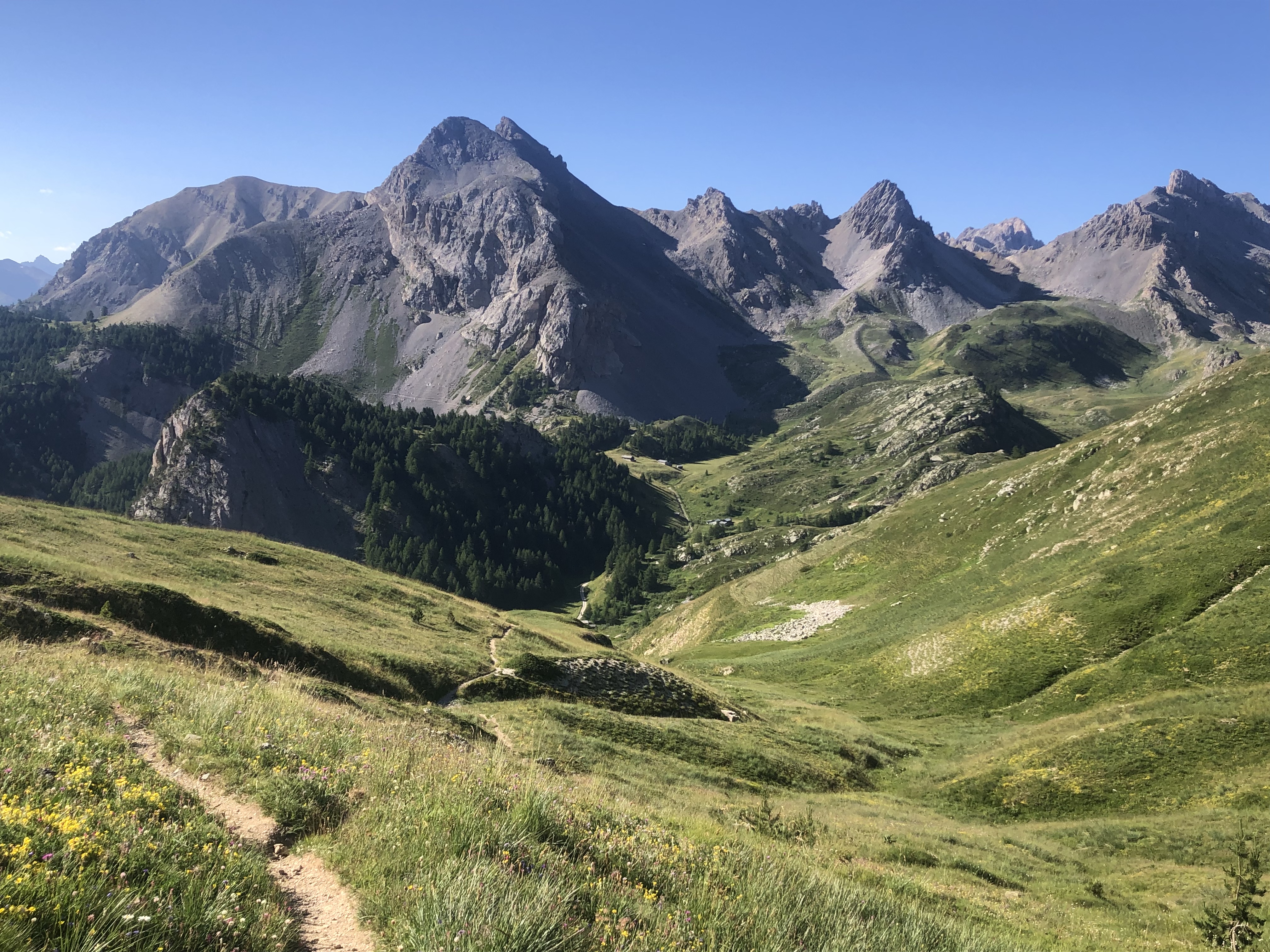
I had a road walk, shared with many cyclists, as it got hotter, and eventually arrived at the Col de Sarenne. There wasn't a view at the col but just above the view was awe inspiring: towering Pic de la Meije (3890 m) at the end of a long mountain range, the vast Plateau d'Emparis (largest pasturage in France), granite cliffs and deep valleys. I could see Besse, my goal for the day, perched on the cliffs.
But I had a long descent first, to Clavans le Haut, where I found a seat in the shade for lunch with water and a rubbish bin. More descent to Clavans le Bas, much smaller. Here I crossed the Sarenne and had a steep hour's climb to Besse in the full sun. This was a pretty village in the local style of unrendered stone buildings, but all I was interested in was having a coke at the bar asap. I camped at a low key campground on the edge of town and there was a thunderstorm in the night/early morning. 22 kms
12 July First up I had the 1000 metre climb to the Plateau d'Emparis and the Écrins national park mainly on open hillsides, the air still fresh after the storm. I could see Besse below and the craggy peaks I had seen yesterday from the other side.
The plateau was huge and grassy, not especially flat, and I undulated along it admiring Meije some more as the mountain got closer. I was able to dump my pack and do a loop walk to a trio of lakes: Lac Lérie the largest,
then a nameless tiddler which was closest to the edge of the plateau, and from where I could look across the Romanche river (my old friend, now in a deep gorge) to impossibly high bare rock with waterfalls cascading down, and round Lac Noir. After this I had a very long descent ending with hairpins that went on forever to Le Chazelet.
I hoped for a snack there; the village was like a furnace and I had to continue to the very last building where I got slices of
gâteau de citron avec sa mousse citronée. I went on towards La Grave (nice 15th c church) as the views of Meije got better and better
and I camped at the campground right below the mountain. There was a thunderstorm in the late afternoon and another in the late evening. 21 kms
13 July I walked beside the Romanche, now roaring along,
mostly in forest to Villar d'Arène, an unpretentious little village. The clouds were hanging low so there was little view. After a coffee I continued by the river often walking right at the edge and this was very enjoyable. Then I had a steep climb to the Col d'Arsine, looking down on the river and almost following it to its source. Powerful waterfalls cascaded into the river.
Higher up I followed a calmer stream. I had great views of Pic d'Arsine and many other high peaks now the weather had improved.
At the col I dumped my pack and walked across scree to the Lacs d'Arsine, two glacial lakes that were pale turquoise and backed by mountains bearing glaciers.
Then as I descended I could see the glacial Le Petit Tabuc stream far below, it too was pale turquoise. I heard marmots screaming. Across the other side of the Tabuc gorge were high rocky mountains with huge scree fields and clumps of larches. It was incredibly beautiful.
The stream entered an almost unworldly lake (pale turquoise) Lac de la Douche. I tried putting my feet in the water but it was so cold I had to take them out immediately.
I went on downhill in pine forest and just outside the national park I stopped by the (now roaring) Petit Tabuc to camp. 24 kms
14 July I walked into Le Casset (its church had an unusually high tower), had a quick look at the water mill museum, and continued into a wide farmed valley, high mountains to either side. I came to Serre Chevalier ski resort and soon Les Monêtiers les Bains. There I bought some exotic pastries for breakfast. I went on to La Salle des Alpes (quite an ugly ski resort) and checked into the youth hostel. It was already baking hot. I had coffee and then lunch (a galette and café gourmand). For dinner: tartiflette and an ice cream. 10 kms
15 July I climbed high to get a view over the valley filled with ski villages and even higher to rejoin the GR 50 and walk a path that was like a balcony above the valley, soon larch forest blocking the views of buildings. Four female deer crossed the trail. I came to a clearing with a first view over Briançon, very impressive with the Cité Vauban on a hilltop and forts all over the mountainsides.
Pic d'Agrenier towered in the distance. As I descended towards the town I could see more and more fortifications. The road up to the old town was super steep and I went in through an entry in the massive walls. Inside was tourist activity I haven't seen since Ribeauvillé. The main street was colourful buildings and also steep.
I checked out the castle for a while and then found a particularly unattractive route down from the old town, managing to avoid any shops where I could get the food I needed. I ended up at the bar opposite the station where the owner talked me into a pizza. The view of the surrounding mountains was outstanding for a
Café de la Gare.
I'm on the GR 5 again. I walked uphill out of Briançon through residential areas until reaching larch forest. The climbing steepened and I had views over the town, less impressive from this side. Then I walked on the road as the grade eased. I passed a rock face with lots of rock climbers. I stopped at a snack bar in Les Ayes. I'm now in the Quéyras.
I returned to forest then emerged onto grass slopes with bare rock and low trees, reaching a plateau with rocky peaks all around. Close to the Col des Ayes I came to a locked hut and I camped beside it. It was a bit sheltered from the strong wind. 28 kms
16 July I finished the long climb to the col (2477 m), from where there were plenty of mountains to see and Monte Viso (3841 m) in Italy towering above everything. I descended into the green valley and then forest and there was a large campground where I was able to buy (unclaimed) bread which was a relief as it was Sunday.
I rushed down through Brunissard to Arvieux, trying to get to the shop before midday closing, and just made it. Then I found an open bakery. The 15th c church was pretty. I climbed out of the town to another plateau and more larch forest and then had to go all the way back down. On the other side on a low rock was Château Queyras, a 13th c castle/fort also worked on by Vauban.
I looked around it, pleased it was only small. And I decided I was fed up with all this climbing. The trail went down further then started an almost vertical ascent in forest, easing off when the forest opened out. I was keen to stop but didn't see anywhere flat until I reached an area with cows. I was all set to camp beside the trail when I noticed a little spot under a tree with a log seat. 21 kms
Day 60: July 17 A cow came to visit first thing. I crossed a stream and came to a bizarre sight of a pair of rocky peaks looming above the forest like two ears.
The trail contoured an open hillside with fantastic views, crossing scree slopes and a deep limestone chasm, a lot of bare rock, low pines. The view at Col Fromage was of nearby rugged mountain ranges, and the peak above had a tiny hut on top.
I came swiftly down to Ceillac on tight switchbacks (lots of people were walking up unlike on my side) and everything was open (on a Monday). The church had frescoes. After that I had a road walk followed by a steep climb to a couple of lakes. Lac Miroir was below snow flecked crags and it was black.
I continued uphill through a ski area: grass, yellow flowers and tiny trees.
This gave way to boulder strewn hillsides and scree, then I crested a ridge and I was blown away by the sight of Lac Sainte Anne: deep turquoise below a line of rocks weathered into pinnacles, patches of snow between the pinnacles. Certainly gave Lake Rhona some competition.
There was a little chapel and I put up my tent next to it; it was crazy windy and I thought I could get some protection but my tent has never been so buffeted. 19 kms; total so far 1171 kms
Days 61 - 71 Mercantour National Park
18 July The rest of the climb to the Col Girardin (2699 m) was crazy steep zigzags on scree. From there the lake was a little blob of brightness among the severe grey peaks and there were mountains forever.
The descent was past boulders into a green valley down to a tiny hamlet. I found lovely cold water to drink, a shed to boil water and a woman let me use her toilet. I had a road walk alongside the Ubaye river to St Antoine where I took a break and chatted with a South African.
It was very rugged country. I could see a titchy bridge connecting two close together rocky points high above the river and sure enough I walked up there, then turned onto yet another stupidly steep climb. The path levelled out with views of towns in the valley then descended a little to Fouillouse. I found a nice cafe at the far end. The climbing continued, grassy slopes and streams, ending with a steep spurt up to Col du Vallonnet; it was so windy I didn't stop. I have never seen so many marmots.
It was like a lunar landscape on the other side: scree and rock. I descended a little to a dried up lake then climbed towards Col de Mallemort. Not far below the col was a ruined barracks (built in 1887) and another ruin on top of the hill overlooking and there was slight protection from the wind in the courtyard so I camped there.
I had always wanted to camp inside castle ruins in the Vosges and this was the nearest I could manage. There was a group of school kids staying there inside. 26 kms
19 July When I woke up the weather looked threatening and there were a few drops of rain so I rushed over the col and down to Larche. I had intended a day off there but as I descended I saw it was a tiny place and I wondered what I would do there all day. I had breakfast at the épicerie and another coffee at the auberge. The sky cleared.
I began the long gradual climb to Lac Lauzanier in the Mercantour national park, half way on a closed road and the rest on a good trail. The valley I was going up was green, a few trees, a calm stream, marmots. Very windy again. It was very rocky getting to the lake and so windy there that the water was whipped up, actually not pleasant at all. I went on up to the next lake, Lac Derrière la Croix, which was a small turquoise gem.

I had a long chat with two English walkers. The trail continued up to the Pas de la Cavale (2677 m) traversing a ledge on scree; with the wind so ferocious I was a bit concerned but the wind was blowing into the mountain. I got above some snow patches. I sat at the top in a sheltered spot. The pass was just a notch through the rocks. The trail came down steeply between huge expanses of scree, down to a green valley with some tiny lakes and large numbers of mountains in view. It was so windy I didn't want to use my tent and I made a bee line for a hut marked on the map; it was a
bergerie open for hikers.
22 kms
20 July The wind was gone! I went over the (mercifully lower) Col des Fourches and walked down through grass to eight-building Bousieyas, including a chapel and a large cafe. Next came a gradual climb on grass slopes to Col de Colombier, windy at the top so I went on, starting a two hour descent to St Dalmas le Selvage.
The path was made complicated by the many ravines. Once I found myself on the wrong trail and I tried to descend to my GR 5, in doing so I ended up trying to cross a red dirt ravine and half way across I had nowhere stable to place my feet; I was extremely worried I would slide to the bottom (nothing stable to hold onto either). I made it back to safety, shaken. I went on and it was very hot by the time I reached the village, which I could only see at the last minute. I checked into the gîte d'étape and went to a restaurant for lunch. It was a lovely little place and I don't know why there was nobody around.
14 kms
21 July It was great to talk to other walkers at the gîte. I had a short climb to Col d'Anelle overlooking a green valley and a long descent to St Étienne de Tinée far below, which turned out to be a sizeable town. Then a hard climb to the large and unattractive ski resort Auron. I really attacked the climb. The weather was iffy with some drops of rain.
In Auron I found the bar all the workmen went to and got an enormous sandwich. Then on up in forest to Col du Blainon, a nice grassy hilltop where I chatted with Françoise and the guys from the gîte. The trail descended into a green valley flanked by forested mountains, dotted with barns (many abandoned) and ski stuff on the mountain tops. I had to go down to Roya hamlet and further down to cross a river before yet another climb in the Mercantour.
I was soon in a gorge with a sheer cliff facing me. I was heading for a stream crossing where I hoped I could camp and when I got there it was a spectacular setting (1939 m) - grass flats beside the stream with grassy slopes, boulders and low cliffs above.
Even better, previous campers had flattened the grass in good locations. Another hiker turned up later to camp. 24 kms
22 July I continued up towards the low cliffs and came to a rising plateau filled with boulders. I didn't feel too good, with stomach problems. After more climbing over rocky ground I reached Col de Crousette. I saw a chamois. The path went a little higher for an amazing view of forested valleys, canyons, endless mountain ranges and huge scree slopes. I could see the path snaking down the valley and I had a gentle walk to Col des Moulines.
Then I came into an enclosed valley with strange tall rock formations and caves and I had to climb out of it, crossing streams. It had become very hot. I arrived in another valley, all grass with lots of cows and no shade. Further on was a refuge where I got my first omelette of this trip.
Right after the refuge the trail turned into a deep gorge in larch forest, the bottom was dizzyingly far below. The surrounding high mountains were faded colours in a heat haze. I plodded along slowly with a break at a plateau with chalets. The trail reached a parking area and I was able to camp off the road, hidden by trees and with water. 24 kms
23 July I woke to a lovely view of mountain tops, monochrome in an early morning haze. I still had a long way down to St Sauveur sur Tinée (red roofs as a complete change) on switchbacks cut into the mountainside. I went through Roure, a cute village built on terraces with no commercial activity,
and a church with a 12th c tower.
I also peeked inside a chapel with good (touched up 15th c) frescoes. In another hour I crossed the Tinée river and came into the irritatingly low town (495 m). After a big break I commenced the lengthy climb in oak/chestnut forest back into the higher stuff. My first stop was sleepy Rimplas, from where I could look down at the Tinée. The trail contoured the mountainside with cliffs of differing colours across the river gorge, and passed several ravines.
Then a slight drop into the next valley before more climbing to a series of villages. I wanted to stop and eat and get out of the sun but there was nowhere. When I got to St Dalmas de Valdeblore the first thing I saw was a restaurant and luckily it was continuing to serve lunch later than usual. I had a delicious plate of baked ravioli. I went inside the very simple 10-12th c church and into the cold crypt. Then I headed for the municipal campground. I am done with the GR 5. 19 kms
24 July There was a half hearted storm in the night then the weather looked good. I climbed to a ski resort, walked down a piste and descended to another low town, St Martin Vésubie, on one of those ancient cobbled paths. Rain was on the way and I couldn't avoid the first shower but I got to a cafe in time to shelter from the worst.
Two almond croissants later I set out on a stiff climb (10 kms distance, 1 km vertical gain) to La Madone de Fenestre, way up in the mountains. It was a grey day following a grey Vésubie river on a grey gravel road and hard work. Eventually I reached the hamlet, in an impressive setting with a backdrop of craggy 3000 metre peaks and larches among the rocks, and the refuge where I could stop for the day. I had rinsed myself completely.
At dinner I sat with a family from Saverne - wow that seems a long time ago. 16 kms
25 July The home stretch: I joined the GR 52, my final trail. Nice blue sky again and a climb to Pas du Mont Colomb (2548 m) on very rugged terrain, many rockfalls to cross and looking upwards there appeared to be no exit from the valley. Just before the pass I passed an almost dried up lake, a patch of snow and several chamois darting about.
The pass was a tiny notch in the rock followed by the most difficult steep and rocky descent to date. But not a patch on my Waiau Pass descent. On this side too I could not see an exit until I crossed a low pass.
Then I was in a green valley with a stream, I reached a dam and I could see the Refuge de Nice on a hilltop on the far side of the lake. Quite a weird landscape of smooth rock, grass, skinny waterfalls and small rockfalls. It was cooler than usual. I was done by midday. Françoise arrived later and I ate with the Saverne/Nice families again. I slept in the refuge. 7 kms
26 July Leaving the refuge I saw several chamois. I climbed through very rocky terrain, very steep, passing tiny lakes. Nothing there apart from rock and rockfalls.
Near the top, La Baisse du Basto (2693 m), I saw 3 ibex. The descent was ok and passed a blue lake, Lac de Basto,
and then another climb to La Baisse de Valmasque. I parted ways with my Saverne/Nice friends. The trail entered the Vallée des Merveilles, famous for its 5000 year old rock engravings, but they were almost impossible to distinguish and I could only see a few fish and a ship. The rock was smooth and had big vertical flat surfaces.
The trail went down the valley towards some lakes and I stopped at the Refuge des Merveilles. Later on a police helicopter came to visit. There was a ranger ensuring the bivouac rules were followed. I bumped into the school kids again, they seemed pleased to see me. 11 kms
Day 70: 27 July The area around the refuge looked beautiful in the sunshine as I walked uphill passing more lakes and boulder fields. After the lakes I saw no more water until Sospel. I reached Pas du Diable (innocuous enough) and descended on scree. Then a contouring descent (with great views east of layered mountains) leading over Col de Raus.
More chamois. I had another gentle climb to some WW2 bunkers. The rugged terrain and craggy bare peaks are over. The air seemed smoky to me and it was so hazy that I couldn't see much beyond my ridge. I was walking a knife edge ridge and I had a summit to get over before I could begin the 1600 metres of vertical descent to Sospel. The trail alternated between grassland (very hot) and forest then went deeper into forest on a stony path. There were good camping spots but I had no water. I left the Mercantour. I eventually reached Sospel,
a very normal red roofed town, and went straight for a coke. I also found out that there were fires burning near Nice, accounting for the smoky air and haze. I went to the municipal campsite, which turned out to be only for camping cars but I camped there anyway. The school kids were there. 31 kms
28 July I had coffee with the locals in Sospel and walked through the town. It had colourful houses, a baroque cathedral with an old stone tower and little alleys. I had a long climb mainly in light forest until I was back in the coastal mountains. The air was slightly smoky. In a couple of hours I was at Col du Razet and had my first view of the Med and built up areas including Menton.
After that I had more coastal views and of interesting rock formations. The trail descended then climbed to a final high point Colla Bassa. A bit of descent then a nasty climb to a point directly above Menton, Col du Berceau. I met Françoise there.
Then the final descent to the coast. I had been dreading this because of what I had heard about the loose slippery dirt and stones but it was fine. Long and steep with virtually no shade but fine. Once I reached the end of the stony path I still had a long way down to the waterfront. I went to the first place I saw for a drink. I walked along the waterfront to the old town and had an ice cream. Then a slice of pizza. Then I bought food and walked up to the campground, 300 steps (as if I needed more climbing) and got a wonderful site overlooking the old town and sea.
Had a beer. The end. I have walked down the east side of France. 21 kms
Total 71 days; 1400 kms; 53,332 m vertical gain; 42 nights in tent