As soon as the Heysen was about to be fully open I rushed off to walk more of it, as always having to fit in with the infrequent bus services. A walk north from Spalding to Crystal Brook was convenient for the trail opening (just about), the buses and for me. After that section I could fill in a gap further south.
April 30 Last day that the Heysen is officially closed. The first 19 kms out of Spalding followed the Bundaleer aqueduct (no water) beside harvested wheat fields and sheep paddocks. It was gently rolling dry hills and easy walking. A lot of the Heysen route here is shared with the Mawson bike trail and this was lucky for me because the Mawson doesn’t close for the fire season, so even without a bike I could be where I was quite legitimately.
I had a break at Bundaleer campsite which was in a pretty setting among trees. After that the trail was much more rewarding: I walked the length of a shallow valley, crossing many eroded gullies, lots of grass trees on the hillsides and lots of sheep, who thought the trail was for them rather than me; the lambs were especially confused. I hoped the farmer would not be alerted to my presence by the din they made. 
Leaving the valley the trail became wooded and I got to Curnows Hut, a restored stone hut in a forest clearing, for both Mawson and Heysen users. There were a lot of birds around the hut, noisy and busy. I camped outside the hut. 31.5 kms

Leaving the valley the trail became wooded and I got to Curnows Hut, a restored stone hut in a forest clearing, for both Mawson and Heysen users. There were a lot of birds around the hut, noisy and busy. I camped outside the hut. 31.5 kms
May 1 Fairly soon after leaving the hut on wooded trails I found I was not in the right place and I did a little variation to get back on track, doing an extra 2 kms. (This error, I found later, was the result of an earlier reroute where they had not removed all the reroute signs.) It was all forestry tracks although not much in the way of trees. I spent the next hours crossing farmland, following fences or creeks and seeing lots of sheep. It was really pleasant and quiet. A lot of the trail was through high grass where a way through had been flattened, presumably by the sheep since walkers should not have been there until today. Then I climbed onto a stony ridge (everywhere the ground is covered with stones unless they have been cleared into heaps) of dry hills and walked along with dry hills to my left and a patchwork of fields to my right. I could see a long way in all directions. There was the occasional ruin of a stone hut.
On my way down I met a group of three hikers and one of them was the woman I met at Waukerie Gorge on my previous Heysen section, like me doing another section.
The next part was a long slog on a gravel road into Georgetown, 8 kms which felt longer. I met a man walking a bit of the Heysen with vehicle support; he had been with one of the organised Heysen groups to do a big chunk but they had to abandon their plan because so many of the group got covid.
Georgetown looked a cute little town, nice and sunny, so I made myself coffee in the park; on Sunday afternoon everything was closed. I continued on to Hiskeys Hut, an easy few kms on a gravel road. The hut was another restored stone place with a view over the yellow hills. It was a lovely still evening with a rim of red along the horizon after sunset. I slept in the hut. 30.5 kms

May 2 I had another morning of fence lines, sheep grazing and farmland, less hilly than yesterday, just undulating. Again it was nice in the sunshine and silence (apart from birds doing their thing). This is reputed to be a very dull part of the trail but I like it.
I stopped for an early snack in a small patch of trees in a gully. After that the route was back on dirt roads, with a completely unnecessary detour up a hill, then the last 2 kms were along the highway. Until this highway not one vehicle has passed me on any road I have walked during this section; I have always been able to walk down the middle of the road.
It had become hot and I was keen to reach Crystal Brook. I did not expect much to be going on there so I was happy to notice a busy bakery/cafe. I went inside for a hard earned doughnut and coffee. 20 kms
Then I got the bus back to Adelaide to walk part of a section south of Tanunda.
May 4 I got the bus to Cudlee Creek (the only passenger) and took the short spur trail onto the Heysen. I had some roads before going into forestry plantations and climbing. I came to a wonderful grassy ridge - at the same time as a brief rain shower - and was up there a long time with great 360 degree views over farmland, small settlements, orchards, reservoirs and rolling hills. It was all so much greener than I have been used to. I had a coffee break sitting on a stile. Then I had steep hills in woodland, hard work. I went into another area of plantation pine forest and followed another ridge. More rain was coming and I wanted to get to Scotts shelter before it started. Meanwhile I had another steep descent and corresponding steep climb. 
Near the top the pine trees gave way to mallee and grass trees but the shelter was among pines. I was quite cold, even though it had been sunny most of the day, and I was pleased the shelter gave good protection from the wind which suddenly came up. The rain didn’t return until the night but I never warmed up. At dusk masses of kangaroos came to graze on one cleared hillside. 20 kms
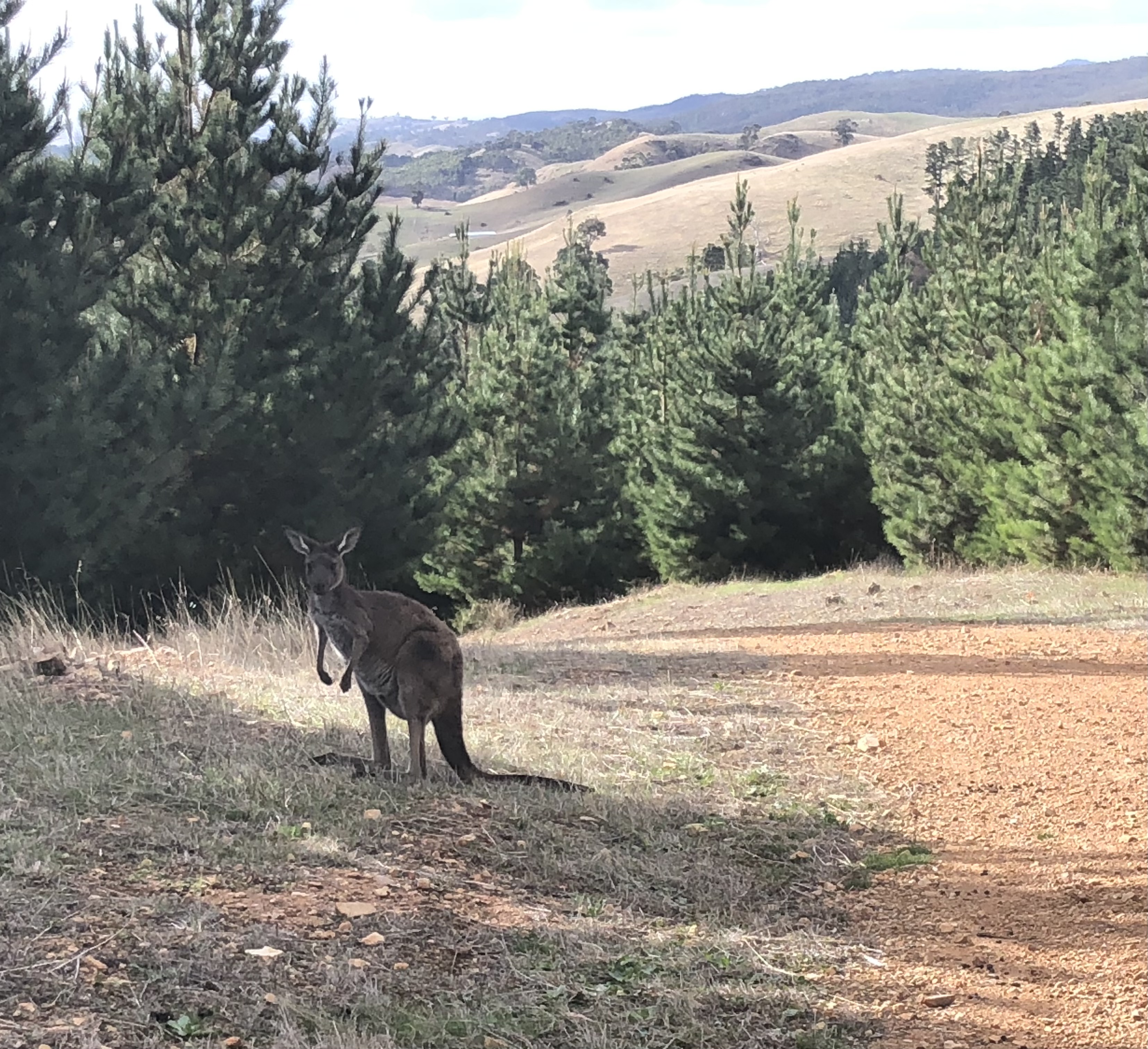
Near the top the pine trees gave way to mallee and grass trees but the shelter was among pines. I was quite cold, even though it had been sunny most of the day, and I was pleased the shelter gave good protection from the wind which suddenly came up. The rain didn’t return until the night but I never warmed up. At dusk masses of kangaroos came to graze on one cleared hillside. 20 kms
May 5 It was cooler but sunny. The forest morphed back into native bush and I entered Warren Conservation Park; the trail went right across the middle of the park, crossing a huge bowl of grass trees, stringybarks and wattle. All I could see was bush. This involved a long downhill to a dry creek and a long climb. Once out of the park I continued to climb a grassy ridge to the top of Tower Hill with masses of kangaroos and great views of forest and farmland. I descended back into Mt Crawford forest and then had a choice of routes; I picked the one that went past a picnic area among the pines so I could have a break. I came to Warren Reservoir, crossed it and immediately had a problem: a large sign across my path said Danger, Tree Felling in progress, No Access. It would be a long way to backtrack so I decided to risk walking through the area as I knew I would hear a lot of noise if they were felling trees and I could quickly turn back. I marched those kms rapidly and saw/heard nothing. This did mean that I reached my planned campsite, Centennial Drive shelter, rather early. That too was lucky as it soon started raining and later rained a lot. The shelter was in a large clearing between the forest and the South Para River (lots of reeds, little water), beneath Mt Crawford. I put up my tent inside the shelter. 19.5 kms
May 6 When I got up I was in a cloud. 
I walked up Mt Crawford knowing I wouldn’t see anything; it was a nice native bush trail. The descent on steps was a nuisance for my knee. Then I had a stretch of steep but short roller coaster hills between paddocks and pines, at the end of which I was once again in the wrong place. I made my own route to the Old Schoolhouse campsite and had a break, having done an extra 4 kms, and I enjoyed a short interlude of sunshine.

I walked up Mt Crawford knowing I wouldn’t see anything; it was a nice native bush trail. The descent on steps was a nuisance for my knee. Then I had a stretch of steep but short roller coaster hills between paddocks and pines, at the end of which I was once again in the wrong place. I made my own route to the Old Schoolhouse campsite and had a break, having done an extra 4 kms, and I enjoyed a short interlude of sunshine.
From here I appeared from my gps to have a choice of routes so I opted to do half on one and half on the other using a linking road. I began back in the pines then had a nice ridge top wooded section on the Wirra Wirra hills. I switched from this half to gravel roads, hilly, beside vines with autumn leaves and sheep paddocks. I am clearly in the Barossa now.

I had lunch sitting on a rock and watched the sky get black while the wind picked up. Soon it was raining but not for long. I walked along fences in a wooded reserve, then more dirt roads and a return to the forest. It seemed a long day, always up and down; I never realised SA is so hilly.
After a final batch of hills, walking between paddocks of cows and pine plantations, I got to Rossiters hut which was small with a great outlook over the forest towards Mt Kaiserstuhl. I read about the resident mice in the log book and chose to camp. 23 kms
May 7 Cold but sunny morning. It was mostly downhill today, first in the grass tree/tea tree/stunted gums Kaiserstuhl Conservation Park and then along fences. Suddenly there are lots of scattered small granite boulders. Coming down I had a fabulous view over the whole Barossa Valley, dotted with the yellow of the vineyards. I stopped for coffee at a stile to enjoy the view. The last part into Tanunda was along flat straight roads and something to be done as fast as possible, proper coffee beckoning. 13 kms
No comments:
Post a Comment