Following my not being able to walk across Spain last year I decided to have a go using an alternative route this year, northbound from Seville to Gijón on the north coast. I could follow the GR 100, Ruta Via de la Plata, based on a Roman road, the whole way. Pilgrims have been using much of this route as a Camino for centuries, which makes for good signage.

15 March I set out from my Seville hotel under a perfect blue sky but cold and walked through the old town to the cathedral then made a lap around it. I found the start of the Via de la Plata and followed signs to the canal off the Guadalquivir River, crossed it into an area called Triana and crossed the wide brown river. I was already out of Seville, without any industry or suburbia. I walked along a path beside the river then through farmland, some horses. It was getting hot. I came into the town of Santiponce, which I found rather confusing: I was expecting to see the ruins of the Roman settlement of Italica with an amphitheatre and houses but instead I found the ruins of a theatre and an uninspiring museum. Eventually I located Italica (covering a large area outside Santiponce) and checked out the remains of houses, mosaic floors, Roman baths and the amphitheatre.
I had to walk along the main road before turning off onto a quiet dirt road for the rest of the day, through farmland, mainly vegetable fields and a few cows. The road crossed many streams with plenty of signs of the recent flooding in the fields and some unavoidable mud. I found it best to follow bike tyre tracks and keep to higher ground to avoid the flooded parts of the route. I saw a few other walkers. I came into Guillena, a town of white houses, and was luckily just in time for the (absolutely packed) bus back to Seville. 24 kms
17 March I got the bus to Guillena and had breakfast at a bar. Rain was coming. The walk out of town was complicated by the flooded Rivera de Huelva river that I couldn't ford and I had to go along a busy road then through an industrial estate. I reached a patchily flooded stony path undulating beside olive trees. As I climbed in the Sierra Norte de Sevilla natural park I came to dehesa, very green grazing land with white flowering rock roses, cycads and cork oak trees. It looked lovely, but just then the real rain started and the flooding on the path was worse. The rain became heavy and I was getting soaked, I often had to cross streams in ankle deep fast flowing muddy water. I joined a dirt road and saw three walkers ahead, while the flooding beside the road got more dramatic and water was gushing from every possible outlet. The rain eased a bit as I walked on a dirt road parallel with the main road and chatted with a Swiss guy, and I hoped the rain would stay light until I reached the town but it got bad again.
In Castilblanco de los Arroyos, where I realised I was cold, I searched for an open bar, passing plenty that were closed, and finally found one. Torrential shower while I drank two coffees. Then by some miracle I located the bus for Seville. 19 kms
18 March No rain. I got the bus back to Castilblanco and set off along the sealed road. It was undulating and not busy, pastures with cork oak trees to both sides. After ten kilometres I noticed a wide dirt trail beside the roadside and it was nicer walking there although I got wet feet crossing streams. I met a Japanese walker and he said the second part of the walk through the natural park couldn't be done because it wasn't possible to cross the river; I hoped he was wrong but when we arrived at the junction a park worker confirmed that the track wasn't passable and walkers had been turning back. So I continued along the road looking longingly at the dehesa, the road was almost deserted and at least I could see lightly treed hills all around. Finally I descended into Almaden de la Plata, a mainly white village in a valley. The church tower had two stork nests. 29 kms

19 March Much nicer. After a false start when I realised I'd left my hiking poles in my hotel room, I set out into the dehesa on a dirt track. Passed wild pigs and sheep and cows. The track undulated alongside rushing streams (which are probably usually dry) with distant hills. I saw some other walkers then we were held up by a large flock of goats being herded into a pasture. I walked a while with the Swiss guy. The track forded several streams and climbed to an area with horses grazing then descended on a single track into another valley of dense oaks. After a gradual climb I could see the castle of El Real de la Jara on a hill above the town of white houses. I had a coffee with the Japanese guy and a sandwich of goats cheese. I checked out the 14th century castle remains on the windy hill, walls arranged in a trapezium and five watchtowers. My hotel was on an industrial estate on the edge of town. 17 kms

20 March Rained loudly in the night. I walked out of the town on a dirt track and soon had to cross the river marking my leaving Andalusia and entering Extremadura, the water was knee deep and discoloured so hard to see what was causeway and what was mud. Nearby was another fortress ruin. Then an undulating track through the dehesa, a few farmhouses. Rained lightly for a while. A cow had escaped and was on the track, rather unsure where to go but eventually settled for grazing outside a paddock full of sheep. The dehesa thinned out to bare pasture and I reached the main road. I stopped at a bar/jamon shop for coffee.
Second half was along a green corridor between the motorway and the N 630, then I stayed alongside the deserted N 630 as it climbed very gradually to Monesterio away from the motorway. Monesterio was on a long hill; everything in the town seemed to be about jamon so I went into a bar for a bocadillo de jamon. I checked out the two churches, one 16th century brick with storks nests and the other whitewashed but it was too cold walking around the town. 22 kms
21 March I left Monesterio after a tostada de jamon and went straight into the dehesa on an undulating dirt road, lots of stone walls and misty views. Crossed a few streams. Rained lightly. Emerged at a high point where I could already see Fuente de Cantos, hours away. A man with an umbrella stopped me and said that I should turn left to avoid muchas aguas but I didn't know where and I didn't see a choice of path either. I left the dehesa for more open fields, nice hilltop walking, and then descended to be surprised by a fast flowing Arroyo del Bodion; so this was what the man meant. I turned left and followed the edge of a field but saw no other way of crossing the river so I went back (with another walker) and waded across, just over knee deep. I climbed above it and had a strong tailwind the rest of the way, passing a massive installation of solar panels (where was the sun?) and a pig farm and several more stream crossings. I walked through Fuente de Cantos until I found a bar and it poured as I sat inside. Later I toured the town, more stork nests on the church tower. 22 kms

22 March I had breakfast in the square then headed along a dirt road to Calzadilla de los Barros; it was very cold, the highlight a huge statue of a cow next to the road that I could see all the way, and I was looking forward to a coffee but nothing was open. After that it wasn't so cold but the rain started and the dirt track became increasingly waterlogged as it crossed agricultural land with flooded fields. My first river crossing was on a makeshift plank of wood and flattened reeds, still ankle deep water, and the second one I had to wade knee deep. The rain got heavier even while the sun was trying to come out. I came to Pueblo de Sancho Perez and walked through the town not expecting much, so I was happy to find a cafe open on the square.
I left the cafe in sunshine but soon it was raining as I walked through the outskirts of Zafra. It was a damp slog to my hotel on the Plaza Grande; very cute to have adjoining squares Plaza Grande and Plaza Chica, colonnades and restaurants. I had tapas and a coffee for lunch on the Plaza Grande as it poured again. In the evening I went to have a look at the castle walls, the fortress like church and the old town before having to go inside again to be warm. In the night I was suddenly very unwell and vomited six times. 26 kms

23 March I left Zafra as soon as I felt strong enough to, had a peek inside the main church with huge gold altarpiece, and climbed into the countryside. Rained all day sometimes stopping so briefly that I didn't realise it had stopped until it started again. Descended to Los Santos de Maimona where the bells of another fortress like church were ringing and people were hurrying there with their umbrellas.

Then out into a landscape of olive trees stretching in every direction. The dirt roads were well drained and the flooding was avoidable. I had to cross the railway line and autovia and walked along the N 630 for a bit then took back roads into Villafranco de los Barros with the sun appearing. Unfortunately there was a flooded bridge with ankle deep water so I got my feet soaked in the end, and it poured before I reached the hotel. I went in my room and cranked up the heating. 21 kms
24 March I still wasn't feeling good but seeing a first sunny day I wanted to get out there. I headed out of the town to start a day's walk that was billed as boring. I walked a series of dirt roads passing olive trees and leafless vines, some farmhouses, a few people out pruning olive trees and stringing up vines, a few puddles but no flooded causeways. It was very open country with one straight stretch of ten kilometres. Sunny but cold. I barely stopped. As I approached Torremejia there were some rock capped mountains on the horizon. It was a small scruffy town on the main road to Merida, and I had a long wait for the bus to Merida. 27 kms
25 March Merida was in fog when I went to the bus station, the Roman bridge reflected in the river. I returned to Torremejia and set out along the N 630 roadside in the fog. There was sometimes a path beside the road but it was often flooded. At half way to Merida I went onto a good dirt road well away from the main roads and had a nice walk through farmland in the sunshine. I ended up at the Guadiana River and crossed on the Roman bridge (longest in the world). On the way to my hotel I stopped to look around the Alcazaba, then the Temple of Diana and the large Roman theatre with its high columns and adjacent amphitheatre. Later I visited the Roman crypt under the basilica and had a drink with a couple of guys. 17 kms

26 March I walked out of Merida in sunshine going through a park with the impressive remains of a Roman aqueduct, huge and looked very out of place. 
Then a boring walk on a bike path until I reached the Proserpina Reservoir and Roman dam. The water was completely calm. The path continued through a park alongside a stream and then a sandy track undulating through dehesa. It was very pretty and almost dry. I came into a tiny village with sheep grazing by the houses and a nice stone church, then hillsides with vines and I reached Aljucen, a larger village. I found a cafe opposite another cute church.

Then a boring walk on a bike path until I reached the Proserpina Reservoir and Roman dam. The water was completely calm. The path continued through a park alongside a stream and then a sandy track undulating through dehesa. It was very pretty and almost dry. I came into a tiny village with sheep grazing by the houses and a nice stone church, then hillsides with vines and I reached Aljucen, a larger village. I found a cafe opposite another cute church.
After my toast and coffee I went on to cross the river on a more than ample bridge and entered the Cornalvo natural park. First I was still in the river valley then the trail climbed gradually to wonderful dehesa with cork oaks and holm oaks and flowering broom. There were cows grazing unfenced and horses and it was hot and peaceful. Still some flooding and mud to negotiate. A long stretch of rock rose bushes and a lot of wild lavender. When I saw a stone cross I stopped for a break; an old woman was sitting there and she yelled a lot of conversation to me. Then I descended towards Alcuescar past farmhouses and I could see a vast valley ahead. In the new town I went to the supermarket to buy my dinner. The much more appealing old part of town on a hillside was a maze of narrow winding streets with fast cars. Another fortress church and some interesting doorway carvings on houses. I stayed at the albergue with a great view over a little bullring, the town and a mountain range beyond. 37 kms
27 March Cold but sunny. I found an open cafe in the new part of town then headed across the valley, passing olive groves and crop fields. Small lake. Chirpy little birds. Outside a small village I watched a long line of procession moth caterpillars moving along. I embarked on a path between dehesa and a road on very boggy ground. This was the original route of the Roman Via de la Plata, and had a Roman milepost still in place. Also a medieval bridge. I detoured into Aldanueva del Cano where the market was packing up outside the church, and a local kindly walked me to an open cafe.
Then a long stretch of dehesa with big oaks followed by broom. Many stream crossings on stepping stones. Tiny blue orchids on the path. I rested in the shade of a shed at an airfield (lots of hangars, no sign of planes and no restriction on crossing the dirt runway). Had to stop again to let a flock of sheep use the path. I descended across a wide open plain to a multi-arch Roman bridge and into Valdesalor. Good cheese bocadillo. 27 kms
28 March My intention was to walk to Caceres and continue straight to Casar de Caceres, then return to Caceres by bus to see the city. I walked beside the N 630 on a muddy track and on the road shoulder out of Valdesalor climbing gradually to a low pass, then descended towards Caceres through grassy pasture land with a view of the city all the way. Entering the city was a drag at first: car workshops, appartments, a dirty canal. Then I climbed steeply to the historic centre and everything changed, with 15/16th century huge stone buildings on all sides, many lovely stone carvings, tiny curved balconies and narrow cobbled streets. My hotel was in an old building off the Plaza Mayor, a substantial square with stone towers and white colonnaded buildings.
I dumped my stuff and went on, passing the bullring. I climbed a hillside of olive trees to get well away from the road, then descended to the grassy plain and walked along a winding cañada real droving track. It seemed a long way to Casar de Caceres perhaps because the town was hidden from view until I reached it, and I was hot. I just made the bus. 24 kms
When I got back I had a good look around the old town, there were so many beautiful buildings in a small area: I went in the cathedral/church with its ungilded altarpiece and went up the tower, I walked around the Plaza San Mateo, San Pablo monastery, Santiago church, climbed to San Jorge church, several towers, several arches, lots of narrow streets, all the houses with decorative stonework. I ate dinner outside another church. There were masses of people about.


29 March I got a taxi back to Casar de Caceres and walked the length of the town, with a stone chapel at the end. Then I was on a wide cañada real passing almost treeless pasture with scattered boulders. I could see a couple of tiers of mountains on the horizon and some appeared to be snow capped. Later the grassy pasture was unfenced, with sheep grazing. After a couple of farmhouses I walked a while along a walled path, then more and bigger boulders. I had a break at a seemingly abandoned farm building where I had my first view of the Alcantara reservoir. Then some nice single track on the hillside as I descended to the huge reservoir (second largest in Europe), bright blue with a few islands. I had to walk along the road but it was close to the water. After crossing two big rivers regulated by the Alcantara dam (Almonte and Tagus) I climbed back into the hills and had a break at a picnic shelter overlooking the water.
The rest of the day was up on a plateau of dehesa with oaks or broom and grassy moorland. A few sheep. A few farm buildings. I was approaching Cañaveral in a big arc because of the railway line in the way and it took ages to get near there and descend. It was hot out there and nice when a breeze came up. The town was completely dead (Saturday 5pm) and I had to walk the whole length to reach my hotel, without seeing anything open. I checked in to my €20 room then went to explore. I found a bar that was half heartedly open. All the action was further down the road at a bar on the square by the church. I hadn't seen any pilgrims all day then the restaurant I picked was full of them. 34 kms
30 March The churreria next door to the hotel was open so I had churros for breakfast and took some for the walk. After a climb out of town to a hilltop with pine trees I was mostly in lovely dehesa of cork oaks and rock roses. 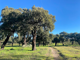
I could see more snow capped mountains ahead, Sierra de Gredos, part of Spain's central range, and I was surrounded by green hills.
A highlight was a stretch of dehesa sloping down to the plain with a carpet of daisies and dandelions.
Three funny things happened: 1. A pilgrim wanted to give me a wooden clam shell to hang on my pack 2. I had to climb a gate that I couldn't open 3. I came to a shallow river crossing, clear water, pebble bottom, and a German pilgrim was blocking the path saying this I will not pass. After crossing this branch of the Jerte River I walked through farmland to Galisteo. I had an early sighting then the town disappeared until I was right there; I rounded a bend and suddenly saw the high encircling turreted wall, a tower peeping over the top and houses outside the wall. It was very hot by then. I dropped off my pack and found a bar on the square inside the wall.
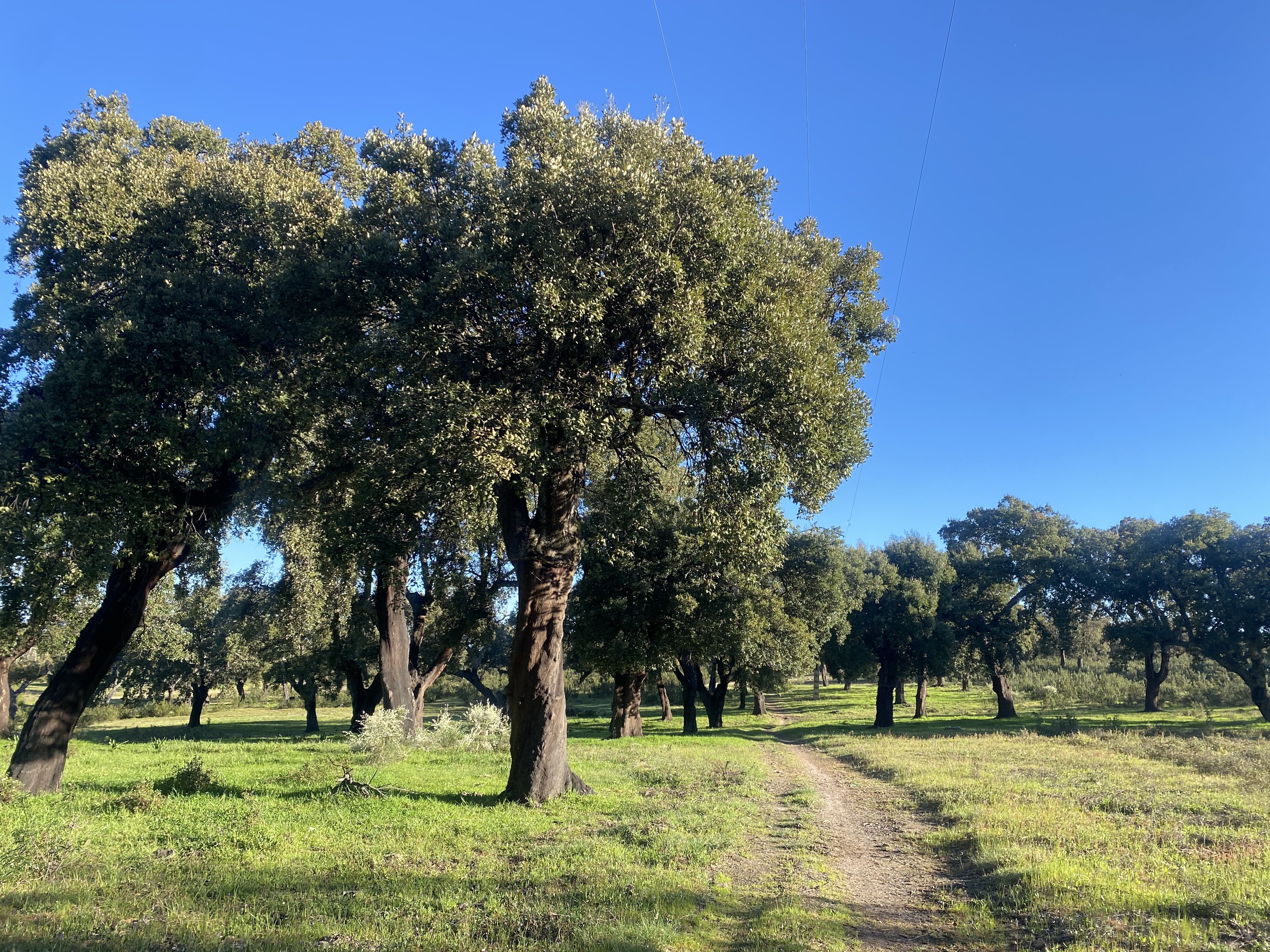
I could see more snow capped mountains ahead, Sierra de Gredos, part of Spain's central range, and I was surrounded by green hills.

A highlight was a stretch of dehesa sloping down to the plain with a carpet of daisies and dandelions.

Three funny things happened: 1. A pilgrim wanted to give me a wooden clam shell to hang on my pack 2. I had to climb a gate that I couldn't open 3. I came to a shallow river crossing, clear water, pebble bottom, and a German pilgrim was blocking the path saying this I will not pass. After crossing this branch of the Jerte River I walked through farmland to Galisteo. I had an early sighting then the town disappeared until I was right there; I rounded a bend and suddenly saw the high encircling turreted wall, a tower peeping over the top and houses outside the wall. It was very hot by then. I dropped off my pack and found a bar on the square inside the wall.
I inspected the 12th century brick church (closed), saw storks circling nests on a tower above the wall, saw the pointy-topped homage tower and had a little walk on the wall. 28 kms

31 March I left at first light and crossed the multi arch medieval bridge then walked along a quiet road to Aldanueva del Jerte where the bar was just opening. I was very cold and the owner turned on the heating, and gave me a baby churro with my coffee. I stayed on the road to the edge of Carcaboso and turned for Plasencia (temporarily off the Camino, and I could continue on a bike path tomorrow). I found myself on a very busy road, and for the next ten kilometres lots of trucks and cars. I didn't stop until I was inside Plasencia's wall and at a cafe off a lovely square.
Just before I stopped I went inside San Nicolas church (have to go inside a church if the door is open) and a man sitting there gave me a guided tour.

Just before I stopped I went inside San Nicolas church (have to go inside a church if the door is open) and a man sitting there gave me a guided tour.
I went to look at the old and new cathedrals but they were closed,

so I walked around the old town seeing decorated buildings and had lunch on the Plaza Mayor, medium sized. Later I went, via the fortress, to check out the aqueduct, only one arch high and well integrated into the area.
More Romanesque churches. Octopus for dinner. I liked Plasencia a lot. 24 kms


so I walked around the old town seeing decorated buildings and had lunch on the Plaza Mayor, medium sized. Later I went, via the fortress, to check out the aqueduct, only one arch high and well integrated into the area.

More Romanesque churches. Octopus for dinner. I liked Plasencia a lot. 24 kms
1 April The market was in full swing on the Plaza Mayor. I waited for the cathedrals to open: old cathedral was small and really cool and connected via a cloister to the new one, gilding redone recently.
Started walk out of Plasencia, stopping for fresh madeleines and bananas and coffee, and joined the Camino Natural de la Via de la Plata. There was a good view of the cathedral complex and fortress dominating the city. The trail, a former railway line, was alongside the Jerte River and then crossed high above it as it went into a narrow granite sided gorge. The trail was wide and smooth, mainly on an embankment through dehesa of cork oaks, lots of stone walls, a few cows. A lot of the time I wasn't far from the autovia but the trail was peaceful after yesterday's experience. I stopped at a couple of former stations and got a coffee at an autovia service station. A lot of the power pylons had stork nests and storks were in the dehesa.
The last part was alongside the Traslasierra mountains with a few high up villages and there were a lot of mountains ahead on the horizon. My hotel was an isolated building at the roadside, good view of the autovia and N 630 and parked trucks. I had a good time comparing walk experiences with an English couple. White asparagus and grilled chicken for dinner. 23 kms

2 April I went back onto the rail trail which went well away from the roads into dehesa. There was mist hanging below the mountains. Some streams rushing down from the mountains. Some high villages. I detoured to Aldanueva del Camino and found a busy churreria. Then a country lane passing olive trees back to the trail, now a sunken path lined by bigger trees.
Coming into Hervas it was trying to rain. Several small squares. I walked around the old Jewish quarter with half timbered houses and tiny lanes, outside of Santa Maria church at the highest point of the town by castle walls with views towards the mountains (with fresh snow), San Juan Bautista church (went inside later on, three soaring gold altarpieces) and convent, medieval bridge over the gushing river. Then rain. 18 kms

3 April Rain was just clearing as I left Hervas, crossing the river and climbing above the town on a lane and then a narrow cobbled walled path passing olive trees to rejoin the rail trail. I had nice views of the town with the mountains behind. The trail followed a ridge with views of a reservoir until I descended to Baños de Montmayor, colourful houses on steep streets, and coffee. I left on (possibly) the original Roman road, stone slabs.
I had finished Extremadura and entered Castilla Y Leon. There was a gas station on the road at a pass (900 m) so I stopped for a break and several pilgrims came in; I was able to practise my German and Italian. The scenery had completely changed: wintery woodland, green paddocks with cows, steep hills. I descended to cross a fast flowing river then climbed alongside, passing boulder covered hills with some original Via de la Plata mileposts. I had more views of the Sierra de Gredos with a lot of snow. I reached La Calzada de Bejar, a small village with mostly dilapidated houses. I went for a walk up a tiny path to a purported Roman fort (four walls in a field of dense weeds) above the village. The German who didn't want to cross the river near Galisteo was the only other guest at my casa rural. 22 kms
4 April (Day 20) I walked along a dirt road passing walled paddocks and leafless trees then into more of the cork oak dehesa. Several Roman mileposts. 
When I reached the first village I couldn't find the bar but I saw some signs and discovered a woman offering coffee and pastry; when I went inside my Italian and German friends were already there.

When I reached the first village I couldn't find the bar but I saw some signs and discovered a woman offering coffee and pastry; when I went inside my Italian and German friends were already there.
It had started raining. I went along the road past the next village. At a junction I turned onto a cañada real but it soon meant wading through shin deep water with no end in sight so I returned to the empty road. I climbed to over 1000 metres (I am on the Meseta Central now) then descended on a claggy dirt road to Fuenterroble de Salvaterra. The bar was nice and warm and so was my casa rural. All I could buy for dinner was bread, a tomato and a box of processed cheese triangles. 21 kms
5 April The only place I could think of to get breakfast was the albergue, unattended when I arrived so I helped myself to coffee from a pot on the table; the owner came in and gave me a box of processed cheese triangles to go with the biscuits that were on the table. I left the village in very light rain and followed the alignment of the Roman road with many mileposts in situ, passing grazing cows and pigs. Then I started to climb on an increasingly rough path to the Pic del Dueña (1147 m). There were wind turbines along the ridge and from the top I had a seemingly endless view to the horizon over farmland.
I descended in a forest of leafless trees with mossy bark. When I reached the road I had an unexciting walk to San Pedro de Rozados with long hills. I walked mostly on the very quiet road because the track alongside was seriously flooded; I had a tailwind and it was sunny. For the final half hour I crossed fields. The village appeared quite suddenly, mainly single storey terraced houses. One open bar, in which the locals were playing dominoes and cards very noisily, and a simple church. For a second Saturday I walked a big distance and could only find a bag of chips to eat at the end. 29 kms
6 April I walked to the next village, Morille, where I had my first encounter with unfriendly dogs and continued. After a stretch of open farmland I went into some lovely cork oak dehesa in sunshine. 

Free roaming cows. I could already see Salamanca in the distance, the cathedral prominent. Then passing cereal fields as I descended to a village and found a restaurant for coffee with nice Spanish music.


Free roaming cows. I could already see Salamanca in the distance, the cathedral prominent. Then passing cereal fields as I descended to a village and found a restaurant for coffee with nice Spanish music.
I had a slight climb to a hilltop with a view of Salamanca then descended to the city through an open area that wasn't quite wasteland, and suburbs until I reached the Roman bridge across the Tormes River. 
What a dramatic way to enter the old city, with the old buildings all lined up below the cathedral. I went immediately to the Plaza Mayor which I found striking for its uniformity and exact square shape and pinkish stone. I had not yet had a proper ice cream in Spain so my first priority was to remedy that.
I went up the Torres de Clerecia for views of the city and strolled around, everywhere very busy. Had coffee outside St Martin of Tours church. Tapas. 24 kms

What a dramatic way to enter the old city, with the old buildings all lined up below the cathedral. I went immediately to the Plaza Mayor which I found striking for its uniformity and exact square shape and pinkish stone. I had not yet had a proper ice cream in Spain so my first priority was to remedy that.

I went up the Torres de Clerecia for views of the city and strolled around, everywhere very busy. Had coffee outside St Martin of Tours church. Tapas. 24 kms
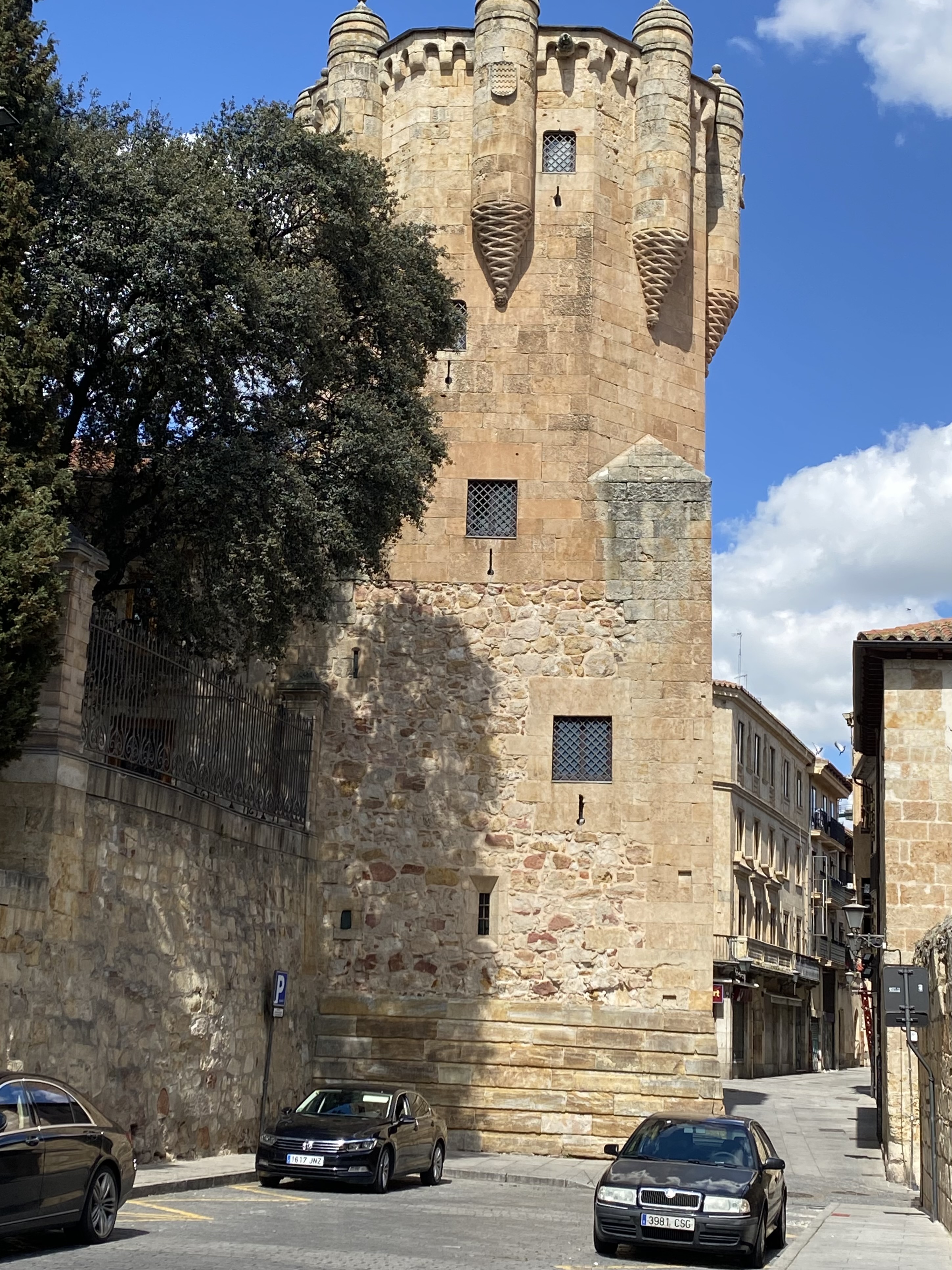
7 April Rest day in Salamanca. Early walk through city, cold, amazing collection of extravagant buildings. Went inside cathedrals new (16th c with unusual walled worship part in the centre) then old (12th c, thick columns, slit windows, frescoes, cloister). Pleased to see storks attending to their nests on many bell gables. Round San Marcos church, 11th c, simple inside; Moorish Torre de Clavero; Palacio Monterrey with an unusual cutout stone frieze along the roofline. Sat in the sun on Plaza Mayor.




8 April I walked out of Salamanca passing appartments and along the N 630. Then farm roads between fields. I went through a village and on to the next, Castellones de Villiquera. I asked three people where the bar was but couldn't find it so I got a coffee at the shop and sat in the shade by the church. I could still see the Sierra de Gredos behind me, covered with snow. I went across more fields to Calzada de Valdunciel. My room was above a restaurant (one of three roadside restaurants, all closed in the evening). 17 kms
9 April I set out early and saw the sunrise over the fields. For the first hour I walked along the N 630 (empty) then moved onto a dirt road parallel with the autovia in an open farming landscape. I saw several pilgrims. I didn't hang around and after 20 kilometres I had a slice of tortilla and coffee at a bar in the first village, El Cubo de Vino. After the village I was well away from the roads, crossing agricultural land, a few vineyards. It was hot. I came to the edge of a mini plateau and had good views over extensive farmland dotted with villages, even distant Zamora in a heat haze, and patches of trees. I descended to Villanueva de Campean; none of these villages seem pretty but there was an impressive stork nest (with stork in attendance) on the church bell gable.
I had a beautiful room at the posada in the centre of the village. 33kms

I had a beautiful room at the posada in the centre of the village. 33kms
10 April An easy walk to Zamora on dirt farm roads passing crop fields with the city in sight after half way. Came into the city, passing my first Romanesque church, along the Duero River with views of the Romanesque cathedral and other Romanesque church towers and crossed on the medieval bridge. 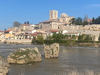
I hadn't had a proper breakfast and was keen to find a bar but I was well up the hill in the old town before I found a bar; by then I had already seen a few churches. I sat on the Plaza Mayor, dominated by San Juan Bautista church and old and new town halls facing each other. 19 kms

I hadn't had a proper breakfast and was keen to find a bar but I was well up the hill in the old town before I found a bar; by then I had already seen a few churches. I sat on the Plaza Mayor, dominated by San Juan Bautista church and old and new town halls facing each other. 19 kms
I strolled around the streets looking at the outside of many churches (all in the same blocky pale stone), viewpoints over the river, the castle ruins, gateway in the wall, outside of cathedral with tower and curious scalloped dome and great carved southern doorway, and many little squares. They've done a funny thing of growing tree branches into each other to form leaf canopy (in summer) in the squares. Pinchos and montados for dinner.
11 April Rest day. I went on a tour of the Romanesque churches. 1. Santiago del Burgo: skinny, gold altarpiece, seemed original, tower with tall cypress next to it 2. San Andreas: two uncleaned altarpieces and altarpiece on pillar, filled with floats 3. San Vicente: high tower with spire, people praying, painted 4. San Juan Bautista: lengthways arches seemed odd, mishmash inside, tower 5. Santa Maria Nueva: 12th c frescoes, decorated chevet, simple doorway 6. San Cipriano: low tower with spire, old window decorations on outside, overlooking river, small passage outside, square with two central pointed arches, two niches beside altar, unpainted 7. La Magdalena: skinny, two side niches, high round windows, unpainted 8. San Pedro Y Idelfonse: big square entrance facade, gothic inside, altarpiece with two separate gilded tombs 9. San Isidoro (closed): by gate in wall, stork 10. San Claudio des Olivares (closed): the oldest, very simple, carved doorway, brick bell gable with attentive stork. 11. Cathedral: square, huge walled choir so public area felt cramped, dome with windows, Hannibal tapestries.


12 April Breakfast at extremely popular churreria (has been voted in the top ten in Spain). A dull walk out of Zamora to Robles de Pan where the first thing I saw was a bread delivery van, and the woman getting the bread directed me to the cafe, which was packed. I chatted with an English couple I last saw in Zafra. The walking was just between fields, highlight was seeing two high speed trains. Montamarta was a long farming village with three stork nests on the church bell gable. 
My Swiss friend I last saw in Merida showed up at my casa rural. There were at least a dozen pilgrims at the restaurant. 20 kms

My Swiss friend I last saw in Merida showed up at my casa rural. There were at least a dozen pilgrims at the restaurant. 20 kms
13 April A rather dull day walking beside fields usually not too far from the roads. The best bits were the hermitage of Santa Maria del Castillo perched on a hill above the Ricobayo reservoir,
and the 15th c ruins on a small hill of the village of Castrotorafe; I was walking alongside the main road when the route suddenly detoured away from it and to my surprise there were the remains of the encircling walls and in one corner ruins of the church.

and the 15th c ruins on a small hill of the village of Castrotorafe; I was walking alongside the main road when the route suddenly detoured away from it and to my surprise there were the remains of the encircling walls and in one corner ruins of the church.

In the village of Riego del Camino - I saw a snake on the way - I found a bar and soon the whole village arrived from Palm Sunday mass, carrying branches of leaves. I finished in Granja de Moreruela. Dinner with pilgrims. 24 kms
14 April Back into the fields and passing animal feed processing works. I decided to stop in every village for coffee if somewhere was open. First the bar in Santovenia del Esla. Then a very straight track. 
I saw storks in a field following a tractor and one solitary stork had managed to make a nest on a pylon. Right at the exit of Villaveza del Agua I found my coffee. I could already see the next village, Barcial del Barco, and it had a church with a tower that even had windows but the bar was closed. After that the walking improved considerably as I went along the wide Esla River and onto a rail trail which crossed the river on a very long iron bridge. There were poplar plantations among the fields. I came into Villanueva del Azoague and had a bocadillo. From there it was built up into the town of Benavente, which was on a hilltop. 28 kms

I saw storks in a field following a tractor and one solitary stork had managed to make a nest on a pylon. Right at the exit of Villaveza del Agua I found my coffee. I could already see the next village, Barcial del Barco, and it had a church with a tower that even had windows but the bar was closed. After that the walking improved considerably as I went along the wide Esla River and onto a rail trail which crossed the river on a very long iron bridge. There were poplar plantations among the fields. I came into Villanueva del Azoague and had a bocadillo. From there it was built up into the town of Benavente, which was on a hilltop. 28 kms
I didn't know what to expect there and I was pleasantly surprised. There were two lovely partly Romanesque churches: San Juan del Mercado which had lost its original top half at some point and had huge thick pillars in the nave and frescoes behind the altar, and Santa Maria del Azogue whose outside was a complete mixture of different types of stone and brick with high gothic arches inside and a gold altarpiece. 
The Plaza Mayor was just a car park. There was a terrace overlooking a huge expanse of forest with sections of different trees and in a corner a view of the rounded 15th c Torre del Caracol.

The Plaza Mayor was just a car park. There was a terrace overlooking a huge expanse of forest with sections of different trees and in a corner a view of the rounded 15th c Torre del Caracol.
15 April Five degrees when I left and cold all day. Roadside walk out of Benavente until I turned onto yesterday's rail trail which was nice for being a bit elevated, passing fields and former stations. On the edge of a village I saw a hillside full of constructed caves and little towers that used to be for making and storing wine (bodegas). 
I stayed on the rail trail until I had to leave it to rejoin the proper route and passed more bodegas coming into Maire de Castroponce with fruitless orange trees down the middle of the street. As I was leaving it started raining and then a few minutes of hail. As I walked on it cleared up then hailed again twice. I crossed the Orbigo River on a very solid 16th c bridge and continued on a muddy dirt track to Alija del Infantado. Passing a farm two unchained barking dogs alarmed me and I dodged into a field of cut maize, surprising some storks. There was a castle at the entrance to the village
and two churches with interesting curved covers on their towers. In the upper village I saw lots more bodegas - when you peer through the entrance all you see is a tunnel. 23 kms

I stayed on the rail trail until I had to leave it to rejoin the proper route and passed more bodegas coming into Maire de Castroponce with fruitless orange trees down the middle of the street. As I was leaving it started raining and then a few minutes of hail. As I walked on it cleared up then hailed again twice. I crossed the Orbigo River on a very solid 16th c bridge and continued on a muddy dirt track to Alija del Infantado. Passing a farm two unchained barking dogs alarmed me and I dodged into a field of cut maize, surprising some storks. There was a castle at the entrance to the village

and two churches with interesting curved covers on their towers. In the upper village I saw lots more bodegas - when you peer through the entrance all you see is a tunnel. 23 kms
16 April Very cold, frost by the roadside. I walked on a track by a little river passing poplar trees keen to reach the next village Quintana del Marco for coffee. I saw a young deer. Eventually I saw a round tower (remains of a fortress) and red brick houses; I walked a kilometre through the village seeing nobody until a man at the bus stop directed me to a large bar at - to me - the wrong end of the place. When I left it was raining. I walked on grassy tracks to Villanueva de Jamuz, where there was a complete fortress at the start of the village, 
and continued on the road to Santa Elena de Jamuz which was a colourful village but nothing to stop for.

and continued on the road to Santa Elena de Jamuz which was a colourful village but nothing to stop for.
The last hour to La Bañeza I stayed on or beside the road which climbed a bit so I had some views and I could see the Teleno mountains (2000 m +) on the western horizon. The rain had cleared but it was only seven degrees. Coming into the town was uninspiring until I got to the centre with pretty buildings and church with high tower around a nice Plaza Mayor. 
Also a church on a hill with a low tower. Both had services going when I went inside. More rain. In the evening I watched a Semana Santa procession with people in gowns and faces covered (penitents), a brass band and a float of Virgin Mary being carried by about 60 people. 21 kms


Also a church on a hill with a low tower. Both had services going when I went inside. More rain. In the evening I watched a Semana Santa procession with people in gowns and faces covered (penitents), a brass band and a float of Virgin Mary being carried by about 60 people. 21 kms


17 April I had a pleasant walk on little roads going in and out of quiet villages with almost nobody around, sometimes the tiny Vega river running through the village, and the sun came out. 
There was snow on the mountains I saw yesterday. In Villoria de Orbigo I asked for directions to an open bar and had a break then looked at the village's big solid 14th c monastery. I stopped again just up the way in Veguellina de Orbigo where everyone was out on a public holiday. Then on to Hospital de Orbigo; my surprisingly nice hotel was at a petrol station on the main road. I walked over to look at the Roman/medieval bridge El Paso Honroso over the Orbigo River - strange because most of it is over land. 23 kms

There was snow on the mountains I saw yesterday. In Villoria de Orbigo I asked for directions to an open bar and had a break then looked at the village's big solid 14th c monastery. I stopped again just up the way in Veguellina de Orbigo where everyone was out on a public holiday. Then on to Hospital de Orbigo; my surprisingly nice hotel was at a petrol station on the main road. I walked over to look at the Roman/medieval bridge El Paso Honroso over the Orbigo River - strange because most of it is over land. 23 kms
Good Friday I went over the old bridge and headed out for a day of walking beside the main road the wrong way on the Camino Frances. There was a steady stream of pilgrims and I counted 80 in 40 minutes. Then I stopped for coffee in the village they had recently left. The next village was long and industrial, then undulating farmland and the pilgrims came in waves. I went into San Miguel de Camino and had coffee and that was my last decent chance to stop. Soon it started raining and rained steadily until I was in Leon, and it got colder; I was lucky the wind was behind me. I saw a set of three storks guarding their nests on a church. 
Coming into Leon was the worst entry yet to a city: miles of industrial estate, wasteland, old appartments, flooded pavements. It seemed to take forever to reach my hotel and a hot shower but I made it. 33 kms

Coming into Leon was the worst entry yet to a city: miles of industrial estate, wasteland, old appartments, flooded pavements. It seemed to take forever to reach my hotel and a hot shower but I made it. 33 kms

I went to watch a couple of processions. Huge crowds. The first one had floats carried by penitents, bands and an extra feature of women with black headdresses; the second had 13 floats and bigger bands. I was tired and hungry and I got into the bar I had been standing outside just in time and had Holy Week lemonade (wine with fruit and spices) and tuna with peppers and lettuce hearts. When I left the processions were on their return route.


19 April Rest day in Leon. Very cold. I went in the cathedral, amazing windows and loved the simplicity. In the afternoon I was pleased with myself to find a convenient cafe to sit at close to the next procession but the rain came and finally the procession was cancelled. When I left the cafe I found the band was doing a performance in the church where the procession would have started. In the evening I saw a performance in another church and had limonada and pizza on the Plaza Major with Swiss guy.
Easter Sunday In the morning I went to a crossroads where two Resurrection processions started out in opposite directions, to meet in front of the cathedral later, and I watched them set off then walked to the cathedral. 


There were already people everywhere and I climbed on a stack of crowd control barriers to get a decent view. The floats arrived at the cathedral door for the encounter between the float of Mary and the float of Jesus.

The sun came out! Spent rest of the day chilling in various pretty plazas.


There were already people everywhere and I climbed on a stack of crowd control barriers to get a decent view. The floats arrived at the cathedral door for the encounter between the float of Mary and the float of Jesus.


The sun came out! Spent rest of the day chilling in various pretty plazas.
21 April I left Leon walking through parkland by the Bernesga River and along the road to the first village Carbahal de la Legua where I had coffee and a pintxo of tortilla. It was raining when I left. (This is also a camino route.) Then there was the best walking for a long time: I climbed on a rough track for a view of a big valley dotted with villages, a bit misty, and continued in an avenue of holm oaks. I got up to 1000 metres. The trail went on through the holm oaks, some grazing cows, and the same river far below. Quite muddy. The rain came and went. I descended to the river, rushing like a mountain stream, and followed it for a while until a big long village with no bar. After the village I mostly walked on the road to La Robla, a small town with main feature a thermal power plant. 28 kms
22 April Nice to start out in sunshine for a change and I was surprised to see I was so close to the mountains. The GR 100 left the camino and I climbed past a huge quarry into an area of holm oaks with views north towards mountains then descended through a leafless forest with bushes of flowering heather. I followed the railway line to the chapel of Buen Suceso and walked by the Bernesga River again, even faster flowing. I came into La Pola de Gordon and stopped at a busy cafe; a lottery ticket seller was very attentive to customers. The towns are getting prettier again.
I walked uphill on a quiet road in a gorge beneath high granite bluffs to the village of Buiza where the GR 100 left the camino to go into the mountains, the Cordillera Cantabrica. I continued climbing on a dirt track (several barking dogs) to a pass at 1320 metres and there I had a wonderful view of a prominent granite peak standing out among a line of mountains, more mountains in the distance. 
There was a farmhouse far below and I descended to it and down to Villasimpliz hamlet
and then had a road walk to Villamanin de la Tercia. The town of white buildings was surrounded by mountains.
I asked for directions to a bar and was sent to a huge busy restaurant. I ordered a bocadillo and was given a plate of chorizo and dried meat to go with my coke; the sandwich was so big nobody could possibly have eaten it. 27 kms

There was a farmhouse far below and I descended to it and down to Villasimpliz hamlet

and then had a road walk to Villamanin de la Tercia. The town of white buildings was surrounded by mountains.

I asked for directions to a bar and was sent to a huge busy restaurant. I ordered a bocadillo and was given a plate of chorizo and dried meat to go with my coke; the sandwich was so big nobody could possibly have eaten it. 27 kms
23 April (Day 40) I had high expectations for today and I wasn't disappointed. I set out on my old friend N 630 walking beside the Bernesga for an hour then another hour on a little road heading into the mountains by another mountain stream, horses grazing. Just past the village Pendilla de Arbas (where the cows were being herded down the street) the views up the valley of green mountains were already great, and I turned onto a Roman road Via Carisa. 

To the west there were seriously high rocky mountains (highest was Peña Ubiña at 2414 m), some flecked with snow, green hills in all directions and lower slopes covered in heather. I could see villages and the railway line far below.

I reached a pass where there were remains of Roman stone houses in a circle and saw I had crossed into Asturias province without fanfare. Thin waterfalls cascaded down to the path, which was flooded in places, and I could see the path contouring for miles ahead. The path topped out at 1691 metres, becoming quite rocky, and started a long horseshoe shaped course around the valley staying high up. The weather was perfect.


To the west there were seriously high rocky mountains (highest was Peña Ubiña at 2414 m), some flecked with snow, green hills in all directions and lower slopes covered in heather. I could see villages and the railway line far below.


I reached a pass where there were remains of Roman stone houses in a circle and saw I had crossed into Asturias province without fanfare. Thin waterfalls cascaded down to the path, which was flooded in places, and I could see the path contouring for miles ahead. The path topped out at 1691 metres, becoming quite rocky, and started a long horseshoe shaped course around the valley staying high up. The weather was perfect.
I descended on the GR 109, some very steep stretches, and unobscured mountain views until I reached a series of sunken lanes among trees. The path had many kinks to avoid unusual granite formations and then passed several villages and the final descent was on a sealed road. I ended up with a kilometre on the N 630 into Campumanes at 380 metres; only stale rolls for dinner but I was too tired to mind. 39 kms
24 April I walked alongside the Lena River in a mountain valley, but also alongside the autovia. I came into Pola de Lena and dropped off my bag, had coffee with one of the local liquor soaked buns, and continued. Although I was still in the mountains I had to walk near the autovia and on a side road with no shoulder to Ujo. From Ujo to Mieres del Camin there was a walkway beside the Caudal River, wide and shallow with rapids, its sound drowned out by the autovia. I wandered around the town (where many signs were in Asturian and people were speaking the language) looking for the bus back to Pola and found it eventually with a lot of help. 24 km
Pola was a zippy little town. I sat in the square with a cafe leche llelo once I worked out what everyone was drinking. With dinner I got cider: the bottle came on a little machine and the waitress found my inexperience amusing.
25 April I walked uphill out of Mieres on a quiet road with occasional houses. Some of the houses were very bright colours. I was soon in mist. The route went along parts of a calle real, sometimes very narrow and muddy, nice and peaceful on green hillsides. I emerged in the next valley and went into a cafe in Olloniego; I was given a big slab of bizcocho. On the edge of the village were the remains of a 13th c round tower and a medieval bridge.
The next part was better, on ancient footpaths, little roads and grass trails, going up and down across the hills, and through a few tiny villages.Barns on stilts in all the villages. It was muggy and the mist hung around. 
When I got to the village of El Caseron I saw Oviedo for the first time and within a couple of minutes I was already in the city. I reached the historic core quite quickly and passed the cathedral. I checked in to my hotel and decided to try to get across Oviedo.

When I got to the village of El Caseron I saw Oviedo for the first time and within a couple of minutes I was already in the city. I reached the historic core quite quickly and passed the cathedral. I checked in to my hotel and decided to try to get across Oviedo.
It was raining again. The city seemed rather strange: masses of roundabouts and masses of apartment blocks all of the same vintage. I crossed the Nora River, leaving Oviedo, and walked past car yards. At Lugones I went to the station and got the train back to the city. The rain was heavy by then. 27 kms
I had cider, this time it was poured by my waitress into my glass from a great height, for every swig. I ate grilled squid with a black jam made from its ink.
26 April It was raining while I had breakfast and when I went inside the cathedral for a rushed visit. I liked this one, a simple layout with no choir blocking the nave but unfortunately the second level of windows had been blocked up.

Then I got the train to Lugones and started my final day on this walk. The rain cleared quite soon. I had an hour on a busy road then the rest of the day on little country roads with no cars; the GR 100 route was complicated but well signed and undulated along, passing clusters of houses, grazing horses and cows. It was nice to have a clear day and I had good views of the green hills, over Oviedo and back towards the mountains. After 12 kilometres I suddenly had a sighting of Gijon and the sea. It was hot and I was becoming keen to find a place for a break when unexpectedly I came upon a busy bar.
Not long after I was on the outskirts of Gijon, a huge aluminium smelter and other industry, all quiet because it was Saturday. The road into the city was long and straight until I reached the marina, the old centre with nice buildings, a small Plaza Mayor and finally the statue of Roman Emperor Augusto Octavio on the waterfront (the Cantabrian Sea in the Bay of Biscay) - the official end of the Via de la Plata. I was so happy to arrive in sunshine. 28 kms


Total 953 kms; 11560 m elevation gain; 38 days of walking plus 5 rest days