I walked most of the Yuraygir Coast Walk in northern NSW as a series of day walks during my escape from covid lockdown in 2020 and I ran most of the Coffs Coast Solitary Islands Walk in 2007 as an ultra. This time I wanted to walk the whole Yuraygir and Solitary Islands trails in one unbroken hike (and perhaps continue south).
8 November I decided to begin in Yamba and walk along the beaches to Angourie, the northern terminus of the Yuraygir Coast Walk, and I made a late start in order to walk at low tide. Several people had advised this. The wide beaches were beautiful and separated by rocky headlands, also I crossed a few rock platforms; it was easy going. At Angourie Point I joined the official trail and went along the cliffs through pandanus and later banksias. I surprised several goannas. This was a swanky new track, a section of trail that was closed when I came in 2020 and not possible on the beach so I hadn't done it. I returned to the sand and after Shelley Beach Head (lunch) I walked along Shelley Beach, the first of the longer beaches. Then another long beach before I came to Lake Arragan. I went on past grey cliffs, over higher red cliffs, more grey cliffs to Grey Cliff campsite right above the beach and with kangaroos hanging around. 19 kms

9 November I walked the beach to Brooms Head at high tide and already hot sun, and had breakfast at the beachside café looking back at the red cliffs. (I had missed out this part of the place in 2020.) I went over the top of Brooms headland (rocks below) and walked the 7 1/2 km beach to the Sandon River mouth. From the north side I got a less than 2-minute boat ride across to Sandon settlement. I clambered around the rocks - slow going - to Sandon Beach and walked the 9 km beach; it was very wide at low tide and had a few 4WDs. The ocean looked stunning. 
At the far end I came off the beach for lunch at Illaroo picnic tables. A bush turkey and an enormous goanna (tongue flapping wildly) visited. I had some bush, paperbarks followed by banksia forest, then onto Minnie Water Beach. I walked through the edge of the place, not seeing the shop I had enjoyed in 2020, and then walked the length of MW back beach. It was an incoming tide and I had to walk on softer sand. (I had to keep going so that I can get to Red Rock at low tide tomorrow.) The next bit was rock platforms and small curved beaches, very nice, and a short inland trail to Boorkoom campsite, smallish on the cliff top. 31 kms

At the far end I came off the beach for lunch at Illaroo picnic tables. A bush turkey and an enormous goanna (tongue flapping wildly) visited. I had some bush, paperbarks followed by banksia forest, then onto Minnie Water Beach. I walked through the edge of the place, not seeing the shop I had enjoyed in 2020, and then walked the length of MW back beach. It was an incoming tide and I had to walk on softer sand. (I had to keep going so that I can get to Red Rock at low tide tomorrow.) The next bit was rock platforms and small curved beaches, very nice, and a short inland trail to Boorkoom campsite, smallish on the cliff top. 31 kms
10 November I went over Wilsons Headland in bush, stepped over a little brown snake, and down onto Wooli Beach.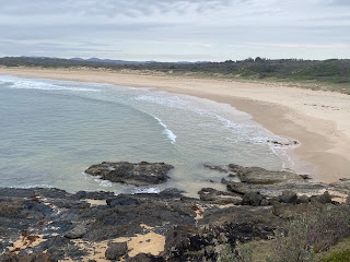
It was a muggy grey day with spots of rain. The tide was high so I had to walk on soft sand through seaweed. I glimpsed several dolphins far out. In Wooli I went to the cafe, which was amazingly busy for such a small town. Then I got a boat ride 2 kms out to and across the Wooli Wooli River mouth. This next 7 kms of the trail had been logistically impossible in 2020. It turned out to be quite different from the rest of the trail: small beaches with tiny pebbles and backed by steep hillsides, lots of pandanus, also long rock platforms of sharp granite.
It was slow going and I was glad of some feint paths over the hillsides that avoided the more awkward rocks. I was relieved to reach a sandy beach. After another stretch of rock I came to the curve of sand that was Pebbly Beach and then Station Creek; I waded this and it was just over knee deep. I came onto Station Creek Beach, a huge expanse of flat sand and clearly very low tide. Little islands offshore and the red rock at Red Rock looming prominently. I sped along in sunshine with a tailwind and reached the Corindi River (beside the red rock) dead on low tide. I decided I could cross at the entrance as there were only small waves and the deeper channel was narrow. I packed away all my gear (except my drink bottle) and headed into the water. It shelved gradually to waist deep then plunged to chest deep and I felt a strong undertow but really quickly I was back in shallow water, all ok except that my drink bottle had floated off and soon disappeared. My pack had only let in water where it was torn and my dry bags had done as they're supposed to. I went straight to the caravan park. That's the Yuraygir Coast Walk finished. In the late afternoon I walked up the red rock
and saw that the river crossing would have been treacherous at high tide. I ate at the bowling club. 20 kms

It was a muggy grey day with spots of rain. The tide was high so I had to walk on soft sand through seaweed. I glimpsed several dolphins far out. In Wooli I went to the cafe, which was amazingly busy for such a small town. Then I got a boat ride 2 kms out to and across the Wooli Wooli River mouth. This next 7 kms of the trail had been logistically impossible in 2020. It turned out to be quite different from the rest of the trail: small beaches with tiny pebbles and backed by steep hillsides, lots of pandanus, also long rock platforms of sharp granite.

It was slow going and I was glad of some feint paths over the hillsides that avoided the more awkward rocks. I was relieved to reach a sandy beach. After another stretch of rock I came to the curve of sand that was Pebbly Beach and then Station Creek; I waded this and it was just over knee deep. I came onto Station Creek Beach, a huge expanse of flat sand and clearly very low tide. Little islands offshore and the red rock at Red Rock looming prominently. I sped along in sunshine with a tailwind and reached the Corindi River (beside the red rock) dead on low tide. I decided I could cross at the entrance as there were only small waves and the deeper channel was narrow. I packed away all my gear (except my drink bottle) and headed into the water. It shelved gradually to waist deep then plunged to chest deep and I felt a strong undertow but really quickly I was back in shallow water, all ok except that my drink bottle had floated off and soon disappeared. My pack had only let in water where it was torn and my dry bags had done as they're supposed to. I went straight to the caravan park. That's the Yuraygir Coast Walk finished. In the late afternoon I walked up the red rock

and saw that the river crossing would have been treacherous at high tide. I ate at the bowling club. 20 kms
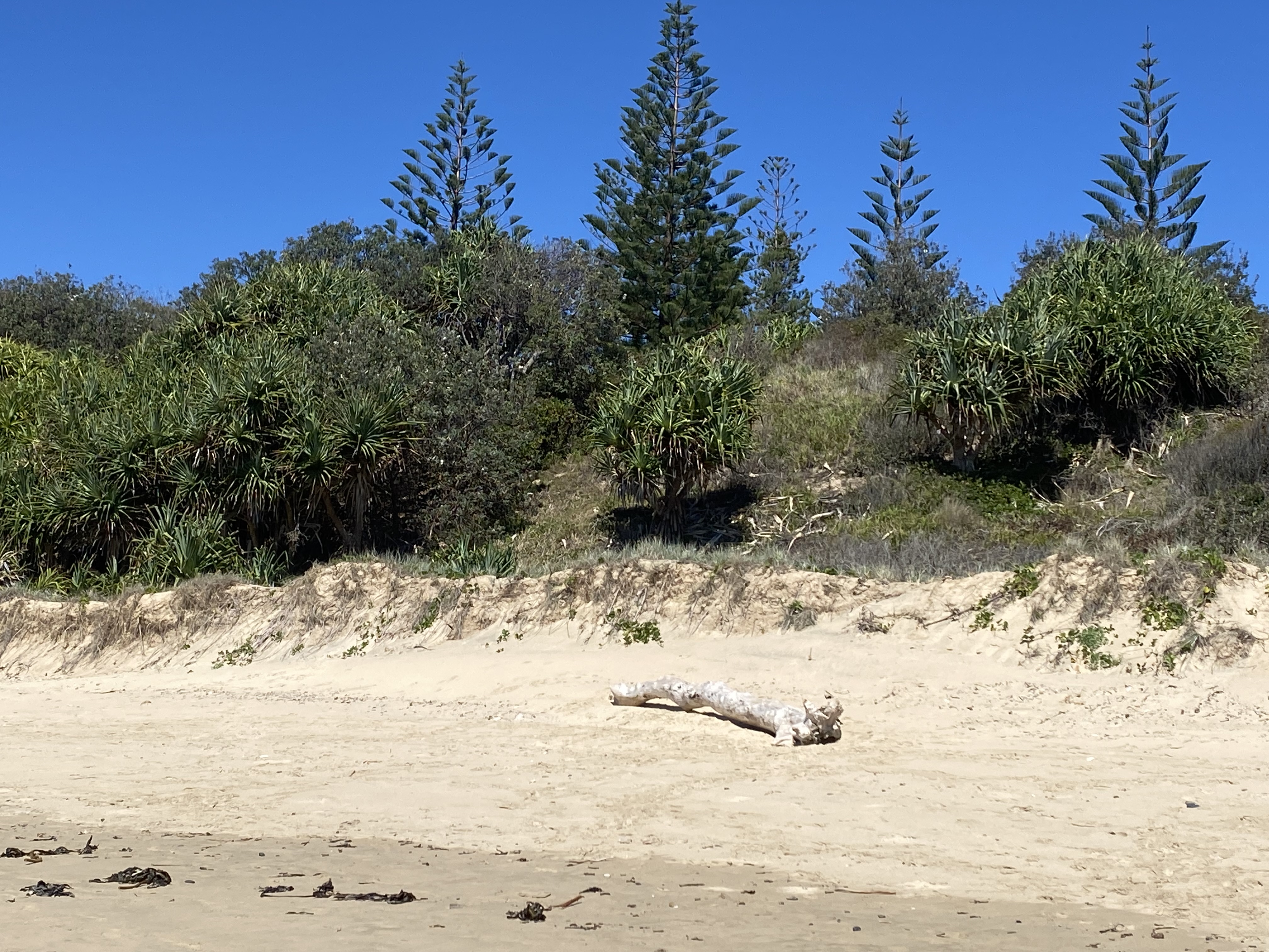
11 November I set out along the first beach of the Solitary Islands walk, a long one in hot sunshine. After 4 kms there was a slight point, backed by pandanus, banksias, casuarinas and Norfolk Island pines, 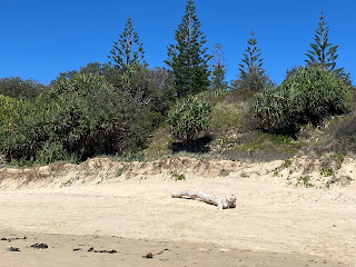
and then another 4 kms of Corindi beach to Arrawarra. I'm conflicted over these long beaches: daunting in length as I start out but always beautiful. At Arrawarra I made coffee and continued over the headland to a small beach, another larger headland to Mullaway beach and then Mullaway headland, from where I could still see the red rock and it looked very far away. I had to walk longer Safety beach, with some welcome bush at the start, and then I tried to avoid walking all of Woolgoolga beach by turning inland but I was going to be trapped by the Woolgoolga lake so I returned to the beach, and my next challenge was crossing Woolgoolga Creek estuary. It didn't look much and it was only shin deep but the outflowing current was strong and I had a fight to get across. Another kilometre on the beach and I called it a day in Woolgoolga. I walked around Woolgoolga headland without my pack; extensive rock platforms
and a view of many more long sandy beaches, plus a couple of tiny islands (one with a lighthouse). 20 kms
and then another 4 kms of Corindi beach to Arrawarra. I'm conflicted over these long beaches: daunting in length as I start out but always beautiful. At Arrawarra I made coffee and continued over the headland to a small beach, another larger headland to Mullaway beach and then Mullaway headland, from where I could still see the red rock and it looked very far away. I had to walk longer Safety beach, with some welcome bush at the start, and then I tried to avoid walking all of Woolgoolga beach by turning inland but I was going to be trapped by the Woolgoolga lake so I returned to the beach, and my next challenge was crossing Woolgoolga Creek estuary. It didn't look much and it was only shin deep but the outflowing current was strong and I had a fight to get across. Another kilometre on the beach and I called it a day in Woolgoolga. I walked around Woolgoolga headland without my pack; extensive rock platforms

and a view of many more long sandy beaches, plus a couple of tiny islands (one with a lighthouse). 20 kms
12 November I walked along a back road (saw 2 kangaroos in the bush and yellow tailed black cockatoos) to Wills Creek which barely reached the beach, and continued on Woolgoolga back beach 
then beautiful sandy Sandy Beach. I walked out on the headland - little pebbly coves and sheer cliffs -
and along Fiddamans beach to the park in Emerald Beach. The beaches are such perfect sandy sweeps backed by low grassy dunes and steeper bush covered dunes, but it is hot work. Another headland, Dammerels, with a lovely view of the full length of Look At Me Now headland.
After a short beach I was on that headland and there were kangaroos everywhere.

then beautiful sandy Sandy Beach. I walked out on the headland - little pebbly coves and sheer cliffs -

and along Fiddamans beach to the park in Emerald Beach. The beaches are such perfect sandy sweeps backed by low grassy dunes and steeper bush covered dunes, but it is hot work. Another headland, Dammerels, with a lovely view of the full length of Look At Me Now headland.

After a short beach I was on that headland and there were kangaroos everywhere.


Off shore was an island that looked like it had cracked in two, Split Island. At the end of the beach was Moonee Creek estuary crossing I'd been worried about but I was able to paddle across mid thigh deep. Then Sapphire beach and I stopped to rest under a pandanus. At the campground there I bought an ice block and noodles for lunch, having failed to detour to any of the better stocked shops along the route. I went over Diggers headland, rocks below, and walked a little beach; at the far end I had to scramble over rocks to avoid the incoming swell and I wasn't surprised the trail made a turn inland, sadly through a new housing development. I came back to the beach via creeks. Then a nice cliff top walkway partly in bush and a stretch in rainforest with tangled vines. Lots of bush turkeys. This was already Coffs Harbour. I had another sandy beach, Diggers, and the wind had come up strongly. My heart fell as I saw the length of Park beach, my final beach for today, as the wind made walking unpleasant even though it was a tailwind. I was happy to get to the caravan park half way along. 28 kms
13 November I walked to the marina and out on the breakwater to Muttonbird Island. It was extremely windy, now a southerly. I climbed to the high point of the island, past lots of burrows, for views of ..... beaches I had walked, and a grey hinterland. Soon I was setting out on 6 km Boambee beach, a beautiful stretch of emptiness, going directly into the wind and it was high tide so almost no firm sand. The sole movements I saw were a couple of oystercatchers and 2 planes taking off (the airport is behind the dunes). 
At the far end I crossed Boambee Creek on a gangway under the railway bridge and walked around the headland (good views of the long beach) to Murrays beach. Half way along was a perfectly situated cafe. I went into Sawtell to buy food then headed to Bonville Creek. This is the southern terminus of the Solitary Islands walk but I was continuing south. I decided to cross even though it wasn't yet low tide and there was plenty of water in the creek. I was only a short way into the water when I realised it was deeper than I first thought so I took off my pack and swam holding onto it with one hand. I had to battle the current to reach the far bank, which shelved steeply. When I was out of the creek I could see my pack was full of water and emptying out the water on the beach it was impossible not to get everything covered in sand. At least I wasn't cold. I was on a truly deserted beach, 7 kms long, and I couldn't see the far end but the wind was no longer an irritation. I had lots of firm sand to walk on. At the end was Bundagen head, a low headland and rocks, and from there I walked a nice trail through rainforest in the swale, coming onto the beach at a cluster of rocks, Tuckers Rocks. Then a rough track into Mylestom and the caravan park. My gear wasn't as wet as I had feared. 26 kms

At the far end I crossed Boambee Creek on a gangway under the railway bridge and walked around the headland (good views of the long beach) to Murrays beach. Half way along was a perfectly situated cafe. I went into Sawtell to buy food then headed to Bonville Creek. This is the southern terminus of the Solitary Islands walk but I was continuing south. I decided to cross even though it wasn't yet low tide and there was plenty of water in the creek. I was only a short way into the water when I realised it was deeper than I first thought so I took off my pack and swam holding onto it with one hand. I had to battle the current to reach the far bank, which shelved steeply. When I was out of the creek I could see my pack was full of water and emptying out the water on the beach it was impossible not to get everything covered in sand. At least I wasn't cold. I was on a truly deserted beach, 7 kms long, and I couldn't see the far end but the wind was no longer an irritation. I had lots of firm sand to walk on. At the end was Bundagen head, a low headland and rocks, and from there I walked a nice trail through rainforest in the swale, coming onto the beach at a cluster of rocks, Tuckers Rocks. Then a rough track into Mylestom and the caravan park. My gear wasn't as wet as I had feared. 26 kms
14 November I had breakfast on the beautiful beach with a return to blue sky. I had to walk inland from Mylestom to get to the first bridge across the Bellinger River. First I walked closely by the wide river, then I crossed it and walked quiet roads to the Kalang River, another wide one. On the far bank, on the outskirts of Urunga, I saw a cafe so I called in. I didn't stay long in Urunga. I walked the long boardwalk through the mangroves to the Bellinger/Kalang combined river mouth - it looked benign but there were warning signs. (I could see Tuckers Rocks up the beach and my 14 kms morning had clearly been a huge detour). Then I was back on a fabulous beach and walked to Hungry Head; the campground I was expecting wasn't there so I went on, and I didn't mind since it was low tide and I had a tailwind. I went around a couple of rocky points and walked the next beach for several hours. Where it morphed from Hungry Head South beach to North Valla beach there was an isolated rock and a creek that didn't reach the ocean. At the far end I continued over the rocks to some smaller coves beneath a headland and passed some caves, only accessible at low tide. I arrived at the next long beach and soon a creek to cross, wide but shallow. A bit further on I crossed the dunes to a footbridge over the same creek, now deep and 50 metres wide, to reach the caravan park in Valla Beach. There were masses of yellow tailed cockatoos. 28 kms
15 November I watched fish jumping in the creek while I had breakfast then went back onto South Valla beach. The sky had a black patch overhead and soon it rained spottily. It was dead on high tide and I had an unavoidable creek followed by beach works where I had to walk in the water. Right there was Nambucca Heads surf club with good views from the veranda cafe of the hinterland peaks and the line of headlands I've passed. I waited for the tide to drop (it didn't) and the rain shower to finish then walked my final beach, Shelly beach, a short curve of sand and a heron. I crossed the headland to the Nambucca River mouth and followed a path alongside mangroves to my motel, then a quick uphill into the centre of Nambucca Heads, my finish line as there is no way across the river except on the highway far inland. 8 kms, total 182 kms


