When I ordered my bike during the pandemic the goal of riding to Adelaide popped into my head. I thought it would be cute to ride from Brighton, Vic to Brighton, SA. It took me a while to work out how I could carry camping gear on the bike, then I got out my oldest setup (because it was the most compact) and it was time to go. I didn't even plan my route properly, I just had a vague plan to ride around the coast because it would be scenic and not too hot.
27 November A bit of a delayed start as it was raining, finely but persistent, kept stopping then starting again. Eventually I just had to get going. I got to the beach at the bottom of Hampton St and followed the bike path to Mordialloc then another bike path alongside the railway line (new to me) to Frankston where the rain returned. I climbed Olivers Hill for the first time in years and went on the highway to Mornington, where it did not appear to have rained at all.
After morning tea I went on the beachside road to Mount Martha and did the roller coaster to Safety Beach, no shoulder but little traffic. On the peninsula I had a long stretch on the coast bike path passing beaches in a little sunshine and going through the foreshore camping areas. I had a headwind for a change. After Rye the bike path was away from the beach, still nice bush riding, and as I came into Sorrento I could see the ferry was docked so I went straight over there without going into the town. The bay looked great from the ferry.
In Queenscliff I went to the caravan park; it was stupidly expensive so I pedalled off to find another, the next place cost more with nowhere nearby to get food so I went back to the first one. By now it was a sunny evening and I got fish and chips and ate by the beach with a hundred seagulls around me. 97 kms
28 November After drying out my tent I went on to Point Lonsdale, back road to Ocean Grove and a nice off-road track to Barwon Heads, partly right beside the beach. As I was riding towards Torquay a cyclist passed me and commented on my amount of luggage so I told him where I was going; a few kms up the road he stopped and when I reached him he asked if I wanted to have coffee in Torquay. (I had to speed up so he wouldn't wait too long for me.) We chatted for an hour about bikes and triathlons.
I had come into town on the beachside bike path and I stayed on it, crossing the lagoon on a long boardwalk which seemed precarious on a bike. I set off on the Surf Coast path to Jan Juc and Bells Beach, both beautiful even on a grey day, but the path was only suitable for walkers so I came back to the road. The coastal views were more open from the road. I had a pie in Anglesea and rode to Aireys Inlet in light rain and under the Great Ocean Road arch. Then I had whopping Big Hill and a welcome descent. The rest of the way to Lorne was easy riding and empty beaches, views of misty headlands.
Lorne was busy with schoolies and the campground manager thought I should go out of town so I went to the Cumberland River campsite and regretted this: very exposed, windy and basic facilities, and my tent pole snapped. The wind became worse and worse. 93 kms

29 November I packed up quickly before my tent could get further damaged as the wind gusts were severely contorting the poles, and sat in the bbq shed contemplating having to walk to Apollo Bay if the wind meant I couldn't ride. Then the rain came. When it briefly stopped I set off, soon raining again but it was the gusty wind that made riding tricky, constantly changing direction and strong. It was a lovely ride by the water/beaches/rocks and over headlands even while I was cold, wet and wobbly (seemed less difficult than running the GOR marathon).
I had a coffee at Kennett River and booked a motel in Apollo Bay. There wasn't too much traffic and the rain worsened but the wind was often from behind. It helped that I know so many landmarks from the marathon. When I reached the koala trees I wasn't keen to peer up into the rain looking for koalas but I quickly found a big fat one sleeping.

Coming into Apollo Bay the side wind was finally so strong I couldn't ride and the town was chockers with day trippers. Pie, shower, tried to dry my clothes. Too wet to visit the beach. 37 kms
30 November I never saw the beach in Apollo Bay. I left early, really windy, and had a big climb, in stages, up through rainforest followed by a descent, in stages, to Aire River and a flattish valley of marsh and grazing. I saw a couple staring at a tree and they pointed out a koala to me.
At the far edge of the valley the road briefly touched the coast at Castle Cove and I had a snack to prepare for climbing Lavers Hill. This was a protracted climb with a few short respites but the wind was helping. Again rainforest and ferny. The traffic was all courteous and no tour buses. It started to rain as I reached Lavers Hill settlement and I went in the cafe (where I could watch 3 varieties of parrot). The road stayed on the ridge (with a few views of inland hills that were marred by the weather) then a long winding descent among gum trees.
I crossed Gellibrand River and had a climb I had not expected, then from the top it was all downhill to Princetown with a distant view of coastal cliffs. I had the run-down backpackers to myself, next to the closed down pub and closed down cafe. I walked to the Gellibrand River mouth with a sandy beach to one side and a sandstone bluff to the other. 80 kms
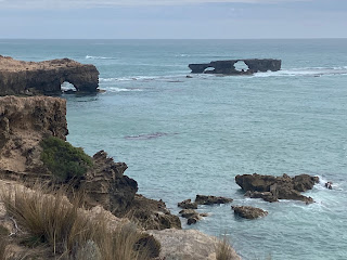
1 December The road swooped and climbed. Time for the sandstone stacks and arches. I stopped at Gibsons Steps for two stacks, then the (fewer than 12) Apostles 
and Loch Ard Gorge where the series of headlands and island were impressive. Then I stopped for early coffee in Port Campbell (prettiest town on GOR). I had sunshine at London Bridge
and a quick look at the Grotto, then another stop at Peterborough before the last stacks: Bay of Martyrs and Bay of Islands.

and Loch Ard Gorge where the series of headlands and island were impressive. Then I stopped for early coffee in Port Campbell (prettiest town on GOR). I had sunshine at London Bridge

and a quick look at the Grotto, then another stop at Peterborough before the last stacks: Bay of Martyrs and Bay of Islands.
The road immediately turned away from the coast and with a tailwind I sped along the 50 kms towards Warrnambool through farmland, masses of flies. The traffic was ok until Allansford but then the GOR joined the Princes Highway so I turned off for quiet side roads within sight of the ocean. I crossed Hopkins River (where I walked on my recent visit to Warrnambool) and rode to Maccas to rest and decide what to do next.
I was tired but I went on to Koroit and it was an easy ride with a bike lane and then the rail trail I walked 2 years ago. I set up my tent, walked to the shop and it rained for the first time today. 110 kms
2 December I followed the road above Tower Hill lake then quiet roads back to the rail trail, where it crossed marshland and I saw grey herons and white necked herons, to Port Fairy.
After a quick coffee I set off on what should be the longest unbroken highway stretch of the ride: 60+ kilometres on the Princes Highway. It was dull grazing country, away from the coast, wind farms, but mostly a good shoulder. Just before Narrawong (my lunch stop) I saw a snake on the road and couldn't avoid riding over it (at least I think I did, I didn't look back). It was still windy and became sunny. The only major hill took me up to a ridge and soon I could see Portland. I was able to leave the highway at Allestree for a coast road, straight into the wind but it got me to town. 92 kms
3 December I had read the road to Nelson was rough and full of logging trucks but this was Sunday and I saw few trucks, but it wasn't an exciting ride. It rained a little. First farmland then a little bush and a single great view of huge dunes and the ocean, then pine plantations and logged hillsides. I met a German touring cyclist; we had a one-sided chat because he wanted to talk.
Nelson by the Glenelg River was sunny and unchanged from my last visit on the GSWW, my first long hike. I ate a good pie, bought a freeze dried Thai curry and set off on back roads for Dry Creek campsite in South Australia. No sign at the border.
Dry Creek campsite had a row of boathouses on the Glenelg with toilets and a shelter, pretty because the river is in a limestone gorge, and I had a peaceful hot afternoon there. 79 kms

4 December Blue sky! I had breakfast on the wharf. I took back roads to the Limestone Coast at Brown Bay, long sandy beach, and rode along the ocean. I stopped to see swans at a creek estuary and some offshore rocks and further along the coast I came to Port Macdonell, important centre for rock lobster. It was an obvious place for a day off - waterfront cafes, pub, harbour with walkway - so I stopped for the day at 10. I checked into the pub early hoping to wash my clothes but they had no water until mid afternoon and then I wasn't sure how to get my stuff dry. 30 kms, 620 kms from home
5 December I went around the coast to the spot where the original lighthouse was at Cape Northumberland, South Australia's southernmost point; it was a rugged limestone headland with weird rock formations offshore.

Then a long stretch through agricultural land on a variety of back roads, a little sunshine but cold wind. The landscape was flat, I passed a wind farm, stopped briefly in Kongorong, and saw a couple of hills on the horizon. Lots of straight road, and I was glad to get to Tantanoola, featuring a shelter by the derelict railway station (where I made coffee) and a pub with a tiger on the roof.

The last part to Millicent went by quickly. Millicent was a very ordinary town; I chanced on a reasonable bakery. I continued on the Southern Ports highway. There was a pretty lake on the edge of town and the road undulated for a change, crossing low hills. I stopped at Rendelsham, a settlement that took its history very seriously with lots to read about the railway and chicory farming.
I crossed some wetlands and turned off for Southend, 5 kms off the main road. A lovely small town on Rivoli Bay, the calm water bordered by an endless white sand beach and protected from the wind. I rode to Cape Buffon at the end of the road, stopping at Rainbow Rocks; there were unusual rocks and rocky bays all around the cape.
I also viewed the town's short jetty. There was a basic campsite directly behind the beach. I ate dinner on the dunes. 105 kms

I also viewed the town's short jetty. There was a basic campsite directly behind the beach. I ate dinner on the dunes. 105 kms

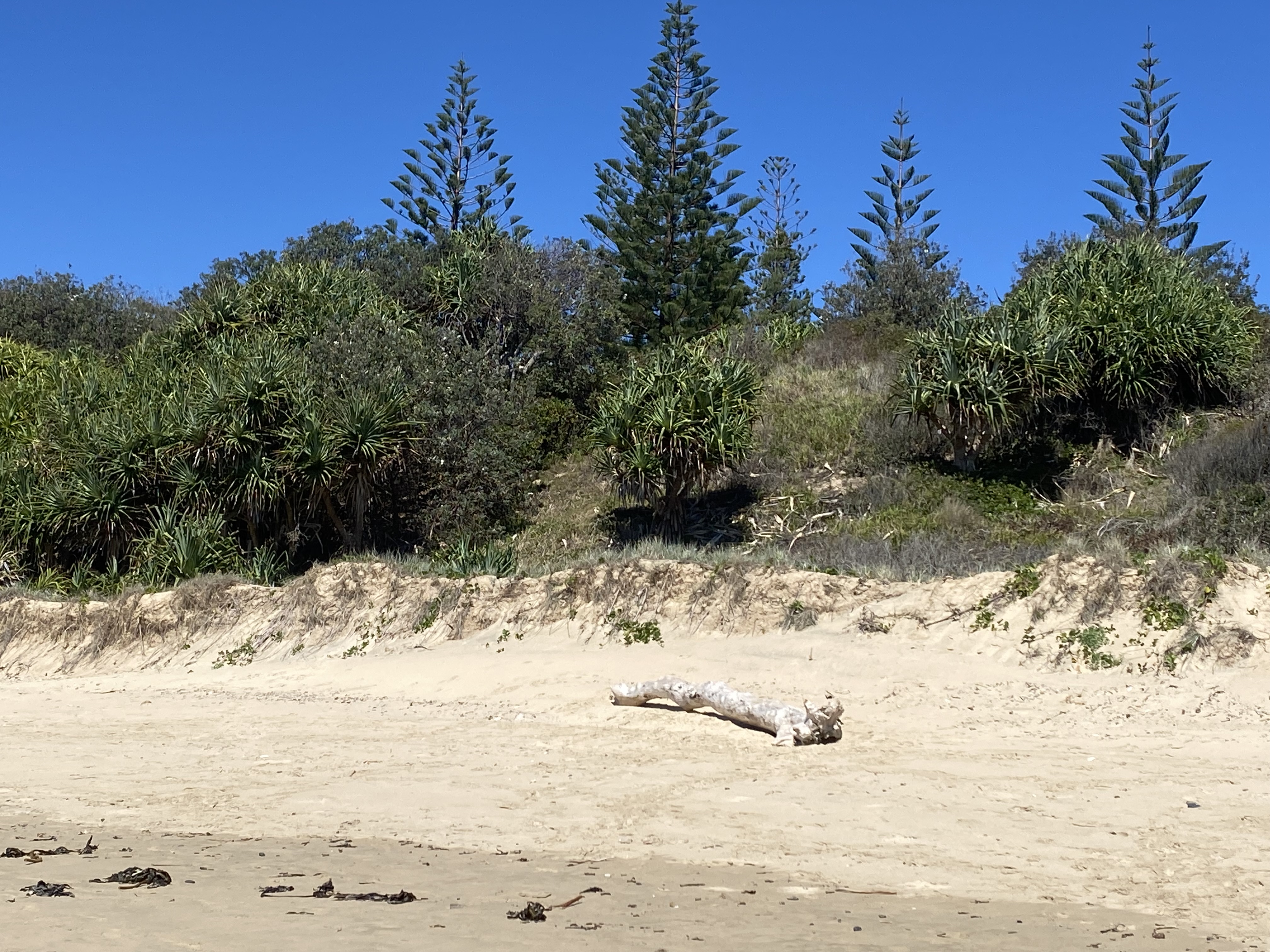
6 December I had breakfast on the dunes then sped to Beachport, enjoying my first day of riding without wind. Coming into Beachport I passed the line of Norfolk Island pines I could see from Southend (except that I couldn't work out what they were from there). There was a bike path along the beach and after that I toured the town, visiting the lighthouse and several headlands for coastal views of limestone islands and sandy coves. I had coffee by the 700 metre jetty (half its original length).

Then back to the Southern Ports highway for Robe. It was nice riding for a highway: very few cars and some views of lagoons between the road and the ocean dunes, some bush, some sheep. Coming into Robe I passed little lakes. I had a very average pie then went to the campground; it had a great view over Guichen Bay, again an endless white sand beach.
I went for a ride around the sights: the iconic obelisk, holes in rocks, limestone cliffs, beaches. 
Became very windy, brief shower. I had a zucchini topped pizza for dinner with a glass of local wine, and at sunset the sky was all red. 82 kms


Became very windy, brief shower. I had a zucchini topped pizza for dinner with a glass of local wine, and at sunset the sky was all red. 82 kms
7 December I returned to the quiet highway heading towards Kingston SE. The first highlight was a paddock of grazing camels. Then vineyards and pine plantations.
I turned off for a visit to the coast at Cape Jaffa and rode a lovely wide deserted road passing a few vineyards, including the one where last night's wine came from. Cape Jaffa was a tiny holiday place (with an unplanned cafe) looking out on calm water, strip of beach and very peaceful.
I returned to the highway on another quiet road and only remained on it briefly before finding a coastal bike path leading right into Kingston, the last part beside a long sandy beach, passing the Cape Jaffa lighthouse which was moved here in 1974 to give the town a tourist attraction. I bought food for the long haul across the Coorong and had lunch at the bakery, ending my time on the Limestone Coast.
I got to the Princes Highway to start on the 145 kms to Meningie, passing the giant lobster that is Kingston's own tourist attraction, and I was pleased to find a reasonable shoulder and little traffic. The road was flat, grassland and low trees. After 25 kms I stopped at a rest area and two cyclists arrived from the opposite direction; we had a good chat and one of them had lost a shoe on the road so I said I would look out for it. That gave me something to keep my mind off my tiredness and I saw lots of things including an echidna and three other shoes. I had a light tailwind and overshot the 28 Mile Crossing campsite turnoff.
The campsite was on the Old Coorong Road; I crossed samphire flats and acacia scrub to reach it and nobody else was there. I went for a walk to the beach, crossing the huge dunes; the beach was windswept. I also climbed the dune by my tent for a view over the samphire flats. For the first time the evening was completely still. 115 kms
8 December I had breakfast on a high dune where I could see the samphire flats inland and also the ocean beyond more dunes. I startled some Adelaide rosellas. It was already hot.

I stayed on the Old Coorong Road for 15 kms to its end, a wide gravel road through the scrub, seeing a kangaroo, a snake, three shingleback lizards and not one vehicle. I had a headwind.
After an hour on the highway (many more trucks today) I went onto another dirt road. This one was badly corrugated. I passed through acacia scrub as the wind became worse and then it rained briefly. I came onto a slight ridge and I could see distant big dunes. I passed a large lake with unattractive murky water then made myself coffee in a sheltered spot by a prettier lake.
When I got going again the wind had died off and soon I had a light tailwind. It was much cooler. I got some water at Salt Creek and continued to the pelican viewing area, once again hot; I saw a snake and some pelicans in flight.
After this the highway undulated right by the water, Coorong southern lagoon, which was nice but became increasingly smelly. I saw several large flocks of pelicans flying overhead. I went out to Parnka Point where the northern and southern sections of the lagoon meet forming a sharp bend. I could see a long way north and south with wide expanses of sand, lots of shore birds, islands, the dunes on the peninsula beyond the Coorong.
My evening did not go exactly to plan. I went to the campsite, saw an emu, and got out my tent; I seemed to have lost the metal sleeve I'd been using to fix the snapped pole and I couldn't manage to put up the tent. So I went back to the second shelter at the point where I'd been earlier (the one I'd been at was full of ants) and laid out the tent inner as a bivy bag with the fly tied down as a roof. 86 kms
December 9 The night was wet and very windy and lots of rain blew into the shelter. I was warm and dry but the noise of the wind made sleeping difficult. In the morning I moved to the other shelter which was better protected from the weather - a good move as it soon poured and poured. The forecast heavy rain had come a day early. The hundreds of birds down on the shore loved it, I've never seen so many egrets and pelicans. Despite the conditions it was an idyllic spot.


When the rain eased I set off back past the campsites (the sandy road quite flooded) and on the last 25 kms of highway to Meningie. It rained steadily.
I went straight to the bakery which was warm inside and the owner gave me towels. The rain got worse and I could only just see Lake Albert across the road. I wished I had booked the motel in town rather than one 2 kms away but when I got there I had a room looking out over the lake and pelicans cruised by. SA got all its average December rain in one day. 29 kms
December 10 In light rain I went the short distance back into town and moved into the other motel as heavy rain was forecast. I stole a spoon to splint my tent pole, then had a walk along the lake and looked at the famous ostrich statue.
December 11 Torrential rain in the night. I left Meningie early and took the back road to Narrung, first by the lake then inland, passing flooded samphire flats, and I had a great tailwind. In Narrung I made coffee then went on the cable ferry across the strip of water connecting Lake Albert with Lake Alexandrina, under the watchful eye of Point Malcolm lighthouse, Australia's only inland lighthouse.

From there I had the most awful headwind and riding was seriously unpleasant. The only distraction was a large flock of sheep crossing the road; when they were half way across they got confused and some went forward, some went back so it took ages for them to be off the road.
When I reached the Princes Highway for a final stretch I thought conditions would improve but I had a strong crosswind which wasn't fun. I had to stop several times. It was a bleak windswept area of grassland and samphire. Finally I went onto a dirt road parallel with the highway, it was rough but felt much safer. I was happy to turn off for the ferry across the Murray River to Wellington. I was exhausted.
At the Wellington caravan park I got my tent up after a fashion (without the spoon) and just as I finished there was a brief thunderstorm with an incredibly loud thunder crack and then ferocious wind; I lay inside hoping for the best. Then it rained. Again.
While I was at the pub (overlooking the Murray) there was another thunderstorm and a deluge; to my great surprise my tent remained standing and dry inside. 81 kms, 1121 kms from home

December 12 Quite blue sky when I got up and I sat by the river for breakfast but it soon clouded over and as I started the ride to Langhorne Creek the sky looked ominous. It was featureless countryside, cattle grazing, and a distant tree or barn was a distraction.
About half way I heard thunder then saw lightning and I stopped outside a house so I could run under the porch if it rained. No rain so I went on, in 5 kms it was raining and I saw a derelict stone building for shelter. Unfortunately it was locked but it had narrow eves and I sat there; the mozzies rushed over and when the rain got heavier there were clouds of them all over me, it was awful. In desperation I wrapped my (wet) tent flysheet around me and that kept some of them off me. As soon as the rain lessened I was gone, the light rain felt nice on my bites. A km up the road I saw a shed and I went inside as the rain worsened again. The thunder and lightning had continued all this time.
When I left the shed the air felt fresher and I powered along to Langhorne Creek passing vineyards, although the road was too puddly. I was glad to reach the general store/cafe for a proper break. From there I zigzagged through vineyards to Milang on Lake Alexandrina, very nice apart from a couple of places where the road was flooded - once I had to bush bash and once I got wet legs.
In Milang it was hot and sunny and I dried out my camping gear. Then a fun ride on dirt roads towards Goolwa. I could see the southern end of the Mount Lofty ranges along the horizon. I'd been warned about a ford at Finiss River where the road may be closed due to flooding and it was, but I decided to risk riding through and it was ok. 
Then there was a flooded stretch of road which was rideable but deeper. Then I came to another ford (I hadn't known there were two) and this one was even deeper, water up to my knees while riding.

Then there was a flooded stretch of road which was rideable but deeper. Then I came to another ford (I hadn't known there were two) and this one was even deeper, water up to my knees while riding.
The last bit into Goolwa was on a busy road. I had a brief visit to Hindmarsh Island over the huge bridge and headed to the caravan park. The day had left me feeling slightly traumatised with the mozzies, storm and flooding. 85 kms
13 December A warm sunny day! From Goolwa I followed an on- and off-road bike route along the coast to Victor Harbor, often slightly above the long beaches and rocky interludes and also through bush corridors. It was scenic but complicated.
I had morning smoko in Victor Harbor as it clouded over. I bought some food and by the time I left town to make my crossing of the Fleurieu Peninsula it was raining and very windy. After yesterday's experience I decided to ride through the rain but I was soon uncomfortably hot in my rain jacket and I stopped at a roadside shelter. Then I sheltered at the Lower Inman tennis club.
One more stop and I got to Inman Valley which I remembered from the Heysen; there was a Christmas party in progress at the shop so I couldn't go in and check if it was better stocked! I had lunch with a cacophony of cockatoos and the weather cleared a bit. The scenery has changed to rolling grassy hills and large gum trees.
I had a big climb out of Inman Valley, I could see the Gulf St Vincent from the top, and a really nice long descent. At Yankalilla, surprised to find shops, I had coffee.
Easy ride to Normanville and at the caravan park I got a good spot behind the dunes. It was a beautiful beach with a series of misty headlands to the south. Unfortunately far too windy to eat my fish and chips by the beach. 61 kms

14 December I got my tent down as light rain started. Still windy. The hardest hills of the trip awaited me. I called in at Carrickalinga beach then commenced a long steep climb to a ridge with good coastal views. Then slight descent to Myponga dam, rode across the dam wall and up to the viewing area. From here the climb continued over grassy hills. I was glad to be wind assisted and (so far) dry but I could see rain inland. The initial descent was steep then I joined the main road and had an enjoyable descent with full ocean views.
As I came into Sellicks Beach the rain caught me but I found a cafe. I had to go inland a bit then had a lovely stretch on a beachside trail to Port Willunga beach 
then more inland with numerous hills and I came down to Moana beach. There was a good view back along the coast, beaches backed by low cliffs. The beaches feel urban here. I ate hot chips at Moana, that's how cold it was.

then more inland with numerous hills and I came down to Moana beach. There was a good view back along the coast, beaches backed by low cliffs. The beaches feel urban here. I ate hot chips at Moana, that's how cold it was.
The next bit on the clifftop to Noarlunga was great, then I crossed the Onkaparinga River and went up steep beachside roads. At Sullivans beach I had to go inland again, this time on a busy main road which was really unpleasant, until Hallett Cove where I followed a small road then a rail side bike path. Everything is so hilly, quite unexpected.
I was pleased to get to the beach at Kingston Park and it was beautiful in sunshine, finally, so I checked into the Brighton caravan park right on the beach (although not quite in Brighton). I ate at the surf club with a fantastic sea view. Could be my last night ever in the Nemo. 74 kms
15 December A bit of sunshine for the finish. I stayed on the lovely beach path through Seacliff, Brighton with art deco ornamented jetty (original mission accomplished) then Glenelg, West Beach to the Torrens River linear trail.

I followed this trail, sometimes swapping sides of the river, with the river diminishing to a trickle surrounded by trees and then wide and landscaped as I passed the weir and arrived at the festival centre. I went under King William Road bridge and designated Lounders Boatshed cafe to be my finish line.
Despite copious rainfall and lack of sunshine this has been a great trip. 26 kms, total 1367 kms