I had long wanted to do the 125 kms Cape to Cape trail (Cape Naturaliste to Cape Leeuwin) in the southwestern corner of WA but I hadn't yet worked out the best season for avoiding both cold weather and crowds. Thanks to covid I was marooned in Perth when I was meant to be doing a Heysen section in SA and, seeing it was likely that Perth would soon be locked down, this seemed an excellent time to embark on the trail. I had to buy a functioning rain jacket (a lot of rain was forecast) and then off I went on the bus to Dunsborough.
June 30 I set out from Dunsborough to walk the 16 kms to the northern terminus of the track at Cape Naturaliste lighthouse. It was overcast but not cold. I wasn't expecting a marked trail but I found one, through Meelup Regional Park, in nice bush. After only 6 kms I stopped for a coffee break at Meelup beach, a little curve of white sand. The trail varied between heathland on cliffs, sandy beaches, a bit of boulder clambering. Patches of blue sky appeared. Yet again I was treated to some lovely wildflower displays: a lot of Cape Naturaliste claw flower (red flowers), tiny white flowering wattles (taxandria juniperina), big and small yellow flowering bushes (guinea flower). From Bunker Bay beach I could see the lighthouse on the promontory ahead. I passed 2 cafes without going in and then when I decided I would go in the cafe at the lighthouse it was closed.

I walked out to the lighthouse and then started on the Cape to Cape track. A couple of people at the lighthouse wished me well. It was initially sealed and went through more wildflower displays (especially a red flowering cockles tongue I had also seen in Lincoln NP). The coastline was very indented and the surf was big. Sometimes the trail was quite rough with sharp limestone rocks and there were curious rock formations, but mostly it was a sand single track. Soon I saw some wildlife: I saw a large rodent; a dugite (small greeny brown snake) slithered off the track; I saw an osprey on a branch. I walked along Kabbigup beach on white sand and followed the track on the cliffs. It was windy but not uncomfortably so.
I reached Mount Duckworth campsite, a clearing in melaleuca forest, and very soon light rain started so that was good timing. I used fallen branches to anchor down my tent on the sand as there weren't any rocks. I could hear the surf all night, over the sound of the rain. It was fully dark by 6pm. 27 kms
July 1 It rained all night and into the morning then stopped at 7.30 and I had a warm sunny day. I came back to the coast and had some long beach walks along Yallingup and Smith's beaches, slow going on soft sand. I was intending to go to the cafe at Smith's beach but it was closed. The coastline was beautiful with many little coves backed by granite cliffs and long sweeps of sand.


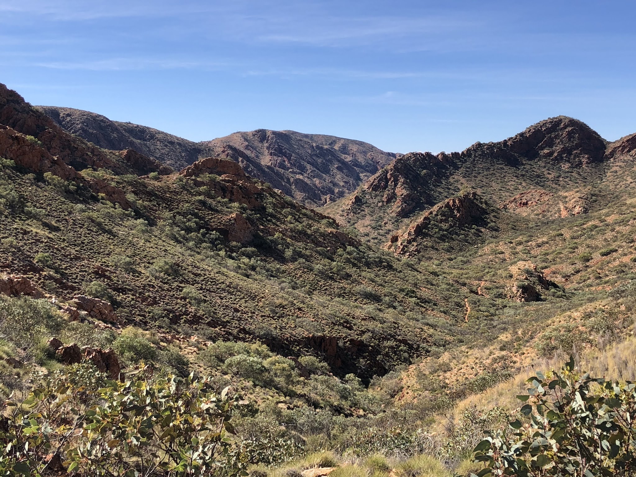
The trail was not flat: there were many steep climbs over headlands and long descents back to the beach. And plenty of lookouts. I was surprised to find a freshwater creek and I collected some water. The bush was full of colourful flowers including delicate pink pimelia, tiny lilac angled lobelia, little purple flag, lots of cockles tongue, yellow guinea flower and golden cascade and prickly Moses acacia. The variety was totally amazing, and this isn't yet wildflower season.


The trail was not flat: there were many steep climbs over headlands and long descents back to the beach. And plenty of lookouts. I was surprised to find a freshwater creek and I collected some water. The bush was full of colourful flowers including delicate pink pimelia, tiny lilac angled lobelia, little purple flag, lots of cockles tongue, yellow guinea flower and golden cascade and prickly Moses acacia. The variety was totally amazing, and this isn't yet wildflower season.
Just before Injidup beach I met some hikers doing the trail the other way and I was able to enquire about the river crossings ahead. Injidup beach was long and hard - they haven't got the idea of firm sand here - lots of cuttlefish remains and blobs of jellyfish. The 4WD trail I walked on most of the afternoon was also soft sand. I made a detour to Quininup Falls, a lot of water dropping into a small pool over granite slabs. The terrain became swampy and spots were flooded. I saw a group of kangaroos. I've been seeing a few birds but not a whole lot, which is how I remember the Bibbulmun.

The last part of the trail was back in bush which was much lusher than earlier and it would have been hard to pass someone. Banksia trees appeared and in the more open parts I could see the spires of lots of grass trees. Moses Rock campsite was on the clifftop and damp so I think it must have rained there today. (I had seen a rainbow while walking.) With nothing to anchor my tent I tied it to the picnic table. 24 kms
July 2 A hot sunny day while I was walking. My first task was to cross Wilyabrup Creek at its mouth on the beach, and it was only knee deep so that was ok. That was my only beach walking for the day. The trail was mainly on heath covered clifftops with views over bouldery coves and sometimes in swales. There were long stretches of rock platforms, and big granite outcrops dotted through the heath. I saw a lot more pimelia and a bush just starting to blossom with clusters of orange flowers, (gastrolobium bilobum, heart leaf poison).

In Gracetown I was excited to go to the one and only cafe but I picked up a distinct anti-hiker vibe so I didn't stay long. From there on the trail gave breathtaking vistas over long sandy beaches with what looked to me, and I’m guessing to all the surfers out there, like perfect surfing conditions.

I left the coast to go to Meekadarabee Falls (I missed the falls) and a little grotto on the creek, where I had a long chat with a local couple who were astonished at my bravery in hiking alone. Ellensbrook campsite was close by in the forest. I had just set up my tent when a day hiker walked in and we chatted for almost an hour; she had done this full trail and was about to do Larapinta so we had lots to talk about. Just as she left 2 guys arrived to camp. Although the campsite was over a km from the beach the thumping of the surf was the only sound until the rain came.19 kms
July 3 In the end the decision about safely crossing the mouth of Margaret River was made for me; after a walk through a tunnel of shoulder high banksia and acacia I came to a sign telling me I had to take the inland route south. By now it was raining again and I sped along a sandy 4WD track, a sealed road and a bikepath into Prevelly, where I ended my day early at the caravan park, and the sun came out. I had an immediate coffee and cake; this could be becoming the Cake to Cake trail, and then strolled along the beach to a perfectly situated cafe on Gnarabup beach. 14 kms
July 4 The weather was awful in the morning and I debated staying the day in Prevelly but then the rain seemed to clear. When I checked out of the caravan park the owner showed me the BOM radar picture on his computer and offered to come and pick me up if the conditions got too bad.
It didn't take long for the rain to start again and before long there was thunder and lightning too. When that finished the rain got heavier for a time. I was deep in the bush and enjoying life in a waterproof rain jacket. I descended hundreds of steps into a gorge to a secluded pool and as I contemplated a break the rain returned. I wandered alongside a creek to Redgate beach and had a few hard kms of walking on soft sand. The sun was trying to appear.
Beyond the headland I had another short beach to walk with a creek to cross which should be easy due to a sandbar; but it was high tide and no sandbar and I got my timing sufficiently wrong that I ended up with wet feet. Luckily not cold. I went into melaleuca forest and had my overdue break in a clearing. From here the track climbed through heath to the clifftops and there was a stretch with limestone caves, stalactites and dripping. 
The views along the coastline were awesome: long sandy beaches and bouldery headlands, blue water as it was now sunny and lots of white froth as it was very windy.

The views along the coastline were awesome: long sandy beaches and bouldery headlands, blue water as it was now sunny and lots of white froth as it was very windy.
I went into Contos campground to get some water and continued to my destination, dry (as in no water tank) Point Road campsite. As I arrived the rain came. Then the sky turned completely blue but within half an hour it was raining again. It was a huge campsite, deserted apart from really persistent magpies. 20 kms

July 5 The wind was hugely gusty in the night; I couldn't feel it, only hear it. I didn't worry about branches falling from the trees nearby but maybe I should have: when I left the campsite there was a newly fallen branch across the path out. I walked through the Boranup forest with karri and marri trees, grass trees and ferns. The weather was peculiar all day: in the morning I had rain followed by clear blue sky followed by hail, more sun, more rain.
When I reached Hamelin beach the whiteness of the sand was dazzling. I had 5 kms of beach walking and I rushed along because I was keen to eat cake at the cafe at Hamelin Bay. The sand was reasonably firm and I had sunshine for the first half, so nice views of Hamelin Island. Then the sky ahead was the blackest I've ever seen and soon the deluge came, but it only lasted about 2 minutes and the sun came out. Sadly there was no cafe at Hamelin Bay, just a shop at the caravan park with a coffee machine. I sat outside the shop eating my lunch thereby avoiding a shower and more hail. There are supposed to be stingrays at the pier but they had stayed away because they knew no tourist in their right mind would be out in this weather.
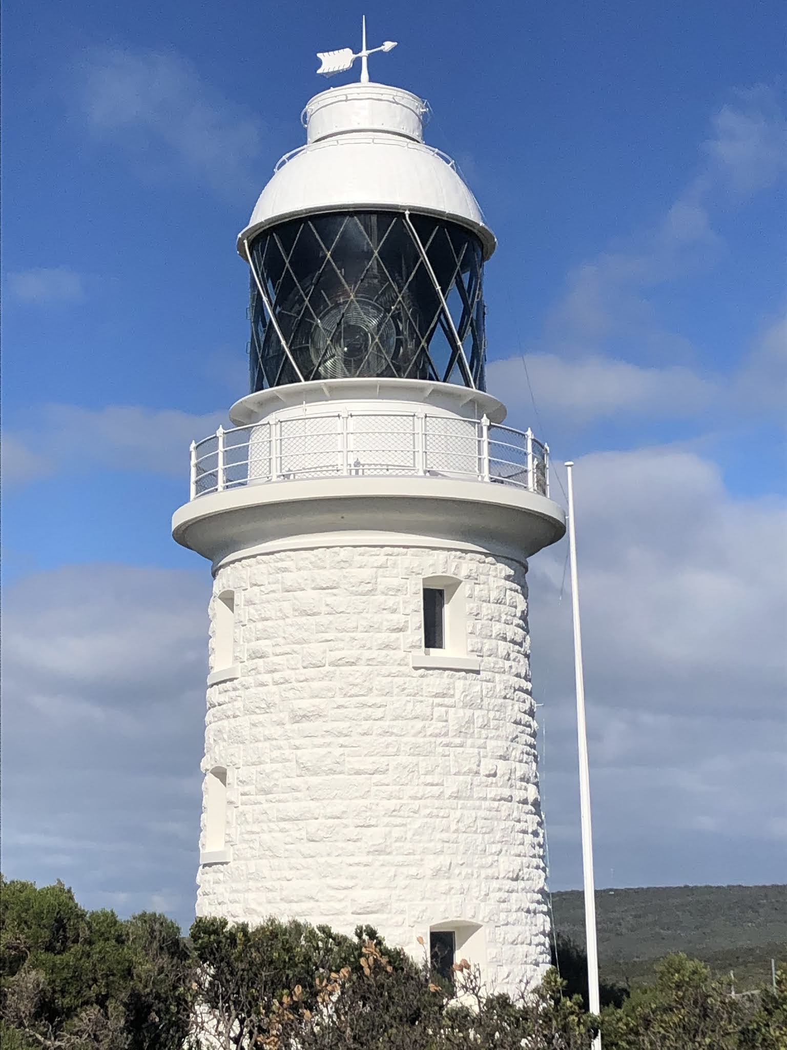
I had another short beach (where I saw a group of Elegant parrots) then a climb to Foul Bay lighthouse from where there was a fantastic view over the inland hills and back to Hamelin Island, 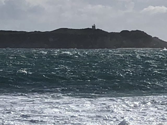
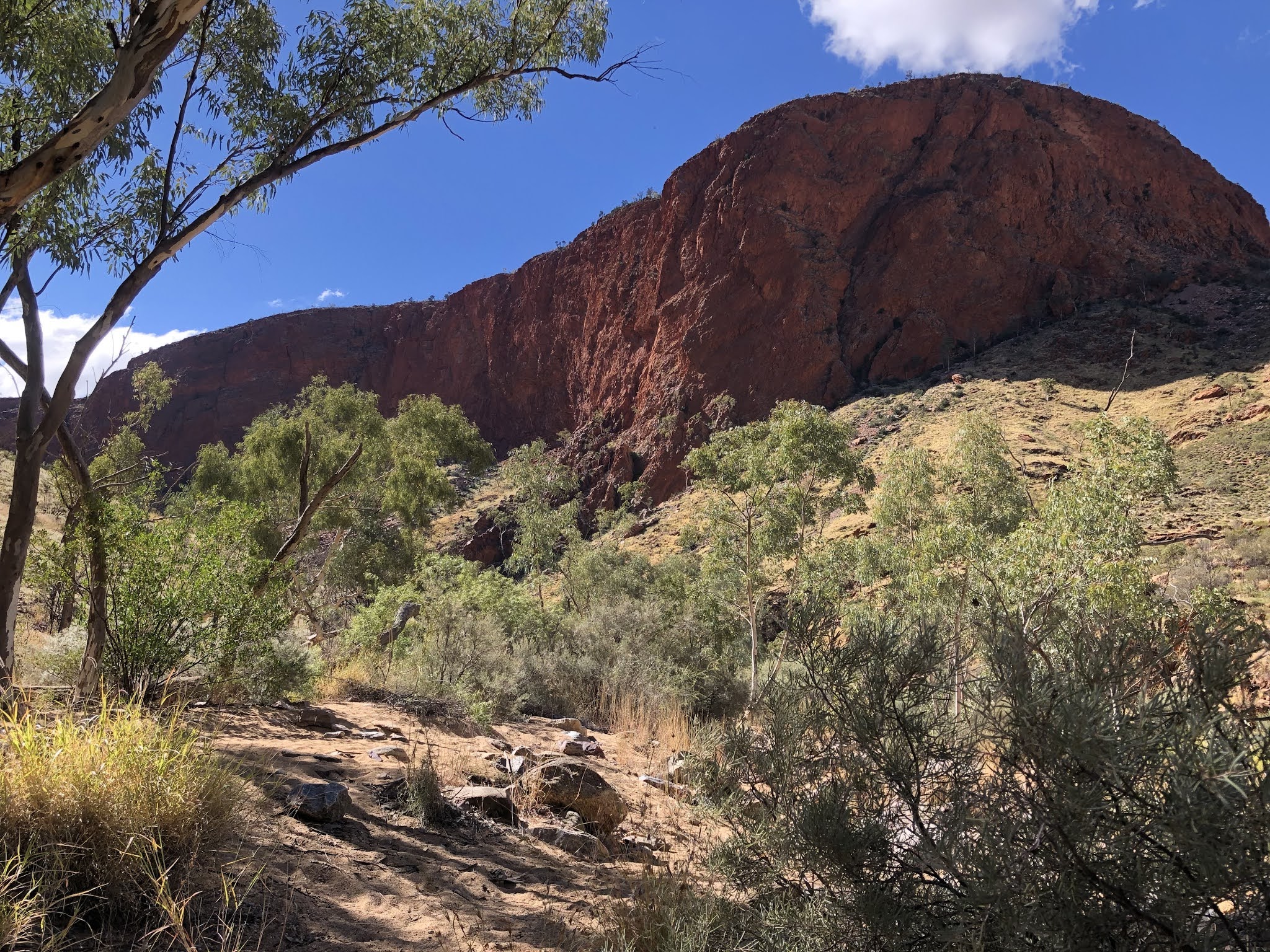
some heathland (I saw a double rainbow and 2 Western rosellas) and then I walked through some of the most unusual coastal formations I've seen: a kilometre of limestone pinnacles, chasms and blowholes. The blowholes were fully performing which meant stepping over them needed good timing, and the chasms were not to be taken lightly either.

some heathland (I saw a double rainbow and 2 Western rosellas) and then I walked through some of the most unusual coastal formations I've seen: a kilometre of limestone pinnacles, chasms and blowholes. The blowholes were fully performing which meant stepping over them needed good timing, and the chasms were not to be taken lightly either.
After a few boulder strewn beaches,
and offshore islands I came to white Deepdene beach and part way along I turned into the forest for Deepdene campsite. I was alone with the wind and the sound of the surf, and the sudden showers continued. 29 kms

and offshore islands I came to white Deepdene beach and part way along I turned into the forest for Deepdene campsite. I was alone with the wind and the sound of the surf, and the sudden showers continued. 29 kms
July 6 The strong gusty wind wasn't gone but I walked without rain for a long time. I walked another 6 kms on Deepdene beach, mainly barefoot once I had taken off shoes and socks for a creek crossing. I had a tailwind that was so strong I couldn't keep up with it, which is an unusual sensation. Another double rainbow. 
Then I had another stretch along weird limestone formations, at one point there were granite boulders on the beach beyond the limestone shelf, a very odd look. The trail went into bush with some ocean views and I could already see the terminus Cape Leeuwin lighthouse on a promontory far away.

Then I had another stretch along weird limestone formations, at one point there were granite boulders on the beach beyond the limestone shelf, a very odd look. The trail went into bush with some ocean views and I could already see the terminus Cape Leeuwin lighthouse on a promontory far away.
The final part of the trail was difficult because of the wind and because I wanted to keep my shoes dry. I had to clamber over boulders and dodge wet seaweed and avoid completely flooded sections of trail, all this with the wind trying very hard to push me off course. When I reached the lighthouse gift shop/cafe the guy asked if I'd been on the Cape to Cape and told me to go and hug the lighthouse.
I was literally 10 paces from the lighthouse when a deluge started and I raced for the lighthouse doorway to shelter. The doorway didn't provide any respite from the wind, though, and I battled to get my rain jacket on; by the time I got it on the rain had stopped. I wanted to walk around the outside of the lighthouse but the wind was so strong I couldn't stand, let alone walk, so I returned to the cafe and had a large scone with jam and cream.

I walked the extra 9 kms to Augusta with a tailwind again so the wind must have swung around, at first by the ocean, now the Southern Ocean while I had been walking along the Indian Ocean before Cape Leeuwin. I got to Augusta as more heavy rain came and by the time I was ready to check out the town there was a town-wide power cut caused by the weather and everything was closed. I had been fortunate with the weather because the rain was much worse in the following days and there were incredible wind gusts at the cape up to 125 kph. 24 kms