
I wanted to try and fit in the first section of the Heysen Trail before the weather got cold and wet so I headed off to the start of the track as soon as it reopened after the fire season, well actually 2 days before the official opening. (I had done the stretch from Quorn to the northern terminus in winter 2019.)
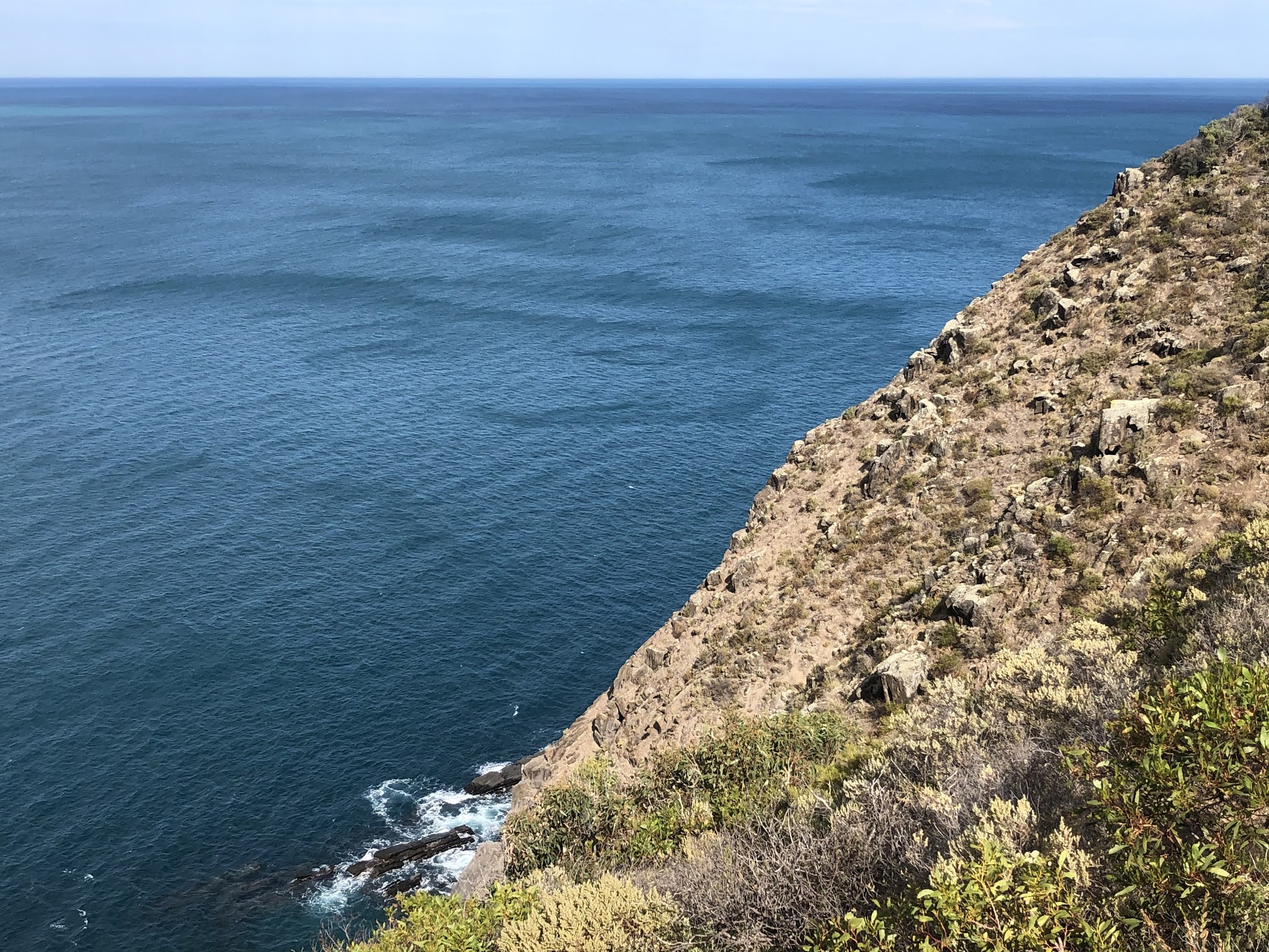
April 29 I was happy to leave the grotty room at Cape Jervis pub and walk to the end of the road and start of the Heysen, although I didn't see a sign labelling this as the southern terminus of the trail. First part was on clifftops above a series of rocky inlets with good views across to Kangaroo Island: cliffs and a long stretch of beach over there. I came to my first beach, Blowhole Beach, and I watched some surfers from a well positioned bench. The trail went inland, became quite rough, and climbed for ages; I kept thinking I was at the top but I wasn't. Eventually I reached a nice plateau and soon a campsite, Cobbler Hill, where I had a coffee break and a chat with a camper.
The trail descended to a creek which I was surprised to hear trickling away (as every earlier creek had been dry) and was in a green gorge that led to Eagle Waterhole which was dry. From here I climbed onto a ridge so I could see the ocean again, nice and blue on this sunny day. I could see the lighthouse at the eastern tip of Kangaroo Island. The trail went into denser bush, mallee and varied bushes, some flowering, and after a small descent to cross a dry creek there was a massive steep climb. On top were lots of mature grass trees, and fenced grazing land which provided the opportunity for a Heysen special: walking alongside an electric fence.
When I got to Trig picnic area I thought I was done for the day but I had to go a bit further to the campsite. There were plenty of kangaroos hanging around at the camping area. In the evening a miniscule mouse scampered all over my tent. 23 km
April 30 During the night a big wind came up. What's this with strong winds everywhere I go this year? I descended in the bush to Deep Creek Waterfall which was pretty


When I came off the beach I had one of the steepest climbs ever, along a fence heading up grassy hillsides. The grade eased off a little and I followed fences across this grazing land with views of the ocean in the distance. It was hot work and I stopped to rest under some trees. There are always beautiful old trees dotted among the paddocks.
The last part of the day was a road walk and not far along I came to a flowing creek; as it wasn't windy I decided to have my long overdue morning coffee (at 3pm). My target campsite, Balquidder, was getting a facelift and roped off but I was allowed to camp in an adjoining paddock, and I picked a spot right beside a little creek. No wind. This was opposite a farm and there were sheep making a huge din - as I approached the campsite I had mistaken the noise for a party going on but there was nobody at the campsite. It was pitch dark at 6pm but when the moon arrived 3 hours later the paddock was well illuminated. 26 kms
May 1 At the first junction I saw a large sign saying the Heysen here is closed annually until April 30 so I was legal by just over 7 hours. I had a descent down sheep paddock hillsides to a fern fringed creek which I followed to a small beach. The trail went up along the cliffs and then the length of Parsons Beach (many surfers) with good firm sand, then Waitpinga Beach, another long surf beach.

After a couple of kms on a sandy track I hit what is probably the best part of the southern Heysen. The narrow trail wound through coastal bush along the cliff tops with frequent views back westward along the south coast of the Fleurieu

My last few kms were on roads and then I followed a fence in a corridor of bush, another sign reminding me how my walk here was legal today. The campsite I was aiming for did not seem to exist; instead I found No Camping signs and a new looking fence blocking off access to what might have been the campsite so I opted to camp right on the trail as it was sandy, secluded and flat and I couldn't imagine anyone coming by. Then someone came by and I got a bit worried but it was too late to pack up and move on, and I didn't know where to go anyway, so I stayed put. This part of the Heysen is a real problem for camping as there just aren't any campsites. I had to ration my water as I didn't have much. 26 kms
May 2 Still windy but much cooler. I had my last mouthful of water and a breakfast biscuit and left. It hadn't been the nicest camping experience. I had a few kms along fences, sheep and then cow paddocks then a long stretch on dirt roads. I called in at a house to ask for water. When I reached Robinson's Hill campsite there was a couple packing up with a 5 week old baby; I have never seen so much camping gear in one place. They were keen ultra runners and we had a long chat while they packed.
I crossed a pine plantation then more grazing land to Inman Valley where I needed to resupply. The shop was open but the shelves were seriously empty. The owner found me some tuna from storage. She commented that the walking season was starting so she needed to restock her shelves, and had some negative things to say about hikers who'd been coming through all summer; some are even camping, she said, outraged.
I climbed steeply up Moon Hill for great views over the farmland and rolling hills,

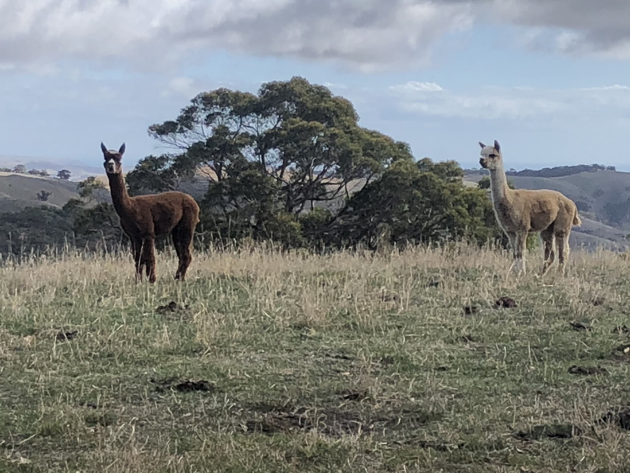

The trail returned to fence lines and grazing cattle and I sat in a great little spot on a log in the sunshine. The Heysen is often criticised for its fence line walking but I don't find anything wrong with traipsing over the grass away from everything else except sheep and cows. Then I was on a dirt road and approaching the end of my day and I could see no possibility of camping where all the land was private land; there were so many signs about not trespassing and the roadside verges were too exposed to traffic, so when I got to the cabins I went in and asked if I could camp there and very kindly the owner let me. I felt bad but couldn't see any other option. 30 kms
May 3 I left hurriedly at first light and stopped further along the road to pack up properly and toilet, and then had breakfast a bit later when I found a log to sit on.
Soon it was drizzling and all day there were intermittent showers, also it was quite cool but it was not windy. After some road walking I climbed into Yuilte Conservation Park which featured a succession of steep ups and downs, crossing creeks which were all dry but pretty despite this. The going was rough underfoot. Soon the trail moved to the edge of the park which meant following a fence. The fence line rose to be along a ridge which provided nice walking: long views over the hills to the coast beyond Myponga and towards a prominent peak the other way. It was somewhat like walking through English pastoral landscapes. Finally I reached a winding farm road that led up Mt Cone and I got to the shelter and water tank on the summit.


I stayed on the farm road with views towards Mt Lofty then walked my last fence lines and reached the road into Mt Compass. I had intended to stay at the caravan park on the edge of town but the weather deteriorated again so I went into the town (walking along a very busy road with cars doing 100 kmph) to get the bus and train into Adelaide. Luckily I had time to stop at the bakery before boarding the bus. 28 kms
135 kms in total