The main reason I wanted to do this trail was that I had previously seen the super cool track markers and I looked forward to walking along looking out for them! The logo is probably intended as a tribute to the historic basis for the track route, but to me it is a picture of a pair of pensioners hell bent on getting to the pub for a pint.
This Hume and Hovell Track doesn’t have the best reputation among bushwalkers. It has too much road walking apparently and the track is not well maintained. It seems to me that the current track bears little resemblance to the journey undertaken by Hume and Hovell in 1825 when they walked, basically, from Sydney to Geelong, and only tiny parts of the track are close to their route. Right now several long sections of the track are closed due to bushfire and flood damage.
I had run a section of the track near Tumbarumba (twice) and liked that so I was curious to see more. The terrain offers a mixture of farmland, eucalypt forest and high country. Logistically it isn’t the easiest track to do because it passes close to very few towns for resupply but I reckoned I could do the section between Yass and Tumut if I was prepared to walk a couple of hours into Tumut when I came off the track. Another complication is the need to take a boat across Lake Burrinjuck on the third day of the hike, which has to be booked in advance and doesn’t always operate. On the plus side there had been plenty of recent rain so getting enough water from creeks on the hike was not going to be an issue, even with the weather forecast in the mid thirties.
I intended to leave my car in Tumut and start by taking the bus (actually two buses) to Yass. Technically the hike starts at Cooma Cottage outside Yass but I couldn’t see any pleasure in walking extra kms along a busy road, so I elected to start in Yass which is where the track used have its start line when first conceived in 1988.
November 25 I had stayed on the wrong side of Yass, the Cooma Cottage side (ha ha) giving me an extra couple of kms to walk to reach the town, get through town and then out the other side on an industrial road. Yass motels were all full because the Victoria/NSW border had only just reopened so I had to stay at the only place with a vacancy. It was an improvement when I turned off after 6 kms for a quieter road, partly sealed with a few cars, properties near the road, lots of sheep, kookaburras, distant hills. I crossed several creeks, all with plenty of water. It was very warm by 8am. I stopped after 14 kms then every hour. The road narrowed and went into patches of bush. It was hillier than I had expected.
I got to The Captain campsite at 2pm, and could easily have missed it if I hadn’t been looking out for it and noticed a stile by the roadside. There was a covered picnic table, toilet and water tank and it was a pleasant grassy area with trees. I read from the log book that the last people had stayed 16 days ago. The neighbour farmer came over to chat and told me a lot about local farming. I enquired about bushfires and he said everything was too damp for fires. The mozzies were really bad. 28.2 kmsNovember 26 After several more kms of dirt road and then a sealed portion I turned onto a 4WD road which was much nicer, through bush with noisy cockatoos, and the going was rough and rocky. I had glimpses of Lake Burrinjuck then followed a narrow trail around the lake edge, with a steep drop off towards the lake. There were hills all around the lake.
Finally I had a nice detour around an inlet, with a rocky crossing. The lake is absolutely huge. The campground was hot and dusty and I was sad to see the shop was closed (even though I had known it might be) meaning that I was only able to buy a few morsels at the office for my lunch and dinner rather than the lavish meals I had been hoping for. 22 kms
November 27 At 7.30am I was taken by boat about 7 kms up the lake to the track continuation. The boat was a full-on tour boat but I was the only passenger. I was dropped off at Cathedral Rocks, which are well submerged just now as the lake is at 88 % capacity. I had a very hot walk on a rough road to Wee Jasper, with sheep, hills in every direction, and the track came and went by the lake.From Wee Jasper I went up into a nature reserve with a long climb in the late morning heat. I thought I was making a short cut but actually I was going further than required, but this kept me off the road. I also believed I was climbing Mt Wee Jasper but that was to come later (and harder). I had window views of distant mountains.
I had a descent to a pretty creek and my introduction to the blackberry infestation with which I was to become far too well acquainted. At the creek I had a chat with a woman who was sitting there (I was surprised to see her) and then embarked on the real Mt Wee Jasper. The track started with a paddock of giant thistles the like of which I’ve never seen before. The climb was hard work on a narrow trail and I made many stops, necessary because of the heat. I hadn’t realised this peak is as high as 1121 metres. There were some views on the way up but none at the summit, and again in the log book I saw that nobody had been here recently.
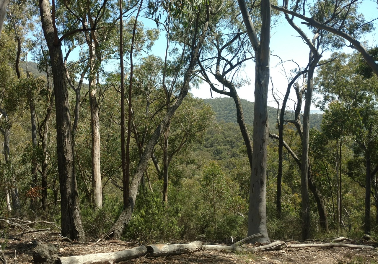
I came down on a dirt road passing logged pine plantations then went into the forest and followed a creek with bad infestation. The trail was just grass and at times really indistinct. I thought I would never reach camp. It was nice to hear a creek flowing as I walked along very slowly. I was hot and tired, and I got to Log Bridge camp just after 6pm. It was an idyllic campsite by a creek in a state of disrepair (broken tables and fireplaces), but sleeping to the sound of trickling water is always a treat. I promptly ate a rather late lunch followed immediately by dinner. 27 kms

November 28 It had been forecast to be 36 degrees so I tried to leave early; I was up before 5.30am and left just before 6.30; the main thing that holds me up in the morning is waiting for my coffee to cool down enough that I can drink it since I’m always packed up and ready to go! I went straight into forest, nice at first then long kms of blackberry and thistle, which made for slow going and lots of hacking. Thank goodness I had my hiking poles with me. If you don’t hack the long, and often thick, blackberry stalks out of the way they cling to your skin like nothing on earth and I soon became immune to the scratches and sight of trickling blood. I climbed into a granite gorge area and was well above the creek. By now I had renamed the trail the Blackberry and Thistle Track. I saw a couple of kangaroos, very shy. Pompey's Pillar was a tall granite rock right by the track.
By the time I made it to a clearing in a pine plantation the going became easier with some 4WD track and some paths through eucalypt forest. There were occasional light breezes which were really welcome. The creek was quite noisy and also the cicadas were deafening. After a long hill, hard going as it was really hot by midday, I came to Micalong campsite, right on Micalong Creek by little falls. I had expected to arrive at 9.30 but got there after 11.
I took a long break and only left when I could face the heat again, although it was definitely not 36 degrees yet. Shortly after there was a sign about a broken bridge and it would be necessary to detour, but the pensioners were only doing the original route so I followed my GPS along some derelict fire trails and hoped for the best. I followed a winding dirt road high above the creek with nice views of nearby pine forest and was pleased to be away from the blackberry. It got windy and I heard thunder, then there were a few drops of rain, then a wet thunderstorm without lightning for 15 minutes. I had been absolutely sure from the forecast that this was going to be a hike without rain. I came back down to the creek and could see track markers in the distance, but first I had to cross this creek which was more like a river. So a big detour to avoid a broken bridge and I had to wade across anyway.
The rain stopped and the sun came out again. Bossawa / Barrois (it seems to have two different names) campsite was in a forest clearing by a grassy creek, and the land here seemed far less rocky.
All afternoon there were on and off showers and it was windy. At night I had a big thunderstorm with lightning. 22 kms. Every day has been longer than expected.
November 29 It was a cool windy morning, muggy, and looked like rain was coming. I walked alongside the creek and crossed interesting swampy areas on a couple of boardwalks, Micalong Swamp and Chinamans Swamp, with grasses in all shades of green.
Then the trail turned into forest on a rough track with mountain gums and masses of small ferns. I was most surprised to meet two hikers going the same way as I was, but in some ways not surprised because I had seen a parked car near last night's campsite which looked like a car left there by walkers. The trail became single track, passed over a saddle, and then clouds of gnats appeared.
I could see distant mountains. I had a small navigation problem on the descent, and started going backwards until I bumped into those hikers, who put me right. I came into a big grassy area called The Hole and sat under a tree for a while.
The sun finally came out and the air warmed up, and I thought I had almost finished for the day. The trail went along a grassy ridge, with blackberry and also prickly ti-tree , and nice mountain views. I saw some pretty wildflowers, common fringe lily I believe.

On the descent I glimpsed two large waterfalls but they were not accessible from the path and I was happy to see a road below, thinking this meant I was approaching my campsite. I reached the road but was dismayed I had to cross it and a creek and climb another hill, which seemed very long. The notes on the walk website are strangely silent about this climb, and that evening when I compared experiences with the other hikers I had met earlier they told me that the very first leaflet about the H and H is the only walk documentation to note the climb, and this leaflet says that hikers are generally disappointed when confronted with another climb so late in the day. Yep. As I was descending there were many fallen trees and while detouring to avoid one big pile of branches I missed a turn and it took me ages to sort out where to go. I eventually reached Thomas Boyd campsite on the wide Goobarragandra River, and camped by the grand suspension bridge. The campsite managers were very friendly, they made some notes about the blackberry situation, and I also re-met the woman I met by the creek before climbing Mt Wee Jasper. She asked how I had liked the thistles! 26 kms
November 30 I crossed the suspension bridge and walked along the river; blackberry often obscured the river views (and lay right across my path) and there was also lots of prickly ti-tree.
Then I had to cross back again and this time I crossed on the most scary bridge ever: I was basically walking on chicken wire with a few thin metal slats, where some slats were no longer nailed down and there were holes in the chicken wire. I would rather have waded the river, which didn’t look difficult.
Luckily the next bridge was much safer (and shorter)
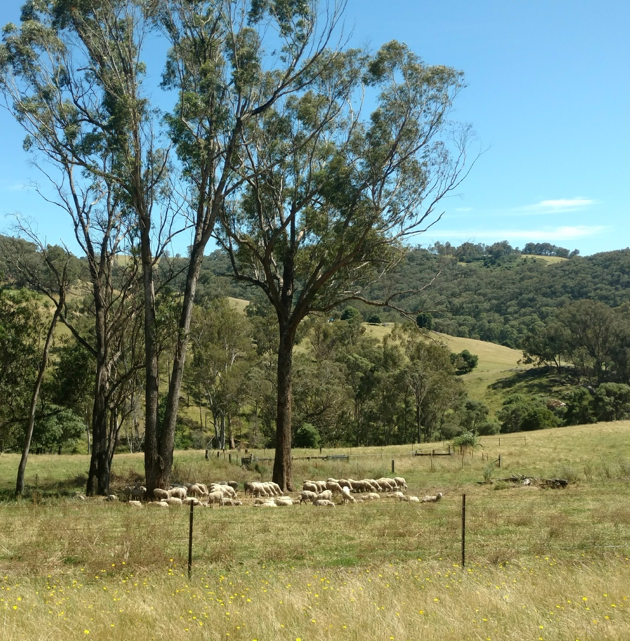
and then I had an undulating dirt road through hilly grazing land. All around were lovely green hills with scattered trees, and sheltering cows and sheep (sheltering from the heat).
Soon after crossing a little creek on stepping stones I got confused at a farm and went a bit off the track because there was a sharp turn required but no pensioners to inform me of this, then climbed steeply into bush, and Kosciusko National Park, to a grassy saddle where I ended up on the wrong side of a barbed wire fence. The pensioners weren’t at all in evidence around here either but I was able to follow narrow tracks across to grazing land and a brand new bridge, where I was supposed to be,
and I followed a fence steeply uphill; the cows in that paddock kept coming closer and closer.
The next 5 kms was across grazing pastures with rarely a track (the website had been vague about this) and at least 10 stiles which I used for navigation. Many signs were missing (or perhaps fallen over because I did chance upon a pair of pensioners lying on the ground among the knee high grass) and I had to rely on my GPS. I stopped to rest under trees. There were lots more curious cows.
The sharp-seeded grass was a real problem and my feet were being scratched the whole time but I didn't want to stop to pull the seeds out of my socks. Then at the top of the final hill I could see the highway and I was pleased. I descended and then rested on a bridge, emptied my boots and was shocked at the contents: a phenomenal amount of grass seeds, as well as my socks being covered in a thick layer of seeds too. I pulled out as many as I could, even turning my socks inside out to get at some of them and this was no enjoyable task; some I could not see but only feel because they had worked their way into the weave of the sock.
At this point I had a choice of finishing my hike today at Blowering campsite, 5 kms further, and walking into Tumut tomorrow or walking into Tumut now and walking to Blowering tomorrow as a day walk. The track is closed beyond Blowering campsite because of bushfire damage. I decided to continue into Tumut which was 10 kms on the shortest route. This was a hot exposed walk along the Snowy Mountains Highway and I had to power myself along with positive mantras. There was not much traffic and a good shoulder. I stopped twice, which meant collapsing onto a patch of grass in the shade. I even poured away my last litre of water to save weight.
The motel in Tumut where I had left my car was full (I had not booked as I didn’t know when I would get back to Tumut) so I collected the car and went to the caravan park by the river. 30.4 kms.
December 1 I had a lazy morning tea at the bakery in town then drove out of Tumut to the point where the track crosses a suspension bridge over the Tumut River and walked to Blowering campsite. This involved a lot of walking through long grass with the inevitable accumulation of seeds in a fresh pair of socks. The last stretch was in the forest leading up to the dam wall and down the other side to the lake edge. This is another huge lake like Lake Burrinjuck and the campsite is in a commanding position.

I had an urgent meeting at a cafe in town, or maybe I was panicking that they would be running out of food, so I didn’t linger by the lake but turned around and returned to the car. 4.6 kms
In total I had walked 161 kms. That’s a nice round 100 miles.